
ORLANDO, Fla. — The warm and muggy conditions will stay for the evening across Central Florida. The official high temperature was 83 degrees at OIA, 76 degrees in Daytona Beach and 79 degrees in Melbourne. Expect even warmer temperatures on Tuesday afternoon.
Here’s what you should expect for your weather starting Monday evening:
- Humid and warm evening, low temperatures in the mid to upper-60s.
- Another round of patchy fog may develop overnight until shortly after sunrise. Please use your low beams, as high beams reflect more light and block visibility further.
- Wind will relax, and stay mainly from the south-southeast Tuesday.
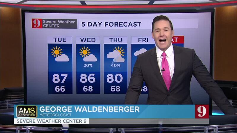
- Highs on Tuesday could be near record hot. Highs in the mid to upper-80s and a very low chance for a brief passing shower, especially in the late afternoon hours.
Since December, #Orlando has set 14 different daily records for heat and 0 records for cool weather. Surprise, surprise. #WFTV pic.twitter.com/fnkX9lgzwJ
— George Waldenberger (@GWaldenWFTV) February 17, 2020
Catch up on your 5-day forecast:
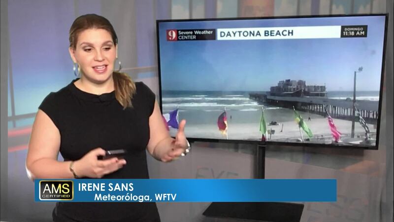
Pronóstico del tiempo en español por nuestra meteoróloga certificada Irene Sans
Follow our Severe Weather team on Twitter for live updates:
- Chief meteorologist Tom Terry
- Brian Shields
- Irene Sans
- Kassandra Crimi
- George Waldenberger
- Rusty McCranie
© 2020 Cox Media Group


