
ORLANDO, Fla. — We have Weather On the Way for rain and another cold blast from Sunday through the early part of next week.
A strong cold front will arrive on Sunday, bringing scattered showers to the area and much cooler temperatures.
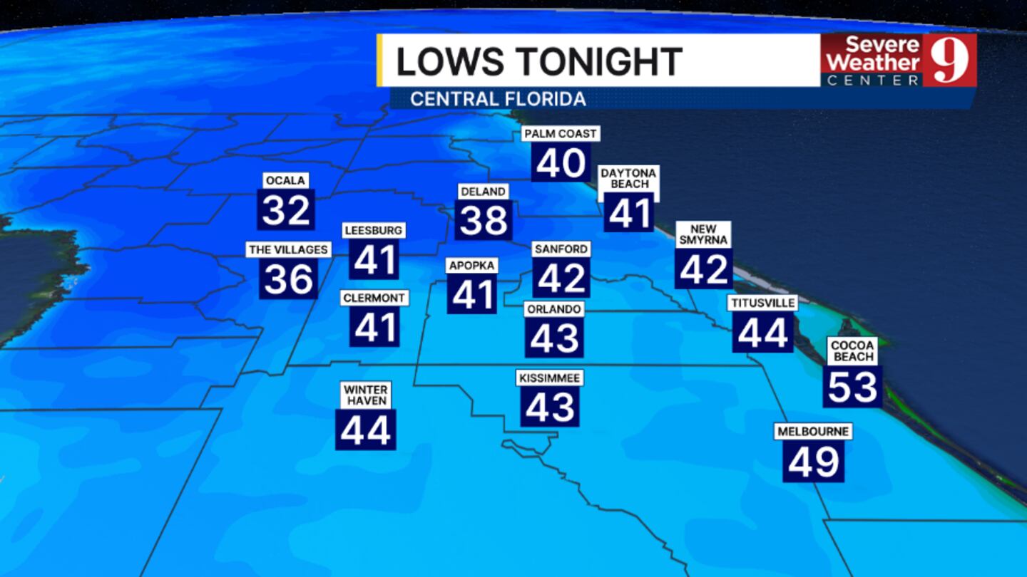
Ahead of the front, temps will warm some. It will be another cold night tonight, but not as chilly as Friday morning, with lows in the low 40s.
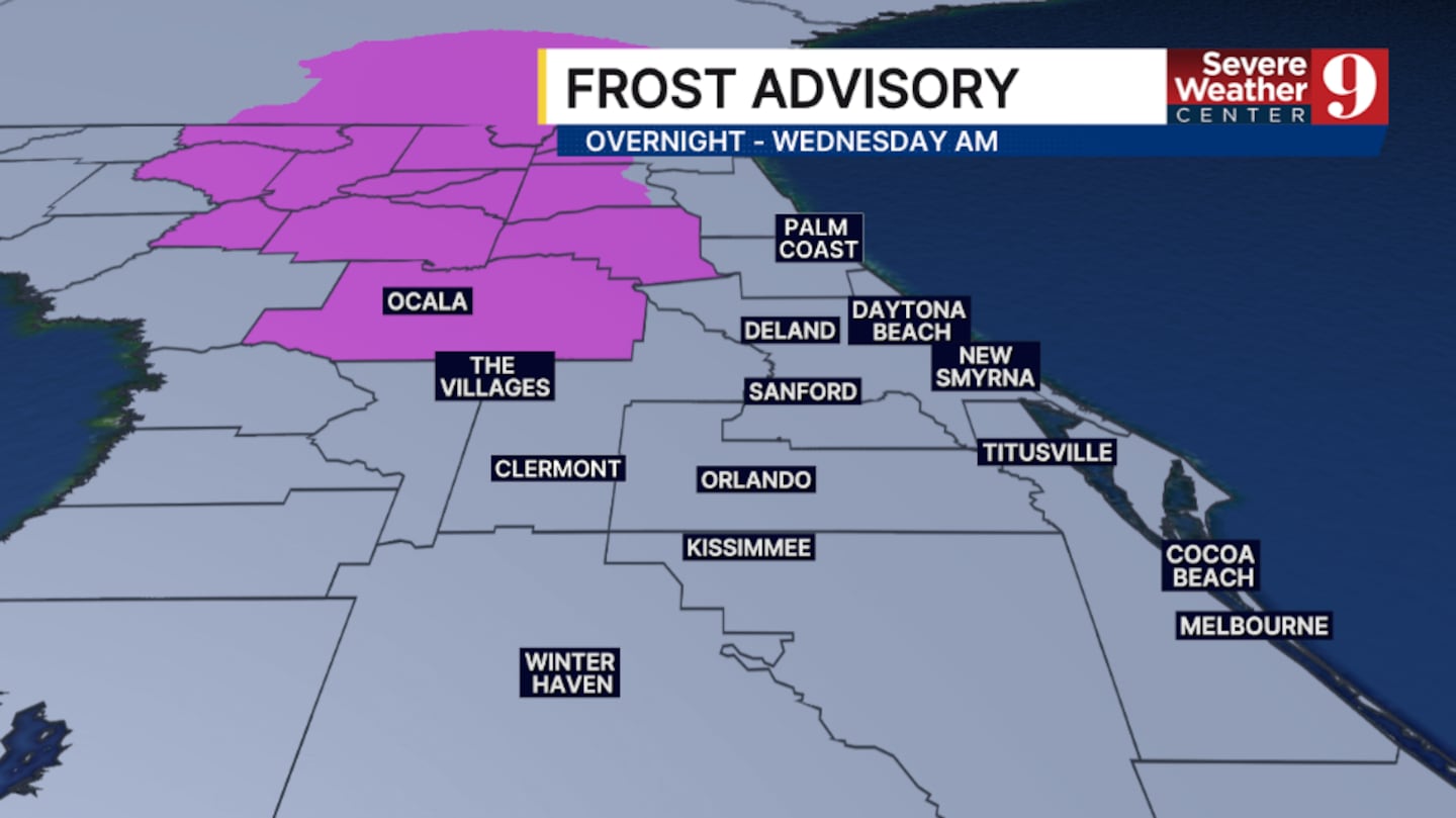
A Frost Advisory is in effect for Marion Co. overnight, with areas of frost possible.
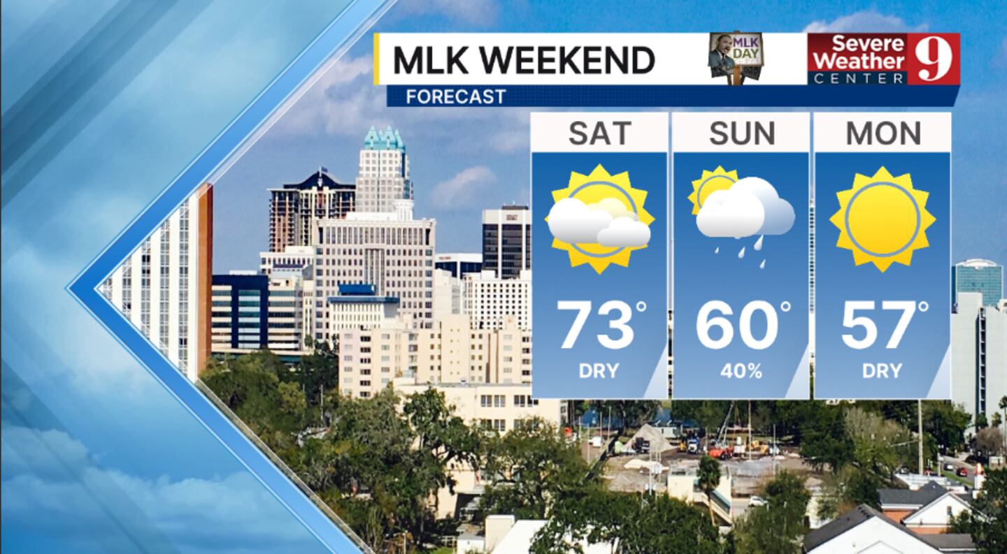
A quick warmup is likely for Saturday, with partly cloudy skies. Highs to start the weekend will be in the low 70s.
The changes begin to arrive on Sunday morning. The cold front will push into the area, bringing scattered showers and temperatures only in the low 60s.
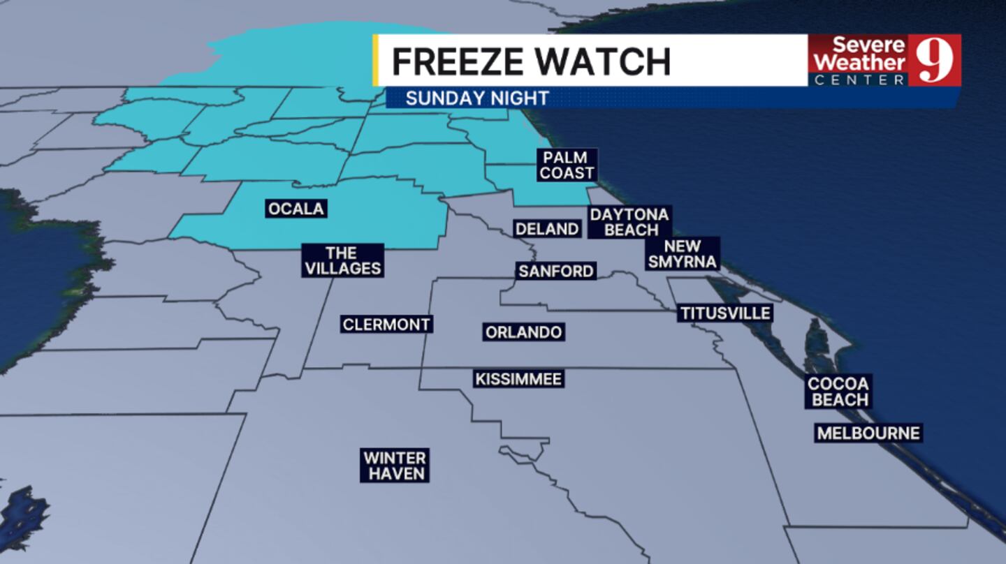
The cold air rushes in on Sunday night, with freezing conditions possible. A Freeze Watch has already been posted for Marion and Flagler counties on Sunday night, and many areas will tumble into the low and mid-30s.
It will be a chilly Martin Luther King, Jr. Day, with sunshine and highs only in the upper 50s.
Another cool night is likely on Monday, with temps in the mid-to upper 30s.
Stay with Severe Weather Center 9 for the latest on the Sunday rain and more chilly temps across Central Florida.
Click here to download our free news, weather and smart TV apps. And click here to stream Channel 9 Eyewitness News live.

©2026 Cox Media Group


