TITUSVILLE, Fla. — With the scheduled launch of the GOES-S in March, NASA is set to double the vision of NOAA’s next-generation satellites working as steadfast lookouts for severe weather on Earth.
GOES-S is the second spacecraft in NOAA’s GOES-R series of geostationary satellites designed to replace older versions, developed in the mid-1980s, that are currently in orbit.
“What we’re seeing here is a revolutionary step forward in performance,” said Tim Walsh, GOES-R’s acting system program director.
Walsh says these advanced spacecraft send four times better imagery, and it's five times faster than previously possible. The older version of GOES satellites can send five images an hour, while GOES-S can send 12 higher-quality images in the same amount of time.
After reaching its orbit 22,300 miles above the Earth, GOES-S will be redesignated as GOES-17. Its sister satellite, GOES-16, was launched from Cape Canaveral in 2016 and is already giving scientists better data to track severe weather activity.
GOES-16 keeps a watchful eye over the full U.S. Eastern Seaboard. GOES-17 will extend this advanced coverage to the west as far as Japan and north to Alaska.
17 days until it gets renamed #GOES17 and by the end of this year it will be GOES-West.. https://t.co/c2MRIE8Ig8
— Irene Sans (@IreneSans) March 2, 2018
The primary instrument on GOES is the Advanced Baseline Imager (ABI), which collects data and imagery from light summer showers to hurricanes. The ABI data is combined with ground based radar and other data to build a more complete model of storms in action.
Watch more WEATHER FACTS AND HACKS
In addition to tracking severe weather from storm clouds, NOAA officials said GOES’ ABI can help meteorologists track tornadoes, ice coverage over rivers, flooding events, forest fires, smoke and volcanic ash.
That was another magnificent launch 🚀 @ulalaunch @NOAASatellites @noaa @NASA @NASAKennedy #goess #goes17
— Irene Sans (@IreneSans) March 1, 2018
Thank you so much @NASASocial!!! pic.twitter.com/1GMD8SYMZo
This is it! #goess up close & personal. Launches 3/1 to spy on Earth’s weather & atmosphere at 23000 miles.
— Irene Sans (@IreneSans) February 28, 2018
Aquí está #goes17, lo más cerca posible. Sale mañana al espacio para vigilar el tiempo y nuestra atmósfera desde 23000 millas de la Tierra. @NASASocial @ExploreSpaceKSC pic.twitter.com/od6a3T32kk
The next generation of GOES spacecraft is also equipped with a Geostationary Lightning Mapper (GLM), which NOAA scientists use to measure lightning strikes on the ground and other activity in clouds and the upper atmosphere.
Check who’s here at @NASAKennedy! @NOAA_HurrHunter GONZO!!
— Irene Sans (@IreneSans) March 1, 2018
Avión caza huracanes de la @noaa en Cabo Canaveral. Parece que vinieron a despedir al satélite que se lanza esta tarde! @ExploreSpaceKSC ! #NASASocial @NASASocial #WFTV pic.twitter.com/62c31DggU9
Who is ready for the next rocket launch!?
— Irene Sans (@IreneSans) February 7, 2018
Mar. 1st - @NASAKennedy Atlas V, carrying the next weather eye!#GOESS #GOES17, 2nd from this set of GOES constellation, will help w/ the forecast for the western U.S., Hawaii, Alaska. Basically from where U.S. comes from. Stay tuned! pic.twitter.com/B9nNd3jVaD
READ MORE ABOUT GOES-S SISTER SATELLITE, LAUNCHED IN 2016:
NOAA officials said this data impacts major industries including sea transportation, communication systems and aviation.
Stay tuned!
— Irene Sans (@IreneSans) February 28, 2018
Camino a la costa espacial de #Florida. El 1 de marzo se lanza el próximo satélite del tiempo al espacio. Manténgase atento a https://t.co/HbqAauOrCi (y a mis redes sociales) #goess @NASA @NASAKennedy @NASASocial @NOAASatellitePA pic.twitter.com/agm34T9vXh
This satellite data is used along with the radar systems and helps fill the gaps to paint a global picture of severe weather events.
Dave Sharp, a science officer with the National Weather Service in Melbourne, points to last year’s hurricane season as a critical test of GOES-16. “With Maria and the extreme winds over Puerto Rico, the radar was blown off the top of the mountain in Puerto Ric. GOES-16 was used to issue extreme wind warnings for the remainder of the event,” Sharp said.
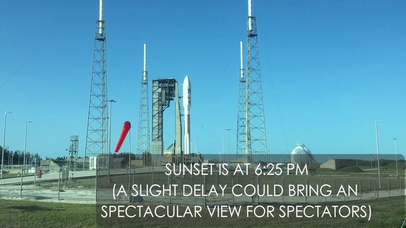
GOES-S launched from a United Launch Alliance Atlas V rocket at Cape Canaveral Air Force Station on March 1 and should start beaming information back to Earth sometime by the start of hurricane season. Once operational, it will extend the over 42-year-old GOES satellite program through 2036.
Cox Media Group


