CENTRAL FLA. — A cold front swept through the area Saturday, and more wind and cooler temps are ahead for Sunday.
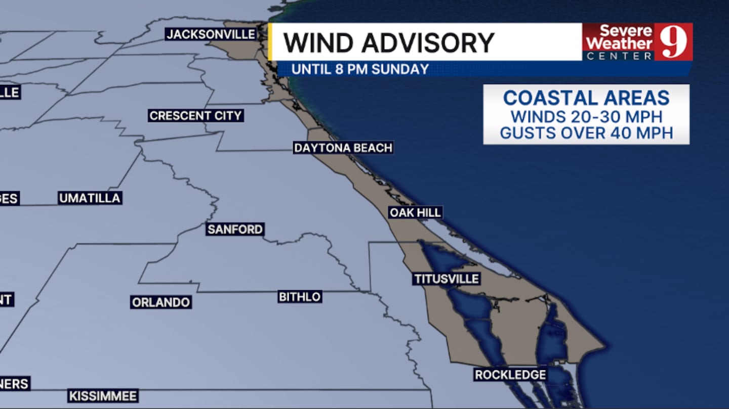
The light showers will fade this evening, but the winds will remain elevated. A Wind Advisory is in effect for much of the coastline overnight, with morning lows in the mid-60s.
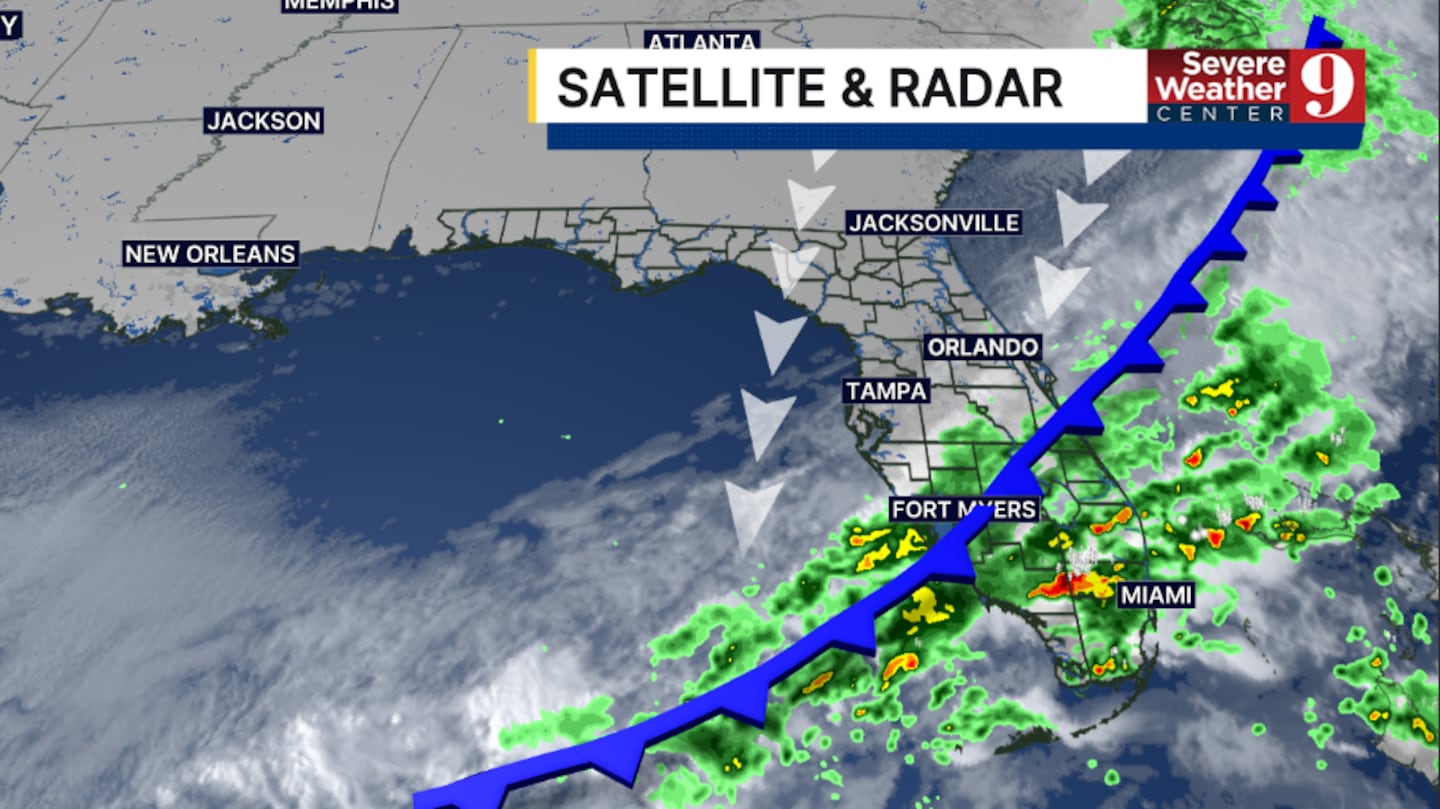
Behind the front, cooler and drier air will move in. A few light showers are possible Sunday, with strong, gusty winds continuing. Temps to close out the weekend will only be in the upper 70s.
More sunshine is anticipated to start next week, but the winds will remain a concern at the coast. A few showers are also possible, with highs in the low 80s on Monday.
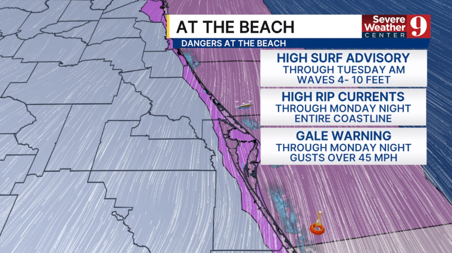
Even drier air arrives by mid next week, bringing more sun and minimal chances of rain. Highs Tuesday and Wednesday will be in the low 80s.
Some low rain chances will return to end next week, as the winds finally diminish across the region.
Click here to download our free news, weather and smart TV apps. And click here to stream Channel 9 Eyewitness News live.

©2026 Cox Media Group