
CENTRAL FLORIDA — It was a warm and stormy start to the work week, and more rain is ahead for Tuesday.
The rain and storms will quickly wind down this evening, with warm conditions overnight. Morning lows will be in the mid 70s.
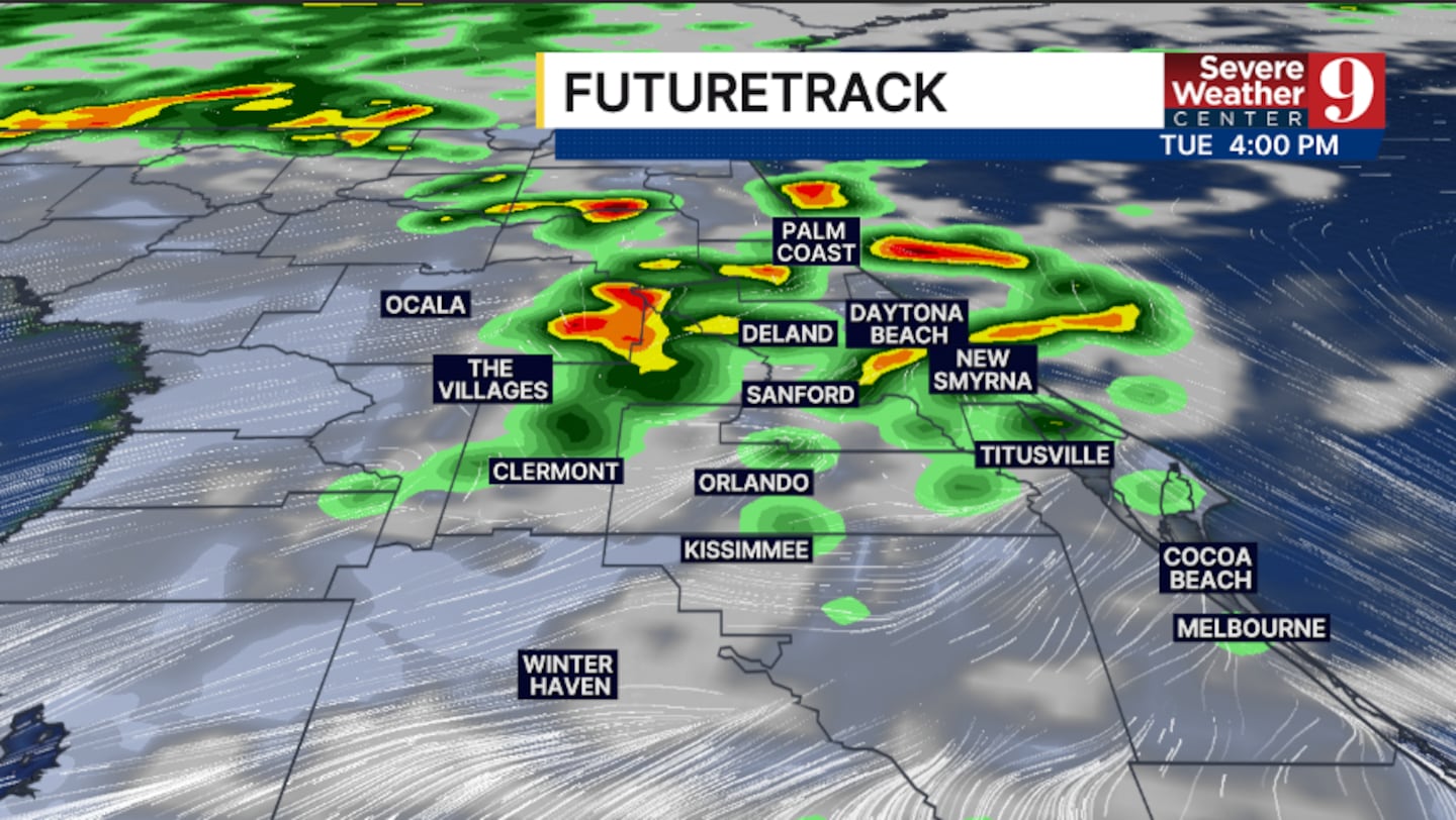
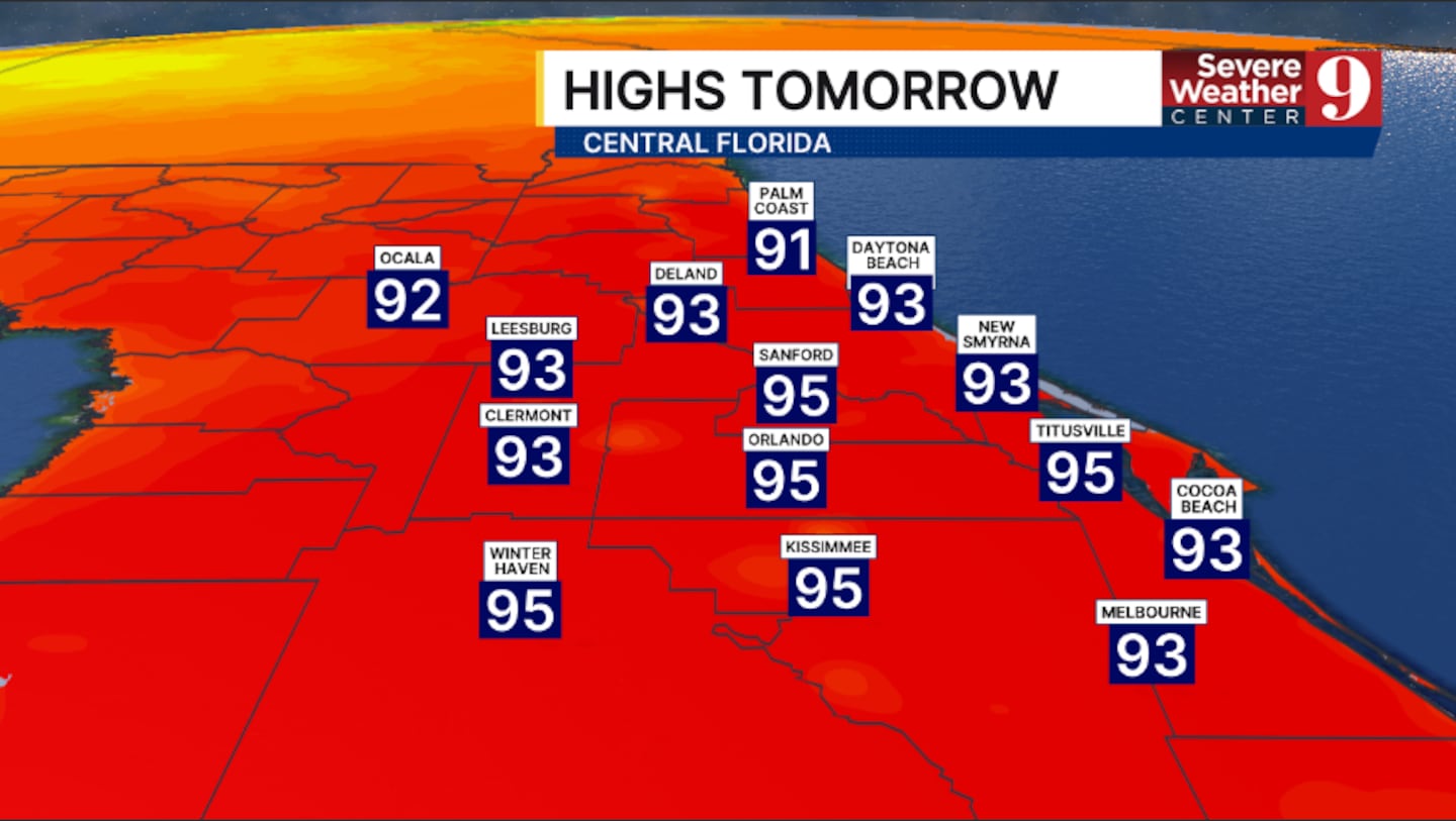
The stormy weather pattern continues into Tuesday. Coverage will be slightly lower than on Monday, with activity developing in the afternoon and evening. Tuesday highs will be in the mid-90s.
Even drier air arrives midweek. Only scattered PM storms are expected Wednesday, with temps again pushing into the mid-90s.
Rain and storm chances increase some late week, as more moisture pushes back into the area. Temps for Thursday will again be in the mid 90s.
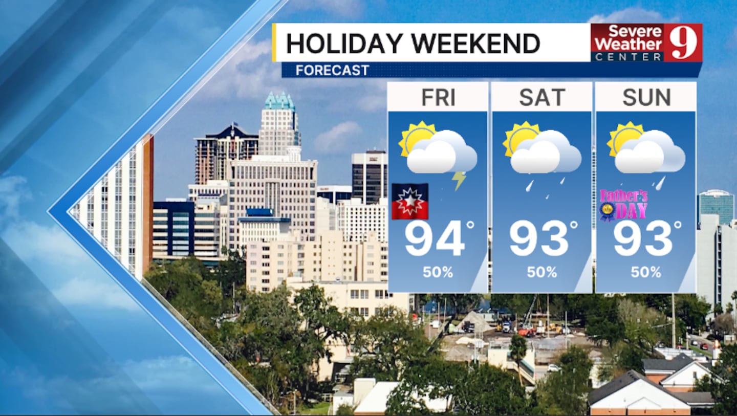
On Friday, Juneteenth, scattered showers and storms are expected, with warm conditions. Highs for the holiday will be in the mid-90s.
The storm threat marches on into Father’s Day weekend, with cooler highs in the low 90s.
Click here to download our free news, weather and smart TV apps. And click here to stream Channel 9 Eyewitness News live.

©2026 Cox Media Group


