
CENTRAL FLA. — Subtropical Storm Josephine formed Wednesday evening off the Mid-Atlantic coast and is expected to move away from the US coastline.
The 5 pm advisory from the National Hurricane Center on Josephine had winds of 65 mph.
Josephine is the 10th named storm in the 2026 Atlantic hurricane season and was previously designated Invest 93L.
A subtropical storm is a hybrid tropical and non-tropical complex. Often, peak winds are well away from the center of circulation.
The system is expected to strengthen further and will likely remain a subtropical storm through early Thursday.
The complex will likely transition to a post-tropical cyclone with hurricane-force winds by late Thursday.
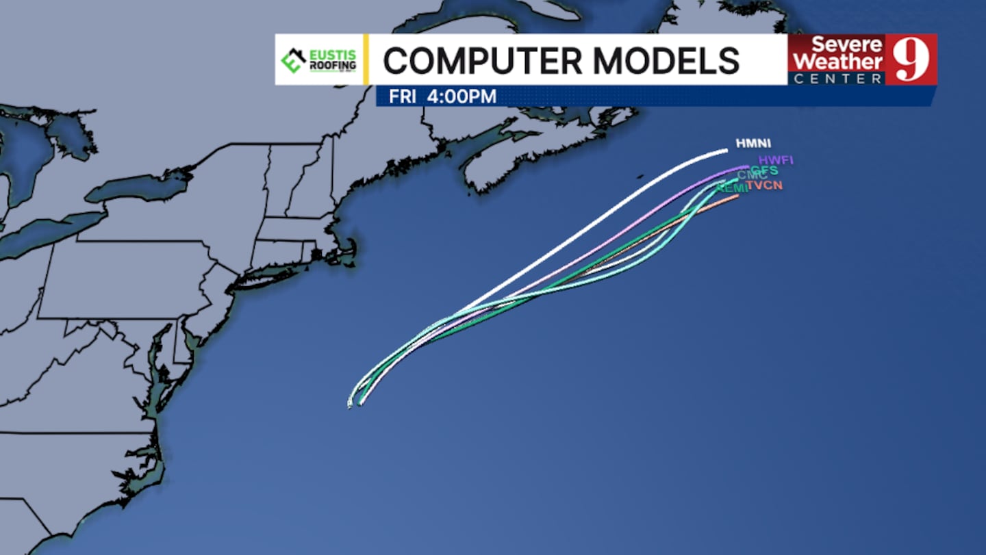
Josephine is moving to the north and will turn to the northeast Thursday with a large increase in forward speed.
The storm will continue to produce gale-force winds along the northeastern US coastline.
Coastal flooding will also be a concern across the Mid-Atlantic coast, and large swells will continue.
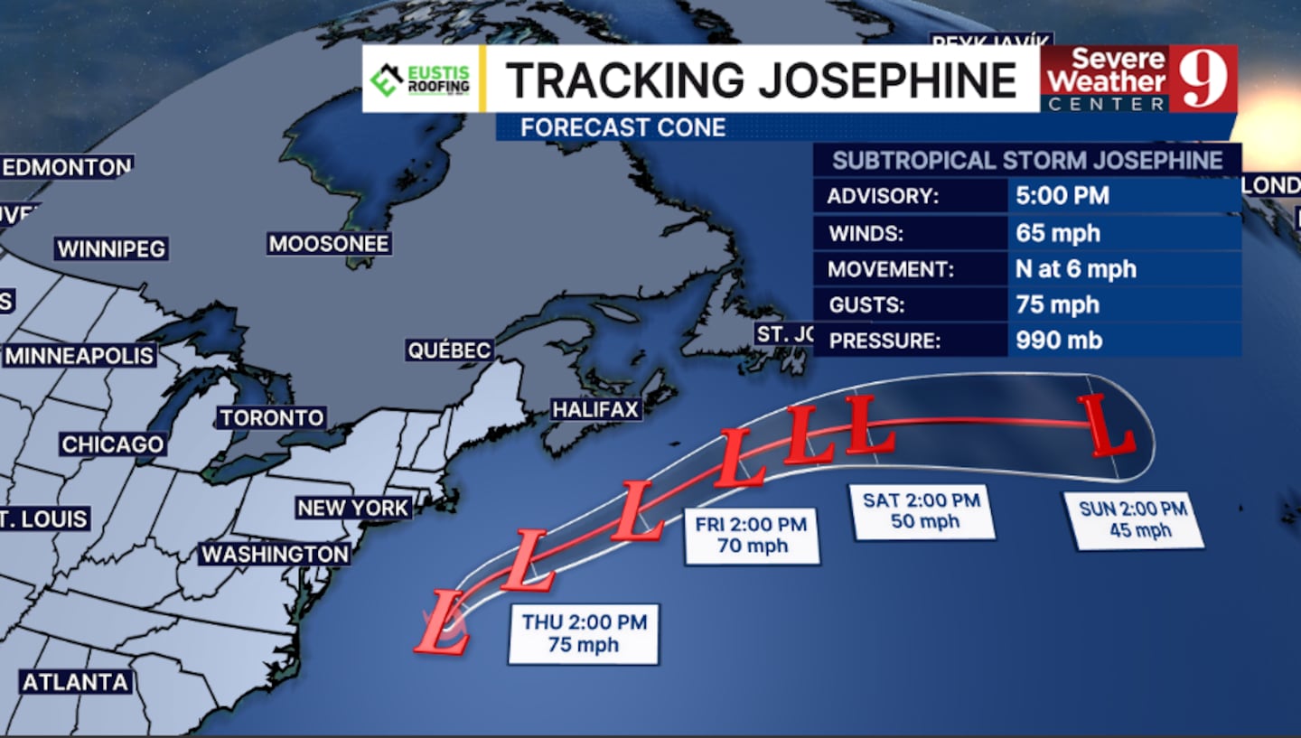
Josephine will continue to move away from the US and will not impact Florida.
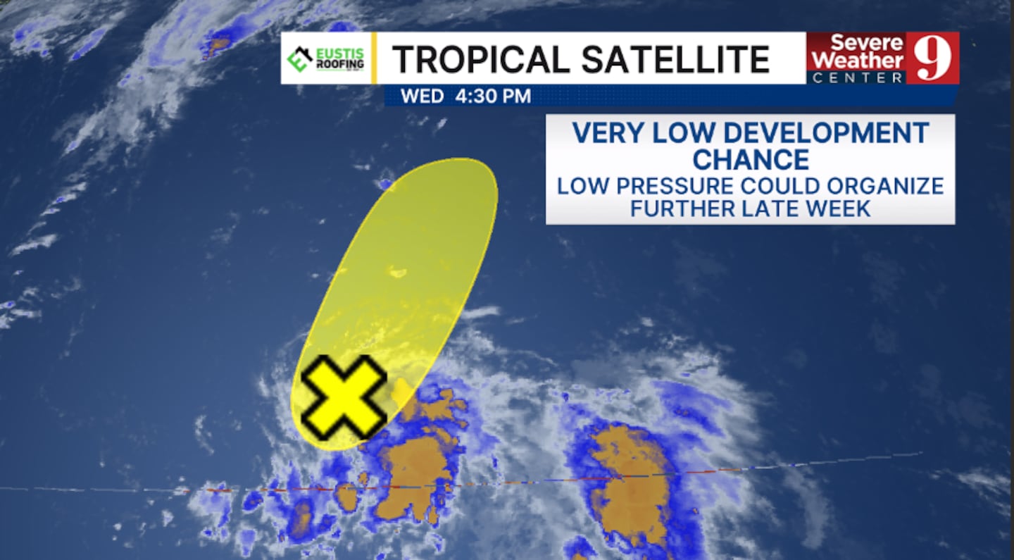
Elsewhere, the National Hurricane Center is now monitoring a new area in the open Atlantic.
A trough of low pressure has formed east of Bermuda and could organize further in the coming days.
It currently has just a 10% chance of development.
Should it develop, it would also stay well away from Florida.
Stay with Severe Weather Center 9 for the latest on the tropics all season long.
Click here to download our free news, weather and smart TV apps. And click here to stream Channel 9 Eyewitness News live.

©2026 Cox Media Group


