ORLANDO, Fla. — Tuesday is a Weather Alert Day in Central Florida due to dangerous heat.
Central Florida is in for another hot day Tuesday, with dangerous heat conditions continuing across the region following record-tying heat for many locations Monday.
While temperatures on Tuesday are not expected to break records, it will still feel like record-breaking heat for much of the afternoon.

Orlando is expected to reach 96 degrees, with afternoon highs generally in the low to mid-90s.
Many record highs for Tuesday are in the upper 90s to low 100s.
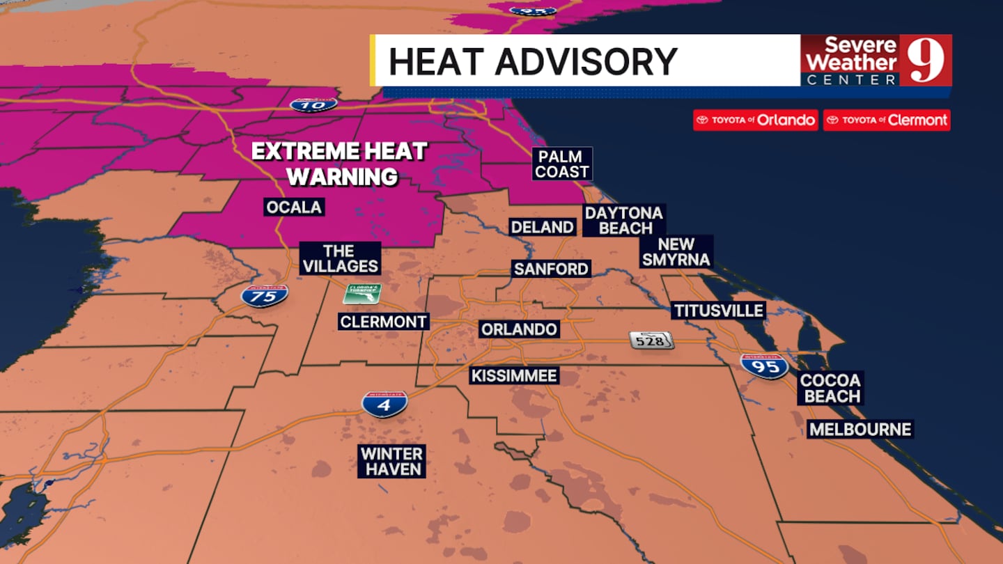
An Extreme Heat Warning is in effect from 11 a.m. to 8 p.m. for Marion and Flagler counties, where heat index values could climb as high as 110 to 113 degrees.
The rest of Central Florida is under a Heat Advisory from 10 a.m. to 8 p.m. Heat index values in those areas could peak between 105 and 110 degrees.
Residents are urged to take the heat seriously. Limit strenuous outdoor activities during the hottest part of the day, stay hydrated and take frequent breaks in air conditioning or shade.
There is also a 40% chance of showers and thunderstorms Tuesday.
The better chance for storm development will be near and east of the I-95 corridor.
Storms could bring brief heavy rain, gusty winds and frequent lightning, so be prepared to move indoors if thunderstorms develop nearby.
There is some good news in the extended forecast.
Temperatures could ease back toward normal summertime levels by the end of the week, providing Central Florida with a small break from the extreme heat.
Click here to download our free news, weather and smart TV apps. And click here to stream Channel 9 Eyewitness News live.

©2026 Cox Media Group


