
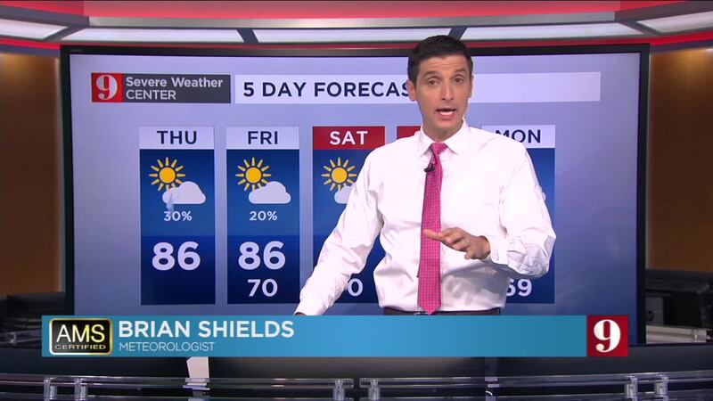
The dry air continues to limit shower and storm activity across Central Florida. It was a nice day with highs only reaching the mid to upper-80s, but feeling nice since the humidity was a tad lower. Expect humidity levels to be comfortable to end the workweek and into the weekend.
Friday will be a very nice day across Central Florida. A very low chance for an isolated shower, high temperatures in the mid-80s and dew points in the mid-60s. For reference, in Central Florida commonly we have dew points in the low 70s (dew points measure how much water vapor is in the air).
Friday night temperatures will drop to the mid-60s across some locations.
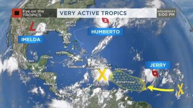
Good Morning! All on track with Jerry -- it still looks to stay away Florida. There are no threats to Florida at this time -- and that is a great thing! I'll see you on Channel 9 this morning. pic.twitter.com/8vbikyccsg
— Brian Shields (@BrianWFTV) September 19, 2019
Check your full five-day forecast below:
Follow our Severe Weather team on Twitter for live updates:
- Chief meteorologist Tom Terry
- Brian Shields
- Irene Sans
- Kassandra Crimi
- George Waldenberger
- Rusty McCranie

Cox Media Group


