
ORLANDO, Fla. — Update:
Showers and thunderstorms will become more widespread across Central Florida through the mid-afternoon.
Heavy rain is likely as storms move from the west to the east.
>>> LIVE RADAR <<<
Expect a wet weekend as well.
Showers could develop as early as the late morning Saturday and become widespread by the afternoon.
Read: CDC: Two new versions of omicron COVID-19 virus gaining ground in the US
Click here to download the free WFTV weather app.
The smattering of rain and storms is becoming more and more widespread across Central Florida during the noon hour. This increase in coverage will continue the next several hours. pic.twitter.com/Yjq9kna1a1
— Rusty McCranie (@RMcCranieWFTV) June 10, 2022
Earlier story:
Friday’s forecast will see the potential for rain early in the morning and through mid-afternoon as a storm system to the north continues to push warm, moist air into our area.
>>> STREAM CHANNEL 9 EYEWITNESS NEWS LIVE <<<
Rain will breakout across Marion and Sumter counties early this morning, so make sure you have the umbrellas as you head out. Showers and storms will then become widespread across Central Florida by lunchtime. pic.twitter.com/X4LTWTivvl
— Rusty McCranie (@RMcCranieWFTV) June 10, 2022
Look for temperatures to reach the upper 80s across much of Central Florida.
This weekend, the warmer weather continues with the chance of rain on Saturday and Sunday at about 60%.
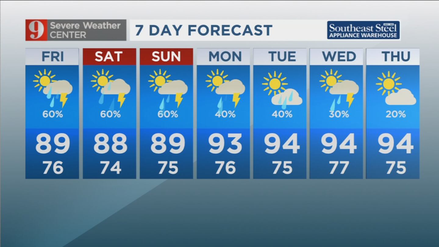
Looking into next week, the wet weather continues with the potential for afternoon showers at around 40%, with highs in the mid-90s.
Follow our Severe Weather team on Twitter for live updates:
Click here to download the free WFTV news and weather apps, click here to download the WFTV Now app for your smart TV and click here to stream Channel 9 Eyewitness News live.
WFTV


