
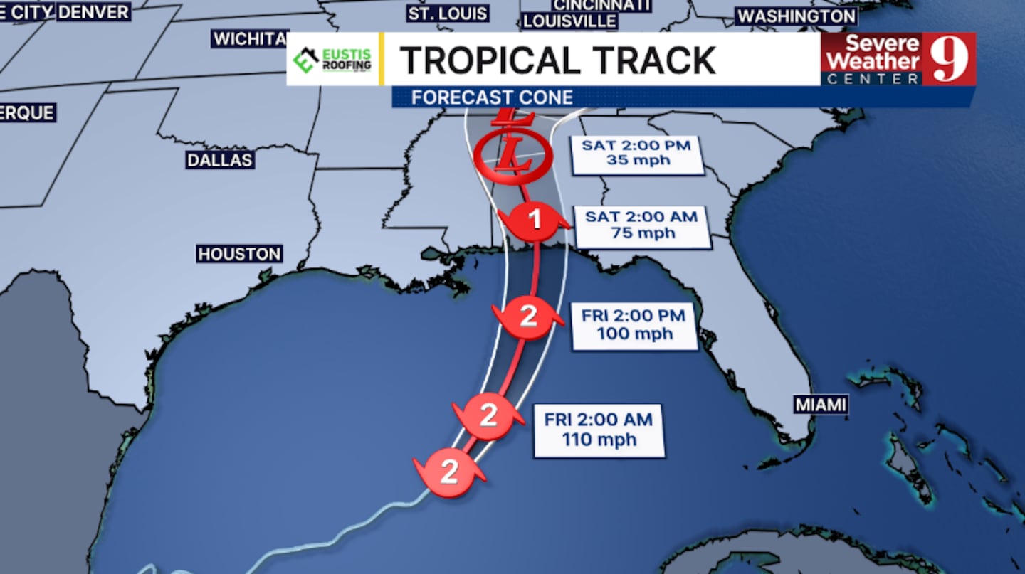
ORLANDO, Fla. — Hurricane Isaias has strengthened to a Category 2 storm and has begun its turn toward the northern Gulf coast.
The 5 pm advisory from the National Hurricane Center had winds of 100 mph, now making Isaias a Category 2 storm.
Hurricane Warnings continue from Ocean Springs, Mississippi, to the Bay/Gulf County Line in Florida.
Tropical Storm Warnings are in effect from southern Louisiana to Ocean Springs, Mississippi, and from the Bay/Gulf County Line to the Aucilla River, Florida.
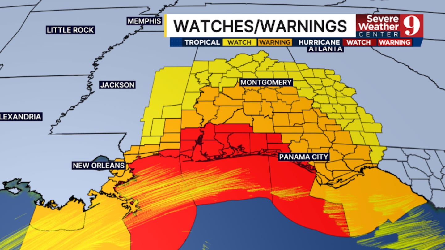
Storm surge is an increasing concern with Isaias, and a Storm Surge Warning is in effect from the mouth of the Mississippi River to the Suwanee River in Florida.
Storm surge of 5-7 feet is possible along much of the northern Gulf Friday night into early Saturday.
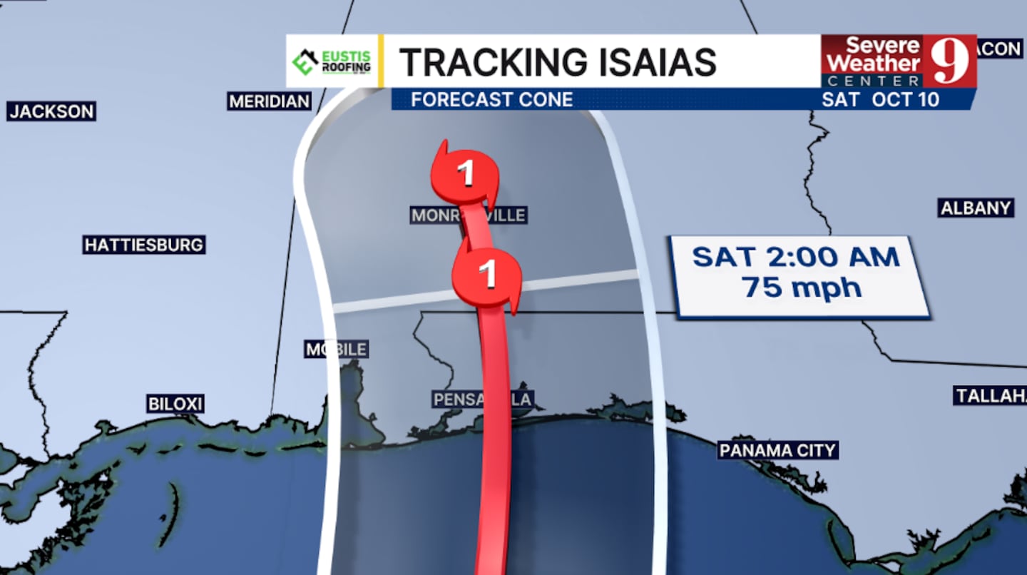
Isaias is expected to remain a Category 2 storm through Friday afternoon, then quickly weaken as it approaches landfall.
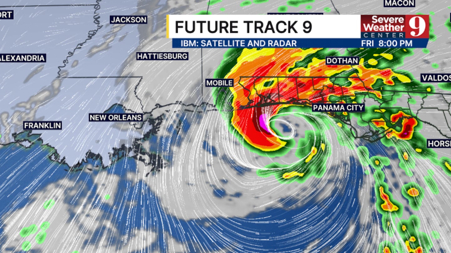
The storm is now moving northeast and will quickly swing north on Friday.
Landfall will likely be between Mobile, Alabama, and Destin, Florida, on Friday night or very early Saturday morning.
Hurricane conditions will likely begin Friday night into early Saturday in the warning areas, with tropical storm conditions beginning elsewhere late Friday.
Rainfall of 4-8 inches is possible with Isaias along the northern Gulf coast, with isolated 15-inch amounts possible across the Florida Panhandle and the Big Bend.
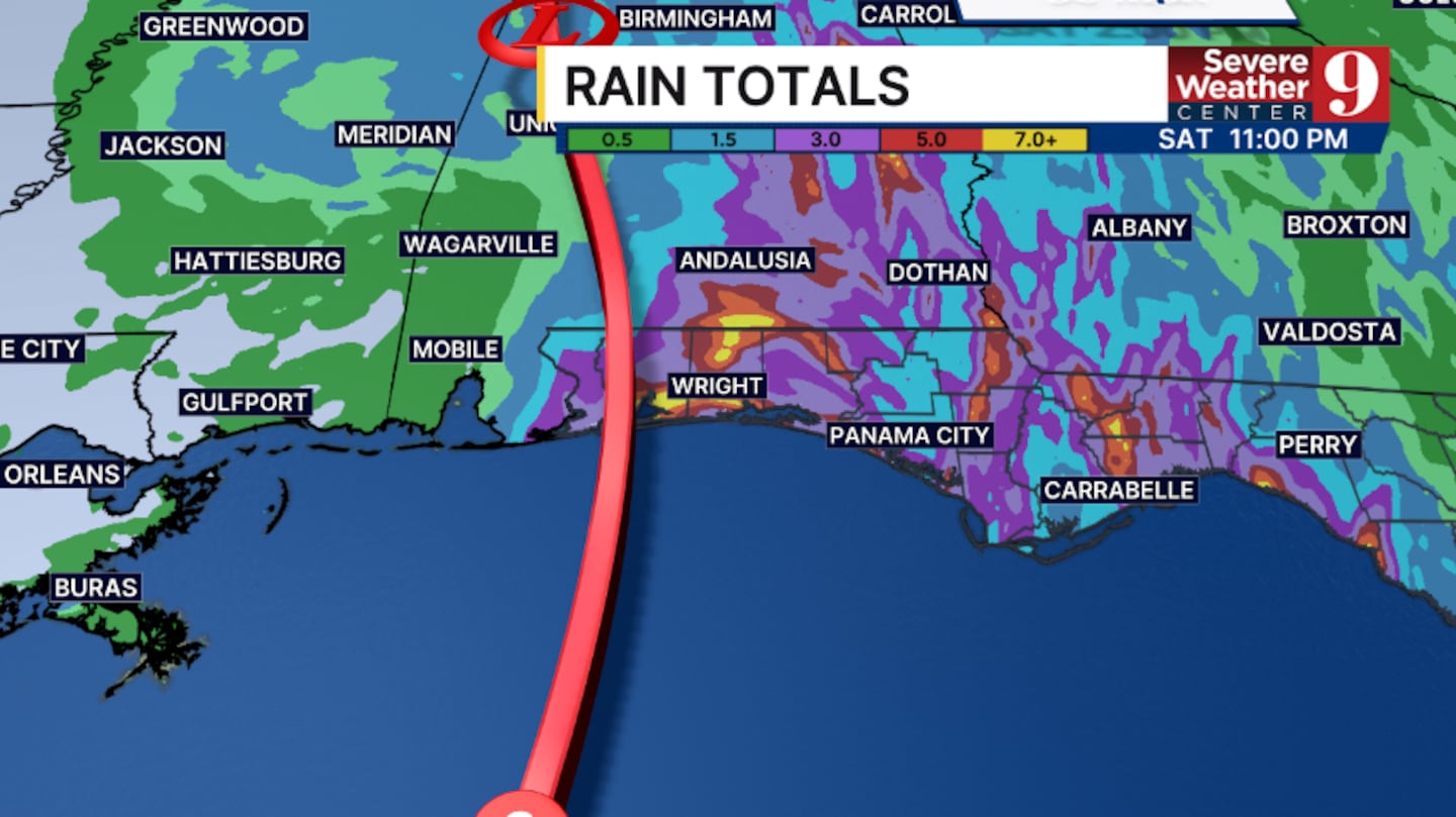
This could lead to considerable flash flooding in parts of the region.
Tornadoes will also be a concern as Isaias approaches.
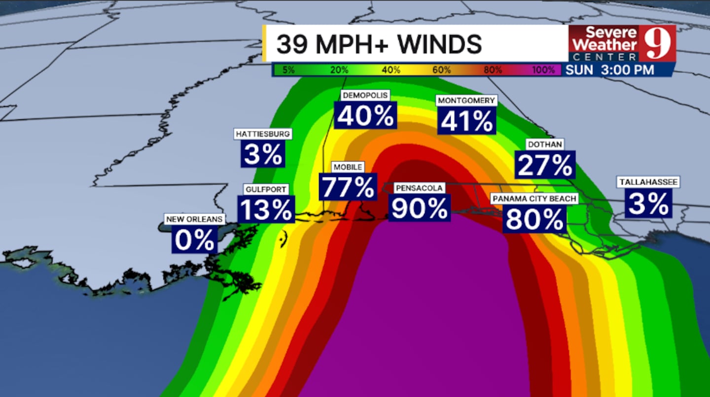
Isolated tornadoes will be possible east of the center, including much of the Florida Panhandle and potentially the Big Bend area, Friday night into Saturday.
Large swells will spread across the Gulf coast on Friday, with significant wave activity continuing into early Saturday.
Stay with Severe Weather Center 9 for the latest on Isaias and its impacts to Florida.
Click here to download our free news, weather and smart TV apps. And click here to stream Channel 9 Eyewitness News live.

©2026 Cox Media Group


