ORLANDO, Fla. — The first official tropical disturbance of the season will move across South Florida on Tuesday evening, chief meteorologist Tom Terry said.
▶ WATCH CHANNEL 9 EYEWITNESS NEWS
The National Hurricane Center has designated the disturbance Invest 90-L.
Doing so allows the NHC to begin more data processing of the disturbance as it moves over Florida over the next day or two.
Terry said flood watches are already in effect in South Florida.
Read: What you should do now to prepare for hurricane season
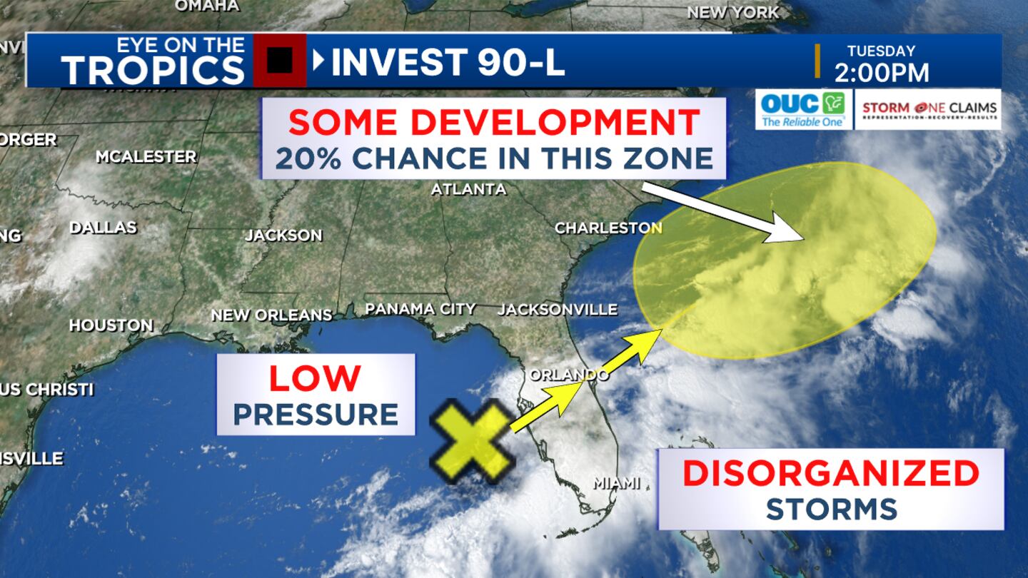
The disturbance has only a 20% chance of development.
Its main threat will be heavy rain and flooding in some areas.
Expect pockets of gusty winds, especially over open waters. There could also be lightning.
Read: 2024 Atlantic hurricane season could be among most active on record, experts say
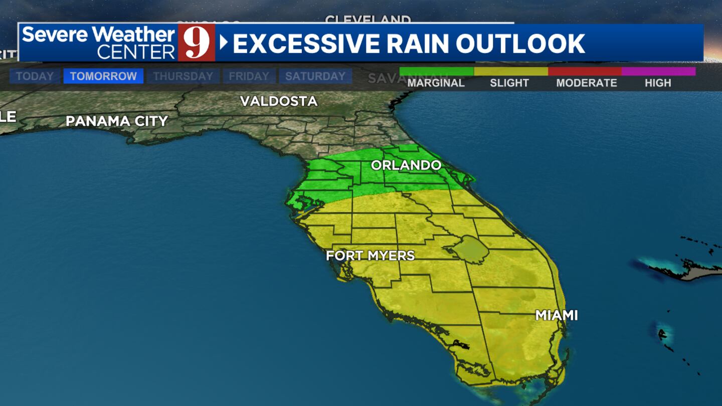
Certified meteorologist George Waldenberger said there will be stronger beach waves along Central Florida’s east coast this weekend.
“(The bottom line is we’ll see) off and on heavy showers for the next few days -- day and night -- and a good opportunity for needed rain,” he said. “This should kick off our summer wet season.”
Some parts of Central Florida can expect 4 to 7 inches of rainfall.
Photos: What will the 2024 hurricane names be?
Terry and Waldenberger are in Severe Weather Center 9, tracking the disturbance.
They will provide your live updates on Channel 9 Eyewitness News.
Click here to download our free news, weather and smart TV apps. And click here to stream Channel 9 Eyewitness News live.

0 of 26


©2024 Cox Media Group


