ORLANDO, Fla. — 5:30 p.m. update:
Isolated storms will continue until the late evening on Saturday, mainly in Polk, Lake, Marion and Sumter Counties, before falling apart.
>>> SEE LIVE RADAR HERE <<<
Weather will be rather quiet Monday morning although we can’t rule out an isolated shower.
Monday afternoon, especially after 2 p.m., storms will be more widespread and there will be an isolated rash of severe storms as well.
Heads up for tomorrow:
— George Waldenberger (@GWaldenWFTV) July 11, 2021
More afternoon storms across Florida, but with the help of an upper disturbance, they could be a little stronger. Watching a 'marginal' risk of severe wind/hail. pic.twitter.com/7j4KkHXsdy
Small hail and gusty winds will be the main threat through 9 p.m. on Monday. We will see drier weather by the end of the week.
Previous Story:
A hot and humid Sunday helped to fuel afternoon storms in Central Florida.
>>> SEE LIVE RADAR HERE <<<
Before the storms moved in, most inland areas saw highs in the low 90s, with temperatures feeling like they were in the upper 90s.
READ: Richard Branson set to launch own rocket to space on Sunday
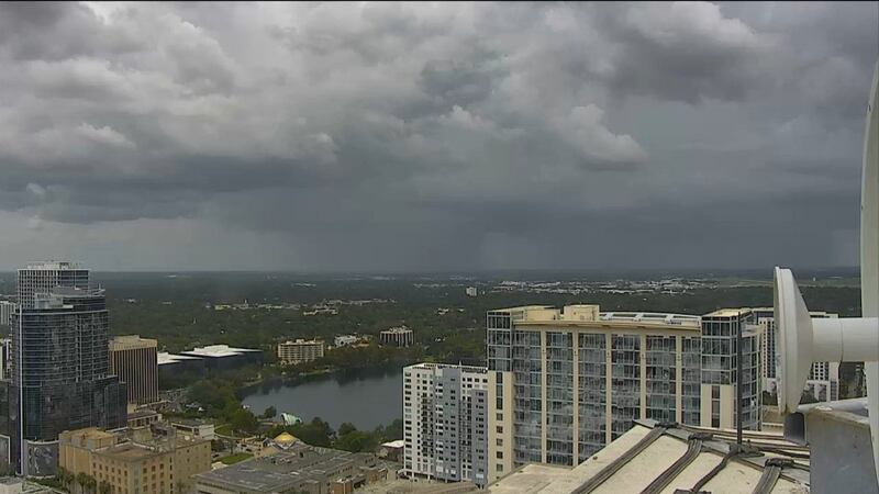
Afternoon seabreeze storms developed along the east coast before moving west over the I-4 corridor.
Fast-moving downpours will move over Orlando before impacting Marion, Lake and Sumter counties.
Quick, thunderous downpours have moved over Orlando...they'll be setting up over Marion, Lake, Sumter Counties for the late afternoon. pic.twitter.com/rCxpL1pFA2
— George Waldenberger (@GWaldenWFTV) July 11, 2021
Storms will continue moving through the western areas late afternoon through early evening.
Visit our hurricane section: EYE ON THE TROPICS
Visite la sección en español: Temporada de huracanes
Those showers will taper this evening, before repeating again tomorrow with more scattered storms
Storm clouds building into Orlando from the east pic.twitter.com/0AnlYxZAhh
— George Waldenberger (@GWaldenWFTV) July 11, 2021
Follow our Severe Weather team on Twitter for live updates:
Click here to download the WFTV weather app for live updates to your phone, and click here to stream weather coverage on the WFTV now app.
©2021 Cox Media Group


