ORLANDO, Fla. — Update:
A few storms are possible Wednesday afternoon -- mainly in Sumter, Marion, Polk and Lake counties.
▶ WATCH CHANNEL 9 EYEWITNESS NEWS
We’ll watch the rest of Central Florida for an isolated storm Wednesday evening. Conditions will be humid.
“Scattered rain, in spots, is likely for the morning drive,” certified meteorologist George Waldenberger said. “It’ll clear out for the afternoon, giving way to breezy afternoon conditions (making it feel) cooler and very dry.”
Read: ‘Looking to game the system’: DeSantis signs squatting bill into law in Orlando
Conditions will improve after the system finishes moving through the area.
“Easter weekend looks great,” he said. “Cool mornings; nice afternoons -- not too windy.”
Watch Channel 9 Eyewitness News at 4 for live updates to your forecast.
Read: DeSantis vs. Disney: Settlement reached in lawsuit
Earlier story:
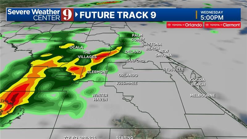
Central Florida will see another warm day on Wednesday as rain and storms are on the way.
We will be cloudy overall on Wednesday morning before a storm system moves into our area in the afternoon.
Our area will have a 40% chance of showers and storms on Wednesday afternoon and evening.
0 of 26


Even with the clouds and storms, we will see high temperatures around 86 degrees on Wednesday afternoon.
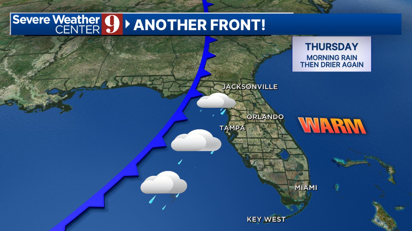
Showers and storms will linger into Thursday morning before clearing out by Thursday afternoon.
Watch: Florida offers disaster support to Maryland after Francis Scott Key Bridge collapse
After the storms pass, we will be gifted a beautiful Easter weekend.
Rain chances will be low, and temperatures will be cooler on Friday, Saturday and Easter Sunday.
Read: Mega Millions: Winning ticket for $1.13 billion jackpot sold in New Jersey
Follow our Severe Weather team on X for live updates:

©2024 Cox Media Group


