ORLANDO, Fla. — Our next winter front is about to move through the Channel 9 viewing area.
With it will come huge changes to our temperatures.
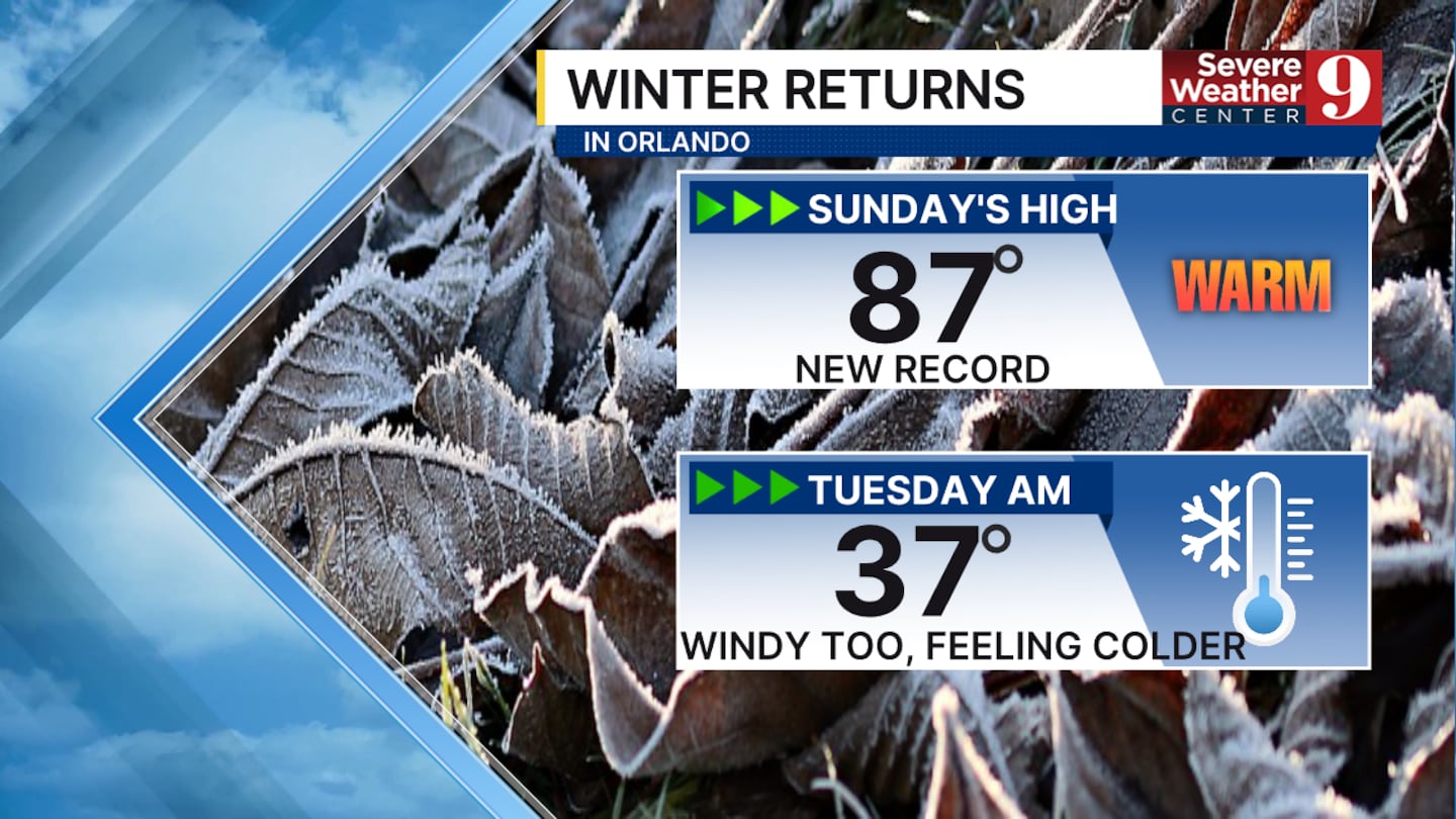
Sunday’s balmy record high of 87° in Orlando may feel like a distant memory by early Tuesday, as Mother Nature delivers a 50-degree drop to the thermometer.
Here’s what else we can expect.
The cold front will bring some scattered showers to the area from Monday morning to midday.
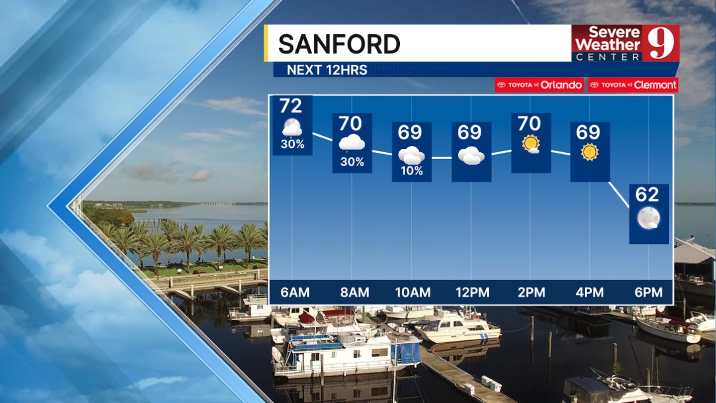
Early morning temps began in the low 70s, but don’t expect them to climb from there.
Meteorologist Kassandra Crimi said they will drop during the day, falling into the 60s this afternoon and getting chilly by Monday evening.

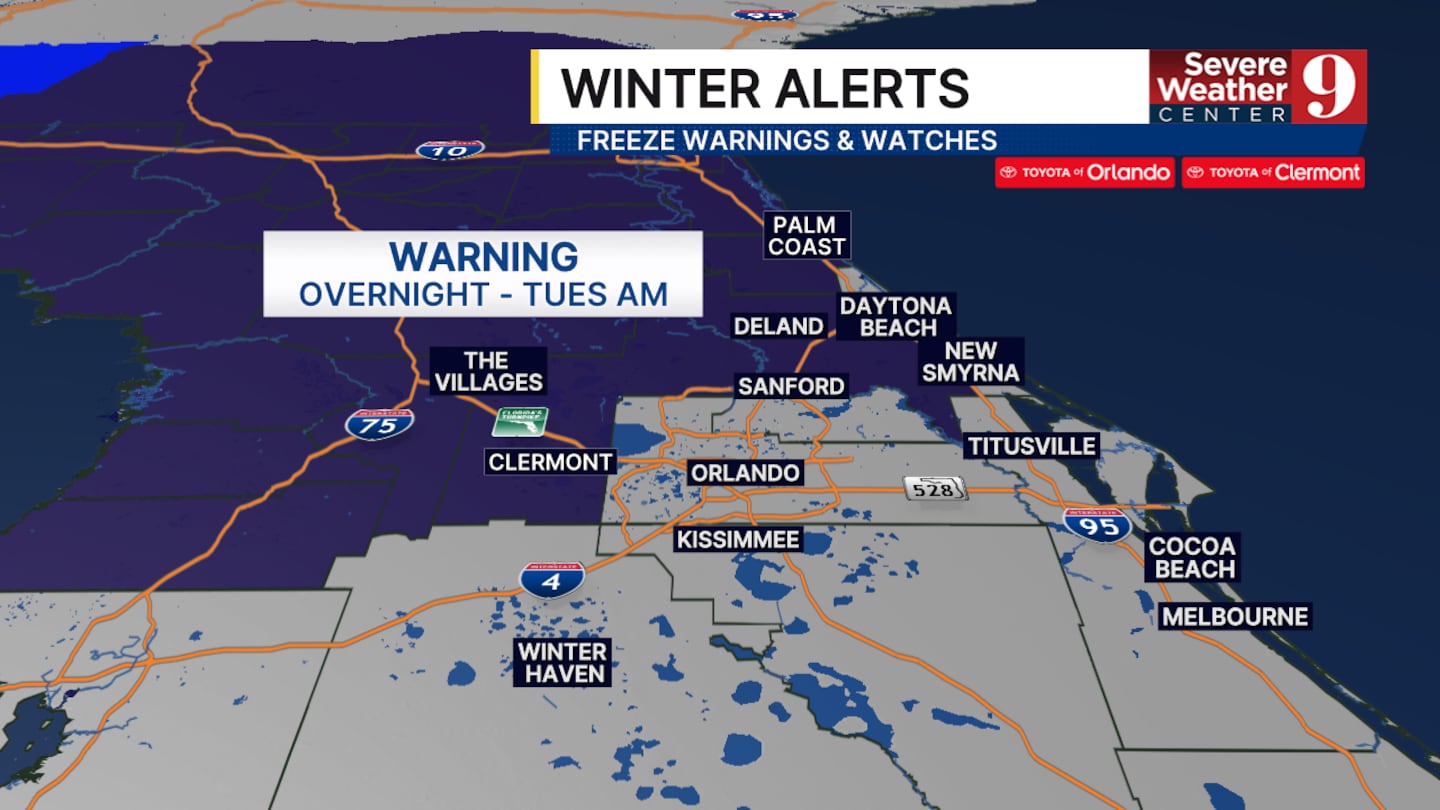
Lows will fall into the 20s and 30s overnight in Central Florida.
A freeze warning will be in place for areas northwest of metro Orlando.
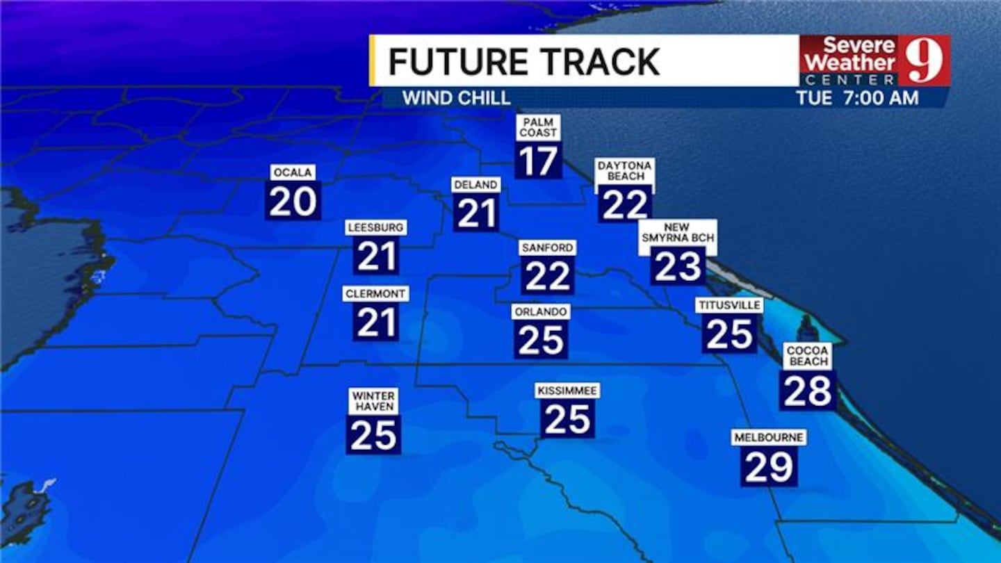
Additionally, it will be quite windy, making the cold feel even colder.
A Cold Weather Advisory will be in effect for most of Central Florida, as wind chill values early Tuesday morning will drop into the 20s.
Be prepared to bundle up!
This cold weather is not in a hurry to move out. Crimi said we’ll wake to 30s in Orlando all week long. Daytime highs will remain in the 50s and 60s.
Click here to download our free news, weather and smart TV apps. And click here to stream Channel 9 Eyewitness News live.

©2026 Cox Media Group


