CENTRAL FLA. — We started the weekend with scattered showers and storms, and more activity is likely for Sunday.
The scattered activity will fade this evening, but a stray coastal shower is possible overnight. Morning lows will be in the mid-70s.
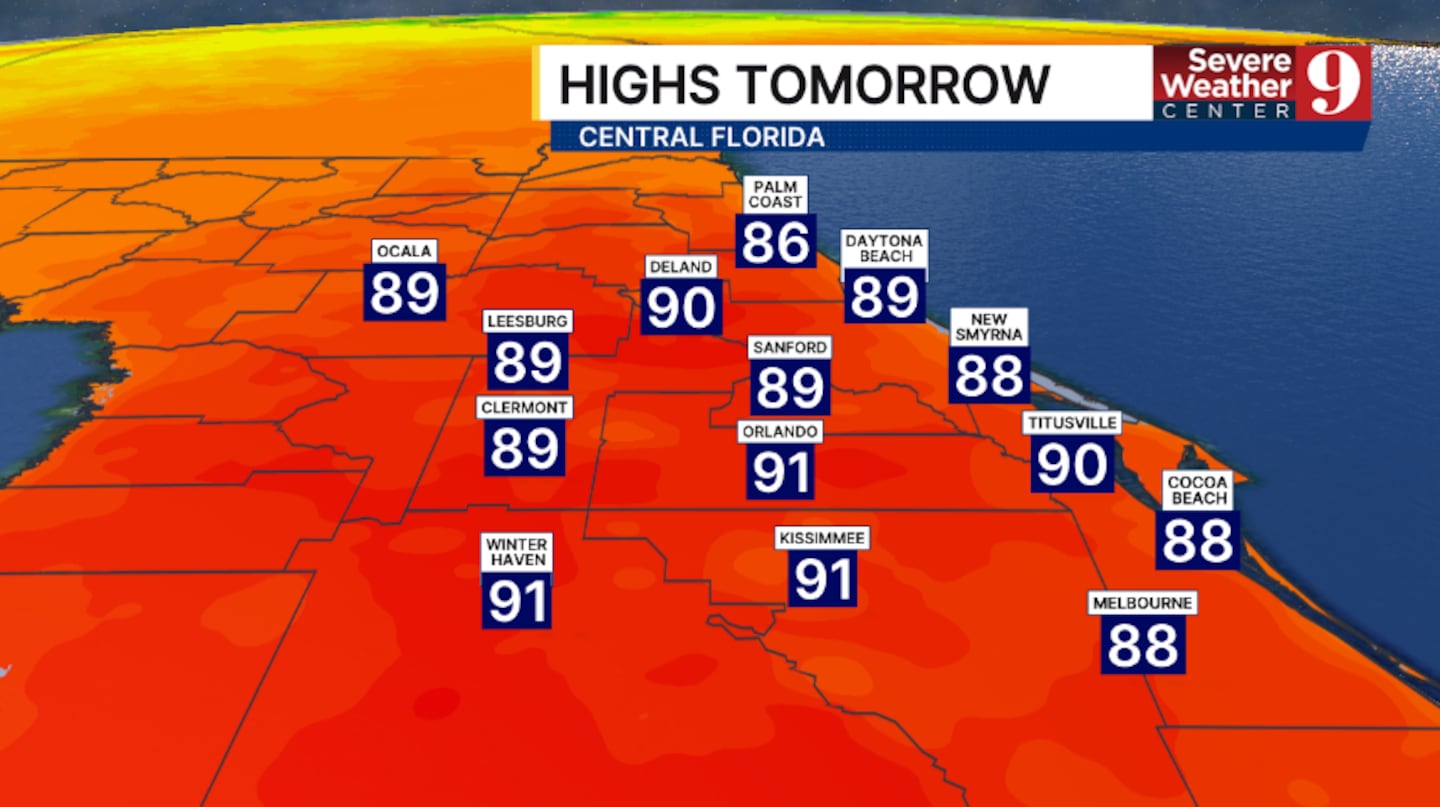
Sunday will feature more rain and storms. Much of the morning and midday now looks dry, with scattered activity developing in the afternoon. Highs for Sunday will be in the low 90s.
We are tracking Weather On the Way starting Monday.
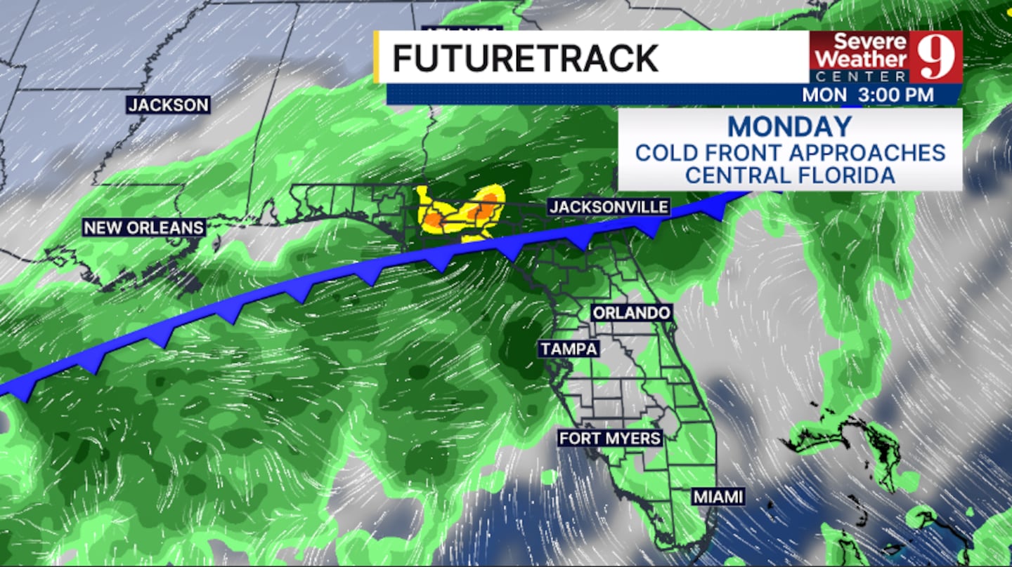
A cold front will push into the region and linger for much of next week, bringing further rain and storms.
Periods of rain and storms are likely both Monday and Tuesday, with heavy rainfall possible. Highs to start next week will be in the mid-80s.
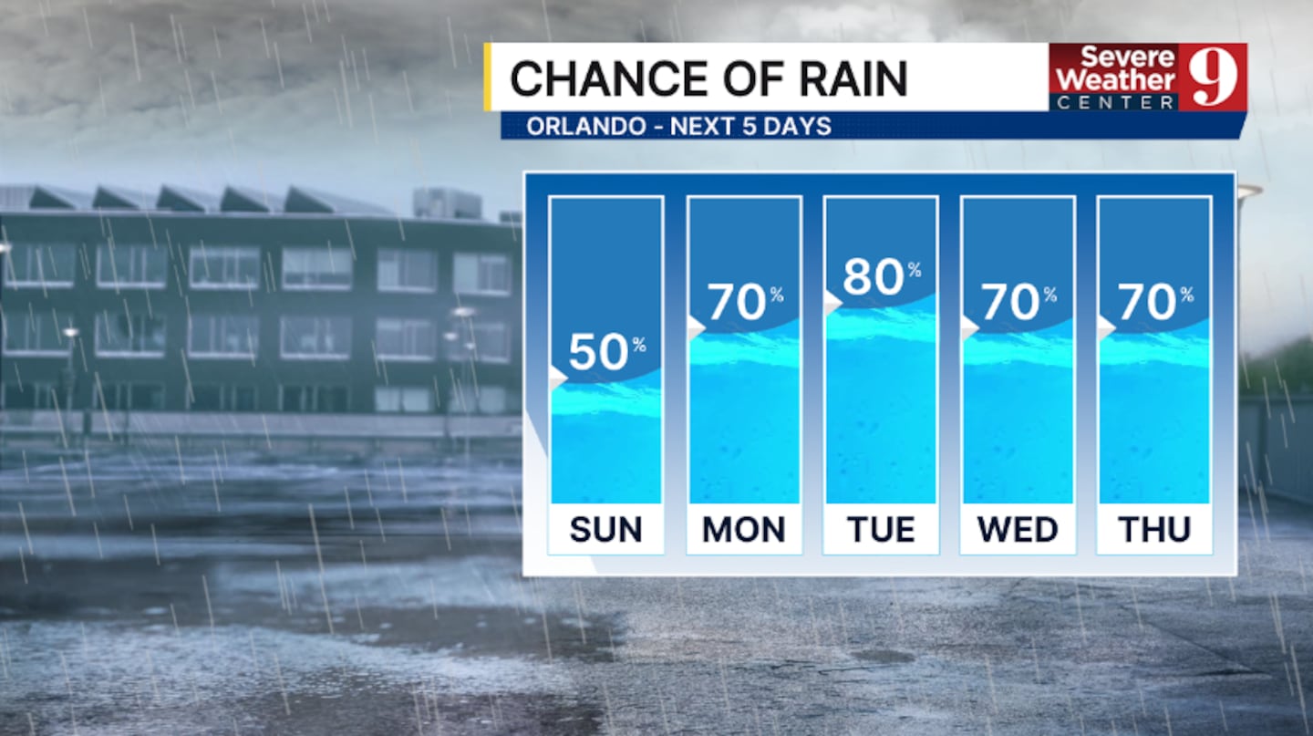
More rain and storms will impact the area mid next week, with coastal concerns possible as a surface low develops. Temps for Wednesday and Thursday will be in the mid-80s.
The very active weather pattern will likely continue for the back end of next week.
Click here to download our free news, weather and smart TV apps. And click here to stream Channel 9 Eyewitness News live.

©2026 Cox Media Group