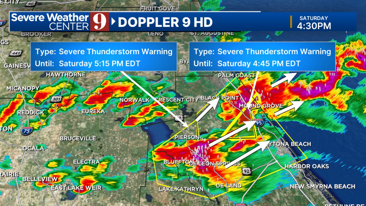
4:30 p.m. Update:
ORLANDO, Fla. — Severe t-storm warnings are in effect for Volusia (through 5:15 p.m.) and Flagler County (through 5 p.m.) for quarter-sized hail and 60mph damaging wind.
Storms between DeLand/DeLeon Springs approaching Daytona Beach and Palm Coast/Flagler Beach.
3:30 p.m. Update:
Storm damage reports: Lake County - East of Leesburg
3:30 p.m.
Bassville Park: Powerlines and several trees are down at the intersection of SR44 and CR473
3:35 p.m.
Lisbon: Powerlines and downed trees near intersection of SR44 and Emeralda Ave.
Earlier Story:
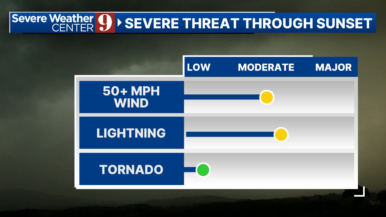
Strong, scattered storms around sunset could bring heavy rain and lightning, small hail, and damaging winds.
▶ WATCH CHANNEL 9 EYEWITNESS NEWS
A tornado warning cannot be ruled out either, so take cover from any storms.
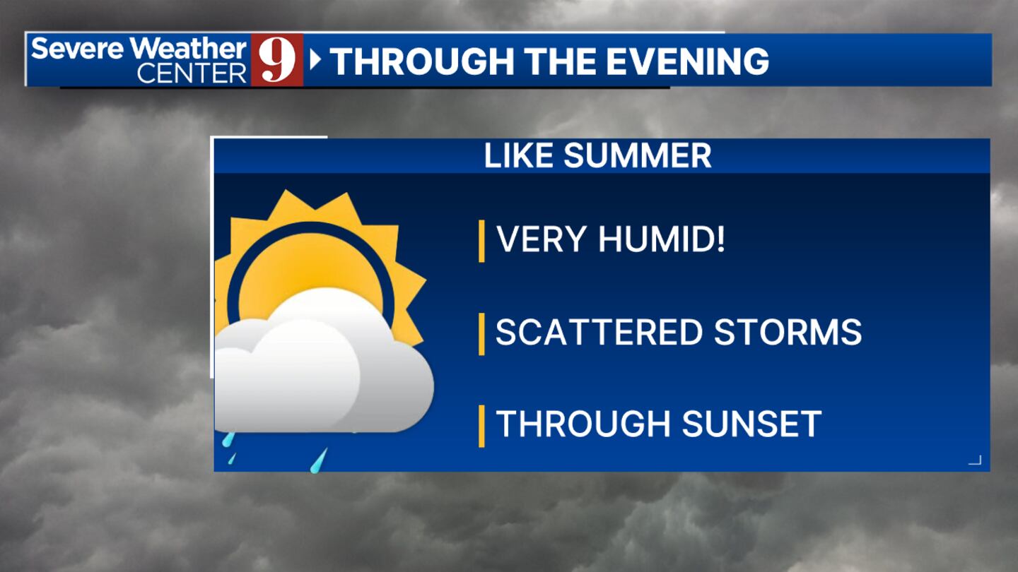
The highest storm chances will be through sunset and near the beaches.
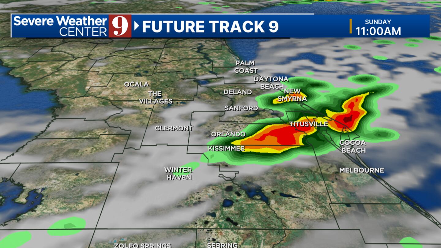
Overnight, an additional storm remains possible, and again, some passing storms tomorrow morning or afternoon, but they should pass through quickly, leaving a good portion of your Sunday without rain.
Follow our Severe Weather team on X for live updates:
Click here to download our free news, weather and smart TV apps. And click here to stream Channel 9 Eyewitness News live.
©2024 Cox Media Group