ORANGE COUNTY, Fla. — 7:00 p.m.
The strongest storms that affected the afternoon commute have pushed offshore. Lighter and scattered showers are affecting Polk and Lake County. There is another batch of storms that could follow these scatted showers coming from the south-southwest. The general movement will be to the north, but this set will struggle to stay strong as the atmosphere loses the heat of the day after sunset.
Overnight, mostly cloudy skies low temperatures drop to the low-70s. It will feel muggy and warm.
>>> Have our WFTV Weather app ready for tomorrow's storms, receive weather and lightning alert wherever you are <<<
Wednesday will start off mostly calm, then storms start picking up steam late morning and the radar filling in starting early afternoon, once again.
Dooms day...#stormalert9 pic.twitter.com/cnTvm7Js8a
— Jround (@Jround7) May 15, 2018
As one batch of storms moves offshore, another builds west of #Orlando for the evening. #WFTV #Florida pic.twitter.com/i9qXB6ywAI
— George Waldenberger (@GWaldenWFTV) May 15, 2018

5:00 p.m.
Storms become more copious just in time for the afternoon commute.
Storms continue to be very strong and have slowly shifted a bit east near the coast. Funnel clouds are likely to develop near the coast are the storms grab more moisture from the Atlantic.
Hail and over 50 mph wind gusts have been reported in parts of Central Florida.
Severe hail possible near #Sanford, moving north at 20mph. #DeBary #Deltona pic.twitter.com/RpCxhpsztx
— tom terry (@TTerryWFTV) May 15, 2018
3:30 p.m.
Storms continue to pick up strength as they move over Central Florida. Although storms will be moving generally north at between 35 to 40 mph, there will be numerous storms just in time for the commute from work and over the I-4 corridor, which will make the roads dangerous. Make sure to take your time and avoid any areas that may be flooded.
📸 Amanda Silva sent to #Stormalert9 She was the passenger taking pics, not the driver
— Irene Sans (@IreneSans) May 15, 2018
Shelf clouds are a good signal of approaching very strong wind gusts followed by torrential rain.
Fotos cortesia de A Silva. Nubes tipo estantería señalan vientos fuertes seguidos por diluvio. pic.twitter.com/lkzfJNGEdg
Shelf clouds are approaching Downtown Orlando, these types of clouds are a signal of strong winds approaching the area. Also, keep in mind lightning can strike miles away from the base of a storms, it's important to avoid been in open fields or under trees when thunderstorms are present.
Share your pictures using #stormalert9 (take them safely)
— WFTV Weather (@WFTVWeather) May 15, 2018
They show up on our website https://t.co/Ld0fGzwdVj https://t.co/R9rNHsLELZ
1:30 p.m.
A storm approaching Ocala may pack a punch with 60 mph winds. Residents should stay inside and away from windows.
Storms building in Lake and Sumter counties are about to bring strong winds and possible hail.
***Severe thunderstorm warning until 2:15pm for Marion County, #Florida***
— George Waldenberger (@GWaldenWFTV) May 15, 2018
Storm approaching #Ocala now may be able to kick up 60mph winds. Stay inside away from windows. https://t.co/cNHkwRXBg2#stormalert9 #WFTV #Florida pic.twitter.com/dS1k8Bhy7o
Hey Sumter and Lake Counties:
— George Waldenberger (@GWaldenWFTV) May 15, 2018
We're watching a building storm in southern Sumter...watching the threat for strong winds and small hail within...https://t.co/cNHkwRXBg2#stormalert9 #WFTV #Florida pic.twitter.com/IF1I5SML9J
12:50 p.m.
Storms have started to fire up, very isolated, across Central Florida. Our radar will become busier within the next few hours as the day's heating feeds the development of more storms across the region.
It had its best chance of developing yesterday... it didn’t. Regardless lots of rain over Florida and the SE US as more moisture is pulled from the Caribbean by this weak low and the high over the Atlantic.. pic.twitter.com/RYh4bzHJNI
— Irene Sans (@IreneSans) May 15, 2018
The highest threat the afternoon storms will bring is lightning. Also, strong gust of winds are possible.
Rainfall today could once again reach 3 inches in some areas, with the ground being already saturated, there could be minor flooding in areas of poor drainage or prone to flooding.
Rainfall locations can vary.
— Irene Sans (@IreneSans) May 15, 2018
KEY: some spots could once again receive 3 in. in the next 24H
Totals keep going up.
Lightning will also be an issue this afternoon. Receive lightning alerts when it strikes within 8miles from your loc. https://t.co/qhWzHINbpD pic.twitter.com/IQtSEBKLDn
By 4 p.m. the storms will likely be dominating the I-4 corridor. These storms could be strong, and some could become severe. Make sure to take your time on the roads and drive carefully. Remember, flashers, or emergency lights, are illegal to use when it's not an emergency.
Storms will generally move north and lose strength after sunset. By 10 p.m. a few moderate showers likely to be left behind across Central Florida.
11:25 a.m.
Showers and more storms are popping up along the coast.
Waterspouts are possible. One was reported around 11:40 a.m. in Brevard County.
Central Florida will see widespread tropical storms this afternoon, according to certified meteorologist Brian Shields.
WATERSPOUTS REMAIN POSSIBLE! Use caution along the canals & coast. Brief waterspouts are possible! pic.twitter.com/fPSXvxFRSC
— Brian Shields (@BrianWFTV) May 15, 2018
Rain & storms are starting to develop. Most of us have been dry, but that is going to change. Widespread rain coming soon! See you from Noon-1 on Channel 9. pic.twitter.com/kY8VBJaNxr
— Brian Shields (@BrianWFTV) May 15, 2018
9:11 a.m.
Lightning could become an issue for residents in Volusia County.
Be mindful of the lightning around Daytona Beach - even inland. Use caution... pic.twitter.com/0NrzoeA14s
— Brian Shields (@BrianWFTV) May 15, 2018
8:15 a.m.
Volusia County is about to see some downpours of rain.
Rain is on the doorstep of New Smyrna Beach. Heading to Port Orange, Daytona Beach and Ormond Beach. pic.twitter.com/zAmZ84ihAr
— Rusty McCranie (@RMcCranieWFTV) May 15, 2018
TRAFFIC ADVISORY:
— Melbourne Police (@MelbournePolice) May 15, 2018
NASA & US1 SHUT DOWN ALL LANES NORTH & SOUTH DUE TO A MULTI-VEHICLE COLLISION.
6:00 a.m.
Heavy rain is moving through parts of Brevard County right now.
WET RIDE FOR I-95: It's already starting off to be a wet ride for I-95 through @BrevardCo_FL. But the rain along the coast is only the start of a wet day(s) ahead. https://t.co/4VtTN7zMSA pic.twitter.com/HIgrkQKUyA
— Racquel Asa (@RAsaWFTV) May 15, 2018
4:15 a.m.
The day will start off cloudy with rain and storms picking up in the afternoon. There is a 70 percent chance of rain throughout the day, according to certified meteorologist Brian Shields.
You will mainly see downpours in the afternoon and evening. An additional one to three inches of rain is possible Tuesday.
Heavy rain working through parts of Brevard County. Use caution. Have the rain gear today!! Wet! Live on Channel 9... pic.twitter.com/SJy4zjM2yQ
— Brian Shields (@BrianWFTV) May 15, 2018
The National Hurricane Center gives a growing disturbance a 20 percent chance of tropical or subtropical development during the next two days, and 30 percent over the next five days.
The tropical disturbance is west of Central Florida in the Gulf of Mexico. It is very disorganized and doesn't look like it will develop further, Shields said.
From the radar to the roads. Here's what it looks like on the roads pic.twitter.com/EbqzUARwUI
— Racquel Asa (@RAsaWFTV) May 15, 2018
Isolated showers Tuesday morning will not as numerous as the ones experienced Monday morning. But as the day heats up, storms will fire up again and that could lead to strong wind gusts and multiple lightning strikes.
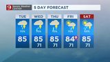
Watch below: 5-day forecast: Scattered rain throughout Tuesday:
Watch below: Certified meteorologist Brian Shield's full forecast

Reminder! pic.twitter.com/IRu0KeNqP9
— Brian Shields (@BrianWFTV) May 15, 2018
Cox Media Group


