ORLANDO, Fla. — Update: The chance of a disturbance in the Atlantic forming has gone down as of Wednesday evening, Channel 9 meteorologist George Waldenberger said.
The chance of formation went from 50% to 40%, Waldenberger said.
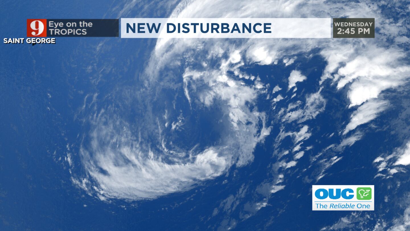
Low pressure over the central Atlantic is producing a large area of disorganized showers and storms. It’s still not a tropical system and is caught up with a front, Waldenberger said.
Although some subtropical development is still possible, time is running out. If it is to develop into a subtropical storm, it’s it will have to do so before it moves over cooler water Friday, which would eliminate the chance of tropical development..
Update:
A disturbance in the Atlantic Ocean was becoming better organized as of Wednesday afternoon.
Mystery object in Daytona Beach They think the object, which they believe was buried under more than 5 feet of sand just south of Frank Rendon Park, may be a cargo ship from the 1800s. (WFTV Staff)
Mystery object in Daytona Beach They think the object, which they believe was buried under more than 5 feet of sand just south of Frank Rendon Park, may be a cargo ship from the 1800s. (WFTV Staff)
Mystery object in Daytona Beach They think the object, which they believe was buried under more than 5 feet of sand just south of Frank Rendon Park, may be a cargo ship from the 1800s. (WFTV Staff)
Mystery object in Daytona Beach They think the object, which they believe was buried under more than 5 feet of sand just south of Frank Rendon Park, may be a cargo ship from the 1800s. (WFTV Staff)
Mystery object in Daytona Beach They think the object, which they believe was buried under more than 5 feet of sand just south of Frank Rendon Park, may be a cargo ship from the 1800s. (WFTV Staff)
Mystery object in Daytona Beach They think the object, which they believe was buried under more than 5 feet of sand just south of Frank Rendon Park, may be a cargo ship from the 1800s. (WFTV Staff)
Mystery object in Daytona Beach They think the object, which they believe was buried under more than 5 feet of sand just south of Frank Rendon Park, may be a cargo ship from the 1800s. (WFTV Staff)
Mystery object in Daytona Beach They think the object, which they believe was buried under more than 5 feet of sand just south of Frank Rendon Park, may be a cargo ship from the 1800s. (WFTV Staff)
Mystery object in Daytona Beach They think the object, which they believe was buried under more than 5 feet of sand just south of Frank Rendon Park, may be a cargo ship from the 1800s. (WFTV Staff)
Mysterious structure unearthed by erosion in Volusia County
Mysterious structure unearthed by erosion in Volusia County
Erosion reveals structure on beach Erosion from Hurricane Nicole revealed a mysterious structure on the beach in Volusia County. (Volusia Beaches)
Earlier story:
Channel 9 meteorologists continue to track a rare spin-up in the Central Atlantic.
The disturbance has a 50% chance of being named as it moves toward Europe.
Since 1950, there have only been 11 named storms in December.
The storm system could bring some rain and wind to the Azores this weekend.
Thankfully, non-tropical low-pressure area will not approach the United States.
Video: Rare December disturbance moves through Central Atlantic toward Europe Channel 9 meteorologists continue to track a rare spin-up in the Central Atlantic.
Click here to download the free WFTV news and weather apps, click here to download the WFTV Now app for your smart TV and click here to stream Channel 9 Eyewitness News live.