ORLANDO, Fla. — 11 p.m. update:
Paulette strengthened into a hurricane Saturday night, according to the National Hurricane Center.
Paulette is forecast to bring heavy rains and strong winds to Bermuda by Sunday evening.
Paulette is not expected to impact Florida.
Paulette strengthens into a hurricane, en route to pass near Bermuda late Sunday night/Monday morning. #WFTV #Florida pic.twitter.com/rBH4WFHAbj
— George Waldenberger (@GWaldenWFTV) September 13, 2020
Tropical Storm Sally is expected to strengthen over the Gulf of Mexico this week.
Sally is moving west-northwest at 8 mph with maximum sustained winds of 40 mph.
Sally continues to move away from Florida and is forecast to bring life-threatening storm surge and hurricane-force winds to portions of the northern Gulf Coast early next week.
Central Florida is still close enough to Sally for waves of rain to continue Sunday.
11pm Tropical Storm Sally updated forecast track. Still forecast to strengthen to a hurricane before a Tuesday landfall. A slowdown would increase storm surge/flooding threat to North Gulf Coast. pic.twitter.com/qCrVFlYNIU
— George Waldenberger (@GWaldenWFTV) September 13, 2020
5 p.m. update:
Tropical Depression 20 formed over the central tropical Atlantic and will likely become ‘Teddy’ as it moves over the open waters. Tropical Storm Sally is moving away from South Florida over the Gulf. Parts of coastal Louisiana, Mississippi, Alabama under a hurricane watch. Much of Florida Panhandle coast under a tropical storm watch. Paulette’s expected to become a hurricane tonight, with conditions deteriorating for Bermuda tomorrow night as it approaches. Rene is still a meandering tropical depression, will likely continue to weaken over the open waters over the next four days. Locally, Sally will be moving away, but the feed of tropical moisture is still there for us to receive rain and squalls tonight and again tomorrow.
Tropical Depression Twenty forms, making four active systems in the Atlantic Basin at once. #EyeOnTheTropics Full Story: https://t.co/dYaDmpKmQ9 pic.twitter.com/BM0upNOw6b
— George Waldenberger (@GWaldenWFTV) September 12, 2020
2 p.m. update:
Tropical Storm Sally formed Saturday afternoon just off the SW Florida coast, south of Marco Island.
Sally is forecast to strengthen to a hurricane by Tuesday morning while approaching the coast of Mississippi and Southeast Louisiana.
Central Florida will see periods of heavy rain and gusty winds into Saturday night.

There’s also another disturbance over the Gulf headed toward Mexico and South Texas.
Meanwhile over the Atlantic, Paulette is forecast to strengthen into a hurricane and approach Bermuda Sunday night and then curve back out to the east on Monday.
Advisories this Saturday afternoon with Tropical Storm Sally: Tropical Storm Watch #Florida Panhandle coast Ochlockonee River to Okaloosa/Walton County Line. Flood watch South and west Florida Peninsula. pic.twitter.com/Lms5LsDOzm
— George Waldenberger (@GWaldenWFTV) September 12, 2020
Tropical Depression Rene is also still out there, forecast to meander around for the next five days, likely dissipating by late next week.
Also, two additional disturbances farther away over the Atlantic will likely develop into tropical depressions, one by Saturday night and one by early next week.
If they get names, the next up are Teddy and Vicky.
2pm update: Tropical Storm Sally forms 35 miles SSE of Naples, Florida. Will move across the Gulf and forecast to become a hurricane as it approaches the LA/MS coast. pic.twitter.com/iA2e55w9Jq
— George Waldenberger (@GWaldenWFTV) September 12, 2020
11 a.m. update:
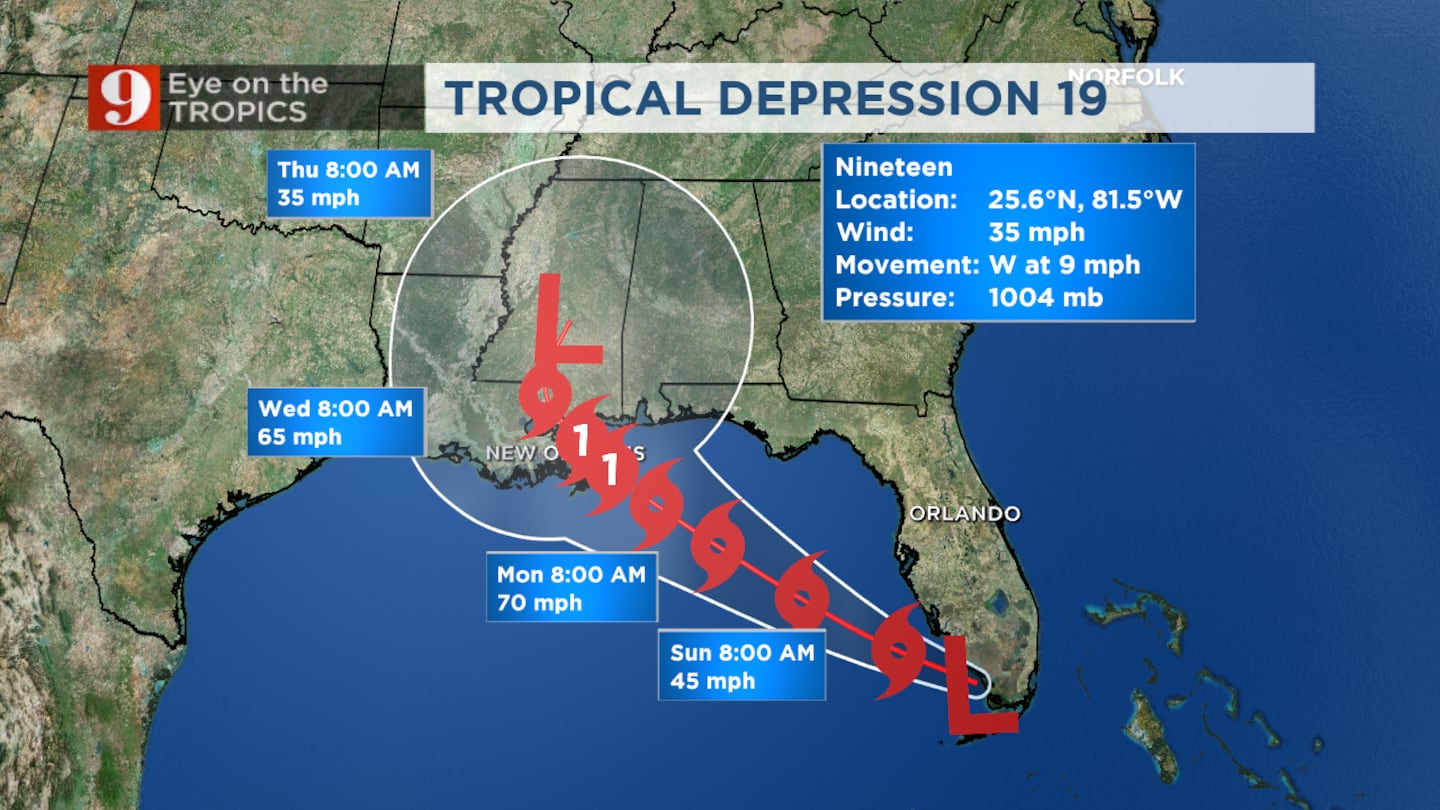
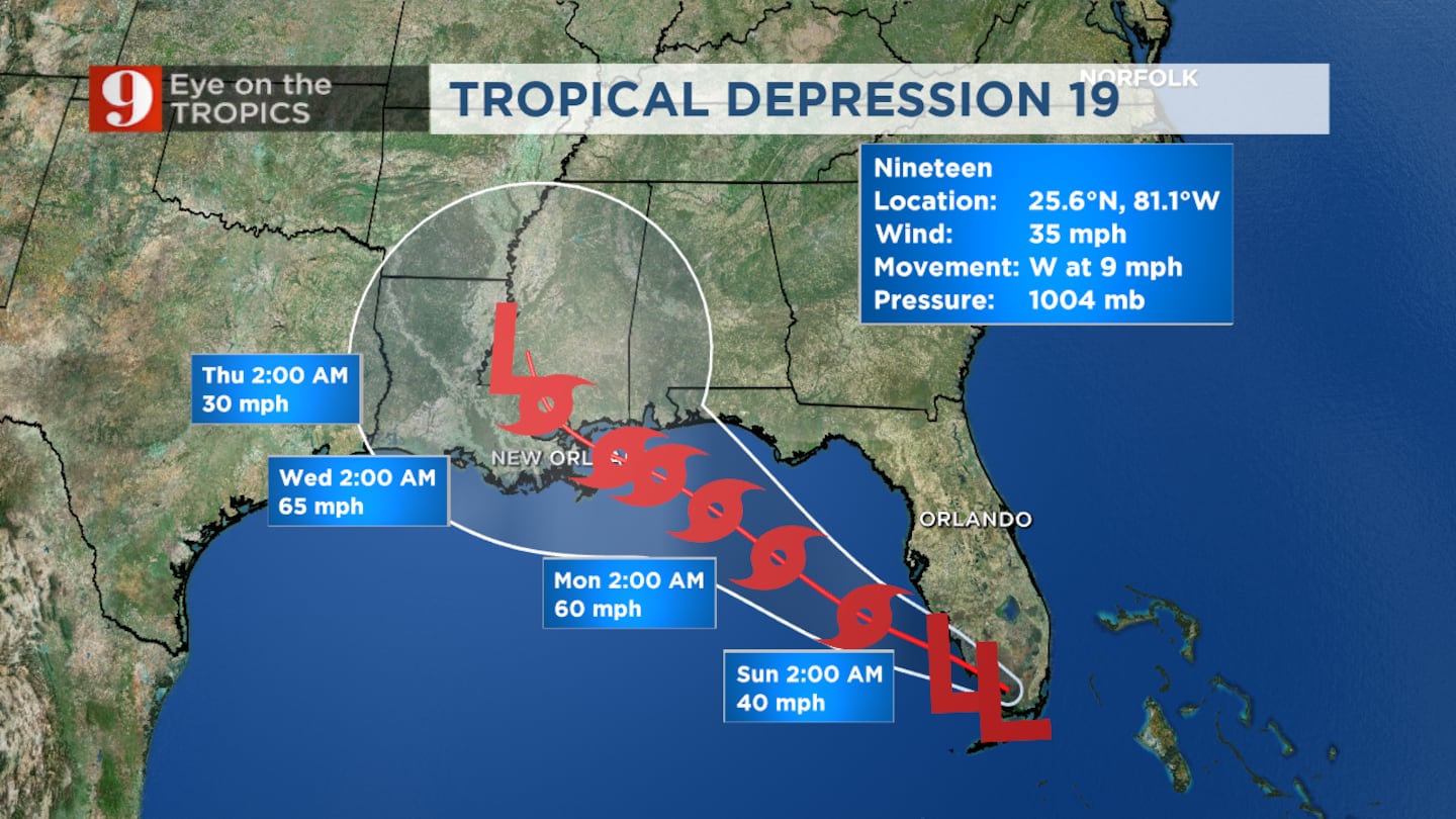
Tropical Depression 19 is still expected to move into the Gulf today. Once it reaches the Gulf, the storm will gradually gain strength. Tropical Depression 19 is now expected to reach Hurricane strength before it makes landfall near the Mississippi & Louisiana coastline. Here in Central Florida conditions remain breezy and wet in the days ahead.
8:00 AM UPDATE
The Tropics remain busy this weekend, with six “areas of interest” that we are watching. This includes Tropical Storm Paulette, Tropical Storm Rene, Tropical Depression 19, Invest 95-L and some Tropical waves.
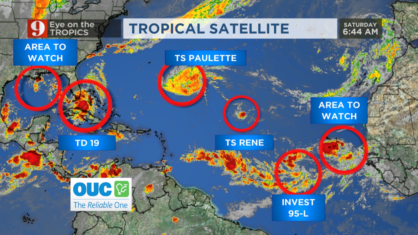
Through the weekend, we’ll be closely monitoring Tropical Depression 19. It’s currently moving west through South Florida and is expected to move into the Gulf later today. We anticipate this system to strengthen as is moves through the Gulf. This could happen as early as Saturday night. Tropical Depression 19 will make for a breezy and wet weekend. Fast moving showers will be possible both weekend days. For now the heavy rain and isolated tornado threat remains low.
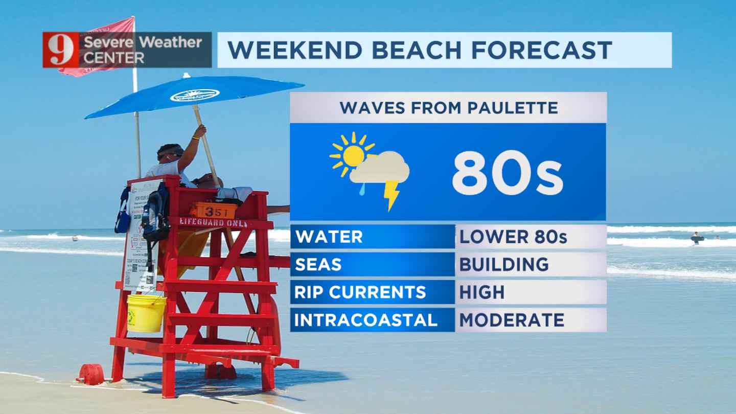
Also, Tropical Storm Paulette remains out to sea, but will be pushing swells our direction. Our seas will build today and stay high through the weekend, with 4-7 foot waves. Small craft advisory is in effect and the rip current risk will be high.
We will continue to monitor the evolution of everything that happens in the tropics and bring you the latest on Eyewitness News, on our Eye on the Tropics section, and on our free WFTV Weather App.
Cox Media Group


