ORLANDO, Fla. — It was a mild start to the workweek across Central Florida, expect a warm and muggier Tuesday with clouds building as the south winds will continue to bring humidity and warmth to Central Florida. This wind flow, combined with a cold front that will arrive on Wednesday, will increase the chance for showers.
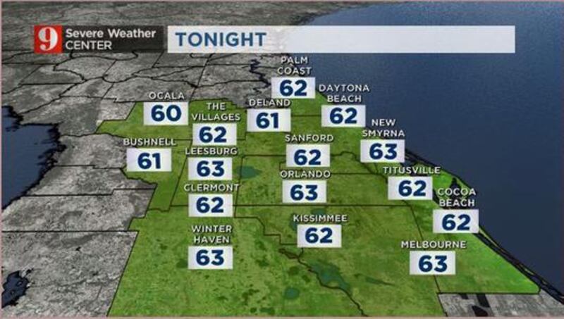
- Evening temps will drop to the low to mid-60s and it will remain humid.
- Temperatures are expected to warm up to 85 degrees by the afternoon.
- Showers and downpours are likely north of Orlando. A few showers are also possible during the afternoon across Brevard County.
- Temperatures will be more seasonable by Wednesday, with highs reaching the mid-70s, and mostly cloudy skies.
- After the cold front pushes over Central Florida, expect the highs to barely reach the low to mid-60s to finish the week.
Catch up on your 5-day forecast:

DOWNLOAD OUR FREE WFTV WEATHER APP TO RECEIVE ALERTS
>>> CLICK HERE TO WATCH LIVE DOPPLER 9 <<<
Pronóstico del tiempo en español por nuestra meteoróloga certificada Irene Sans

Follow our Severe Weather team on Twitter for live updates:
- Chief meteorologist Tom Terry
- Brian Shields
- Irene Sans
- Kassandra Crimi
- George Waldenberger
- Rusty McCranie
© 2020 Cox Media Group


