
ORLANDO, Fla. — The weather has taken us on quite a ride here in Central Florida this week, and it’s not slowing down as temperatures continue to bounce around.
- Temperatures were warm on Thursday, most of the area staying between 75 and 79 degrees and cloudy.
- Rain chances will continue to increase throughout the evening, the winds shift from the south-southeast and more moisture filters over the region.
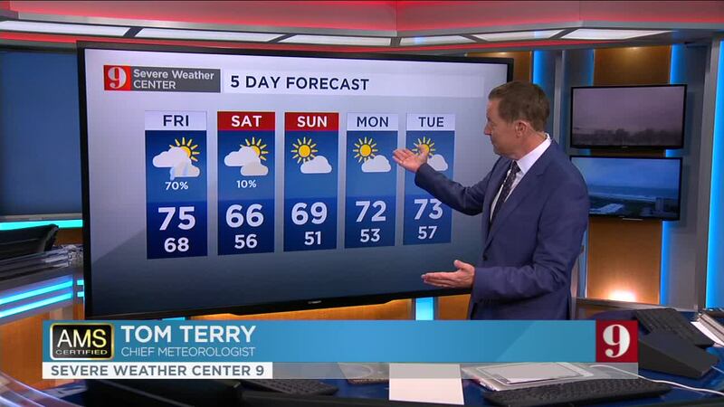
- Expect a rainy Friday as another cool front blows through, bringing a 70 percent chance of rain to the area and highs in the low to mid-70s. Generally showers will move from west to east through the morning hours. An isolated storm is possible.
- A few scattered showers will still be possible Saturday morning, then weather improves through the late morning into the afternoon.
- But the skies are forecast to clear just in time for the weekend, with highs forecast between 65 and 69 with little to no rain.
Catch up on your full 5-day forecast below:
Watch your daily one-minute weather forecast from digital meteorologist Irene Sans:

Más información en español aquí: El tiempo para Florida Central
Follow our Severe Weather team on Twitter for live updates:
- Chief meteorologist Tom Terry
- Brian Shields
- Irene Sans
- Kassandra Crimi
- George Waldenberger
- Rusty McCranie

DOWNLOAD: Free WFTV News & Weather Apps
Cox Media Group


