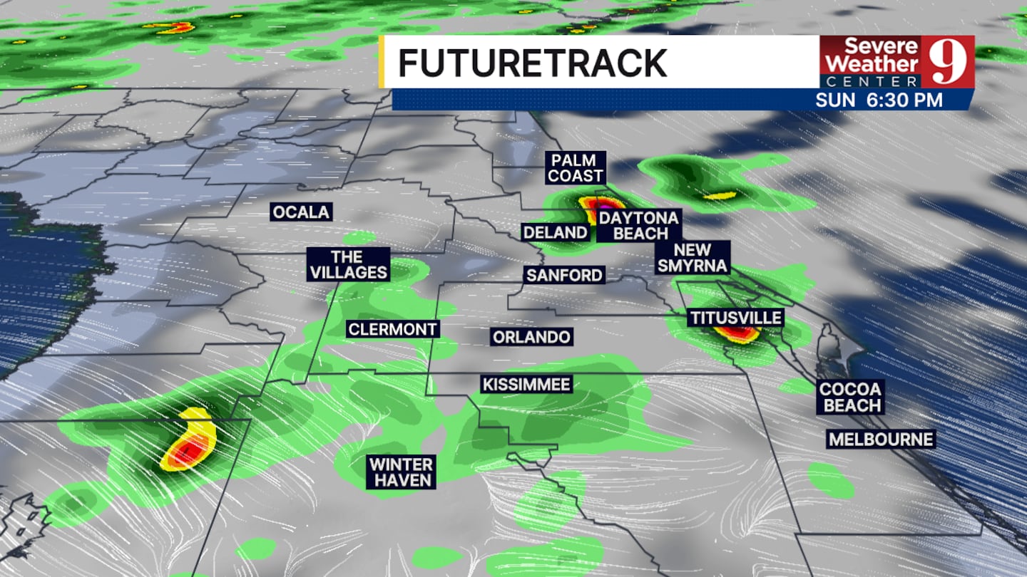
CENTRAL FLORIDA — Easter Sunday will start off dry before better rain chances return in late afternoon for all of Central Florida.
We are tracking a front that will move through our state throughout the entire day. This cold front will have impacts on our region early this evening and throughout most of the work week.
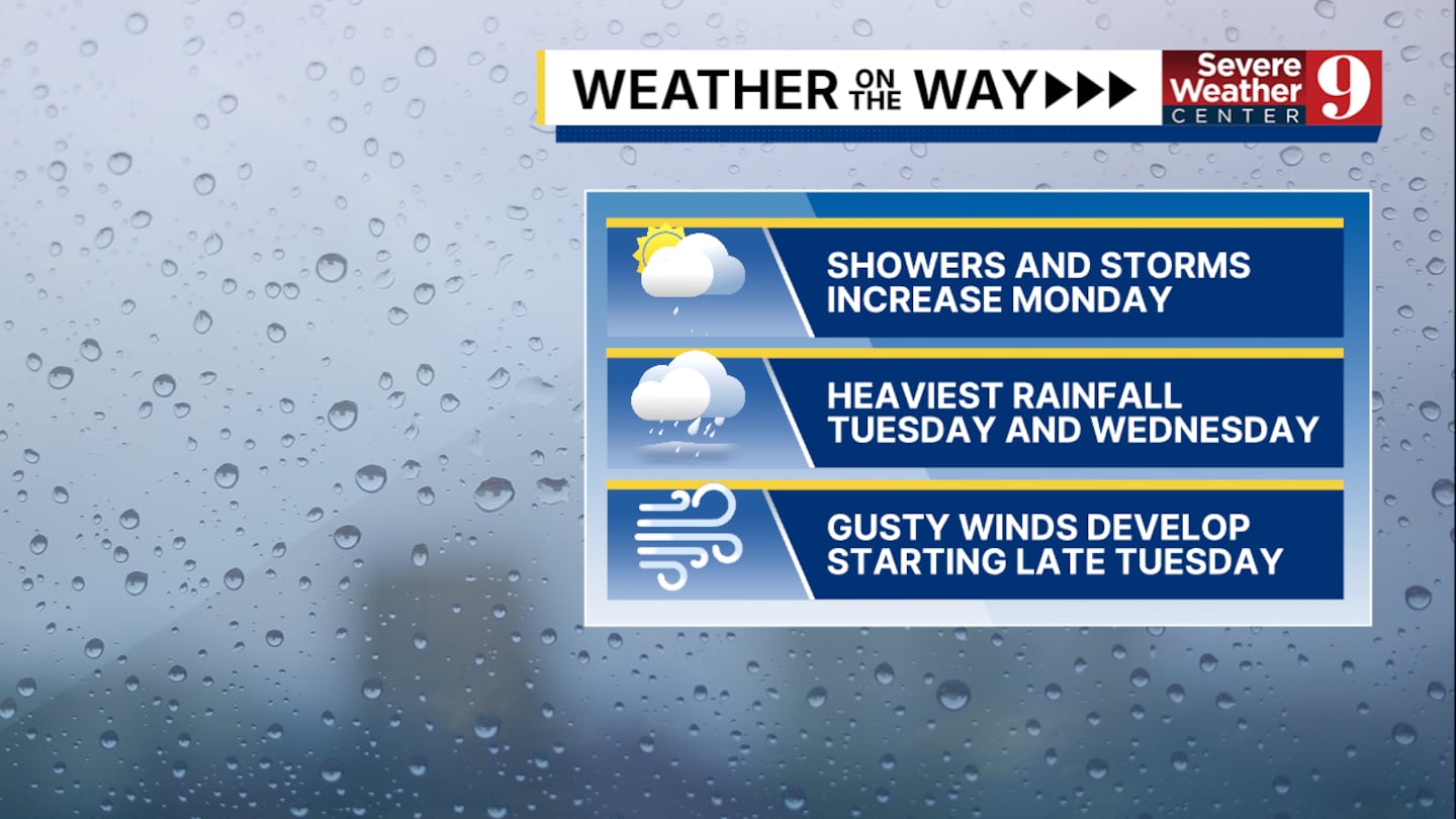
The weather on the way we are tracking will be heavy rain mainly Tuesday and Wednesday, breezy conditions developing late Tuesday and persistent rain through Thursday.
Isolated thunderstorms are possible in our area during this period, but severe weather looks unlikely for the next few days.
The strongest thunderstorms will produce wind gusts of 30 to 35 mph, pockets of heavy rain and a few rumbles of thunder.
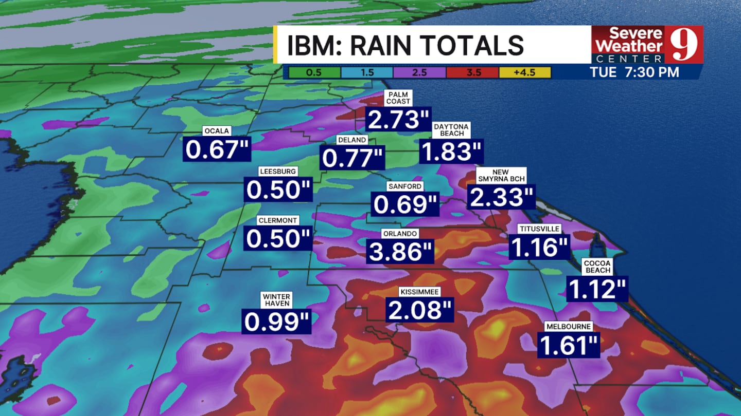
Rain totals between today and the middle of the week could range from as little as 1 inch to as many as 4 inches. This large range is heavily dependent on if you see a thunderstorm develop in your area.
Click here to download our free news, weather and smart TV apps. And click here to stream Channel 9 Eyewitness News live.

©2026 Cox Media Group


