Flooding risk remains as storms move through central Florida
Heavy rain and storms are expected in central Florida today, bringing a risk of localized flooding and lightning.
WFTV Now

Heavy rain and storms are expected in central Florida today, bringing a risk of localized flooding and lightning.
A stalled cold front will bring heavy rain to central Florida through mid-week, with up to 8 inches possible in some areas.
A cold front moving through northern Florida will bring thunderstorms, heavy rain, and wind gusts up to 50 mph today.
Central Florida faces extreme heat today before returning rain and thunderstorms arrive throughout the coming week.
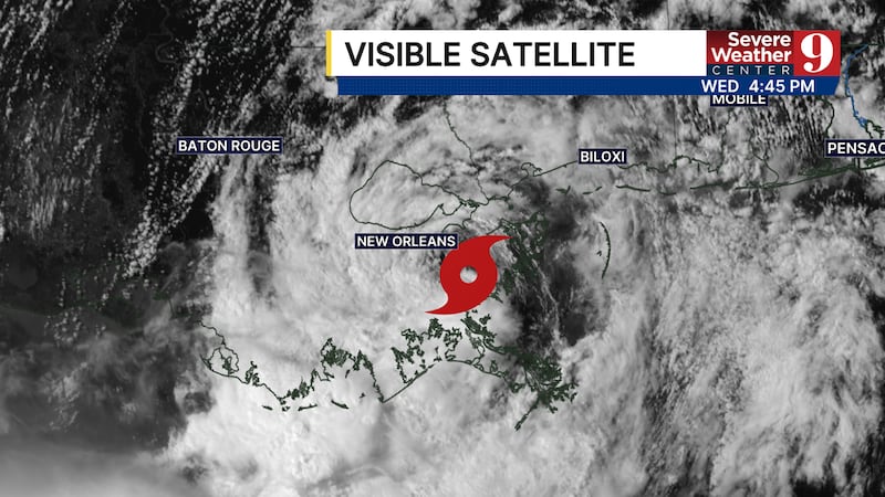
Tropical storm Bertha has made landfall in Louisiana and is expected to move through Texas before dissipating by the weekend.
Tropical Storm Bertha maintains 60 mph winds near Florida. Landfall is expected midday Wednesday across Louisiana and Texas.
Tropical Storm Bertha is expected to make landfall near the Mississippi Delta on Wednesday, bringing heavy rain to the coast.
Tropical Depression Two has formed in the Gulf and is set to track toward the Mississippi Delta, potentially becoming Bertha.
Invest 91L may become tropical depression Bertha, potentially bringing heavy rain to the Panhandle or Louisiana and Texas.
We are tracking an isolated chance of strong to severe storms this afternoon due to heat and humidity interacting with the seabreeze.