CENTRAL FLORIDA — Temperatures remain high for Saturday with afternoon highs stretching into the mid-90s.
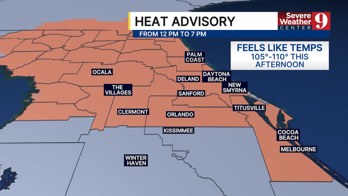
The heat index could feel over 105° at times today. This has prompted the National Weather Service to issue a heat advisory today from noon until 7:00 p.m.
Temperatures will start to fall slightly on Sunday but still remain warm. However, starting tomorrow, better rain chances will return.
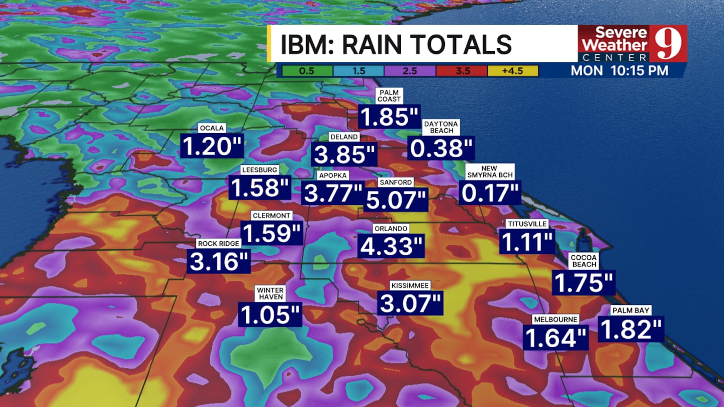
We are tracking plenty of moisture moving back into Central Florida. This could feed heavier thunderstorm development starting tomorrow afternoon through most of the upcoming work week.
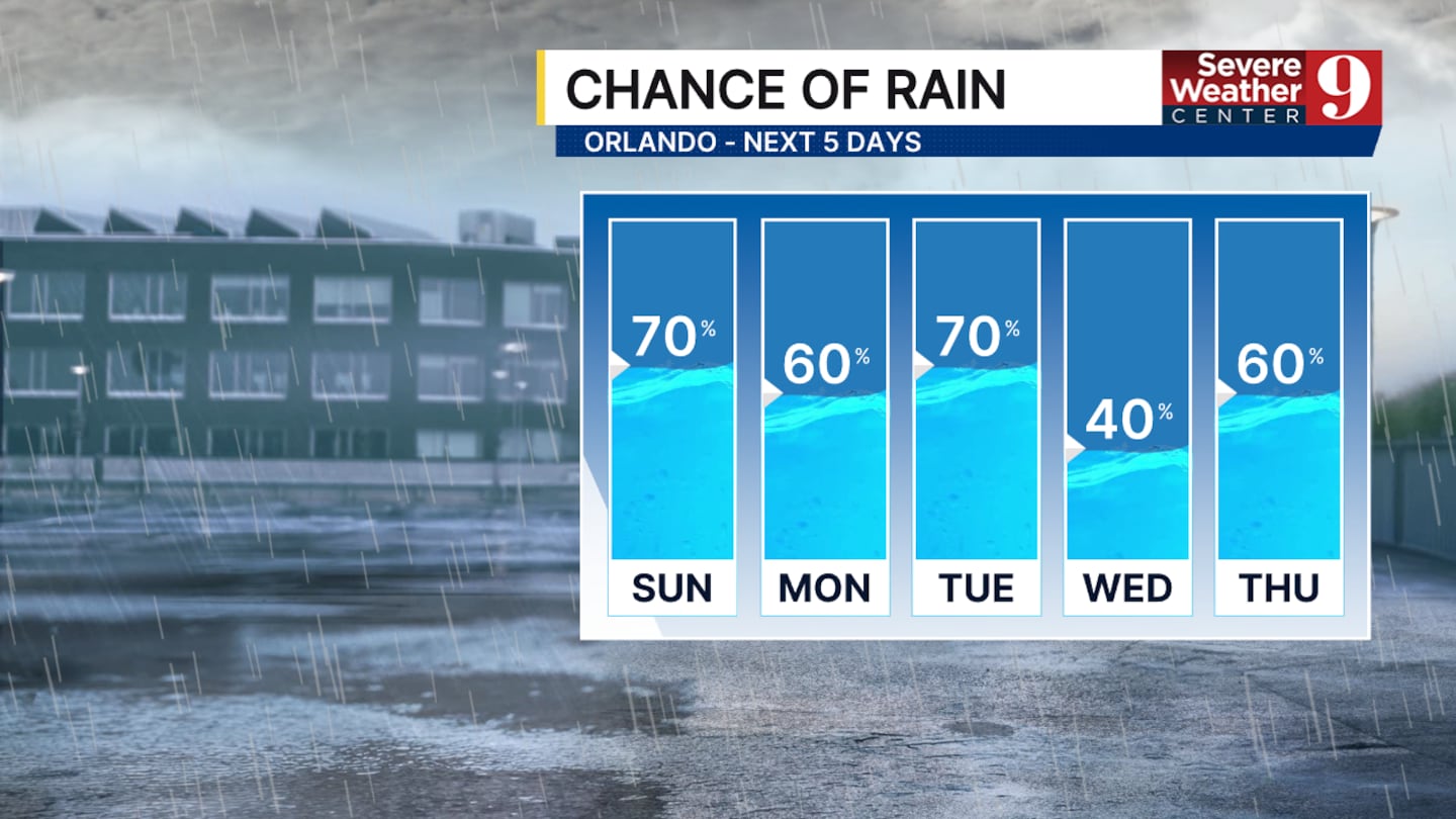
Severe weather as a whole looks unlikely, but pockets of heavy rain, frequent lightning, and strong wind gusts are all possibilities each day over the next week.
Saturday will feature smaller rain chances. We are still looking at some thunderstorm development in the late afternoon and early evening, but it will not be as widespread as what is to come.
Afternoon temperatures by Monday will fall into the low 90s and stay there through the rest of the week.
Click here to download our free news, weather and smart TV apps. And click here to stream Channel 9 Eyewitness News live.

©2026 Cox Media Group


