
ORLANDO, Fla. — The Saharan dust that has been interfering with our rain chances the last few days is slowly moving out of our area.
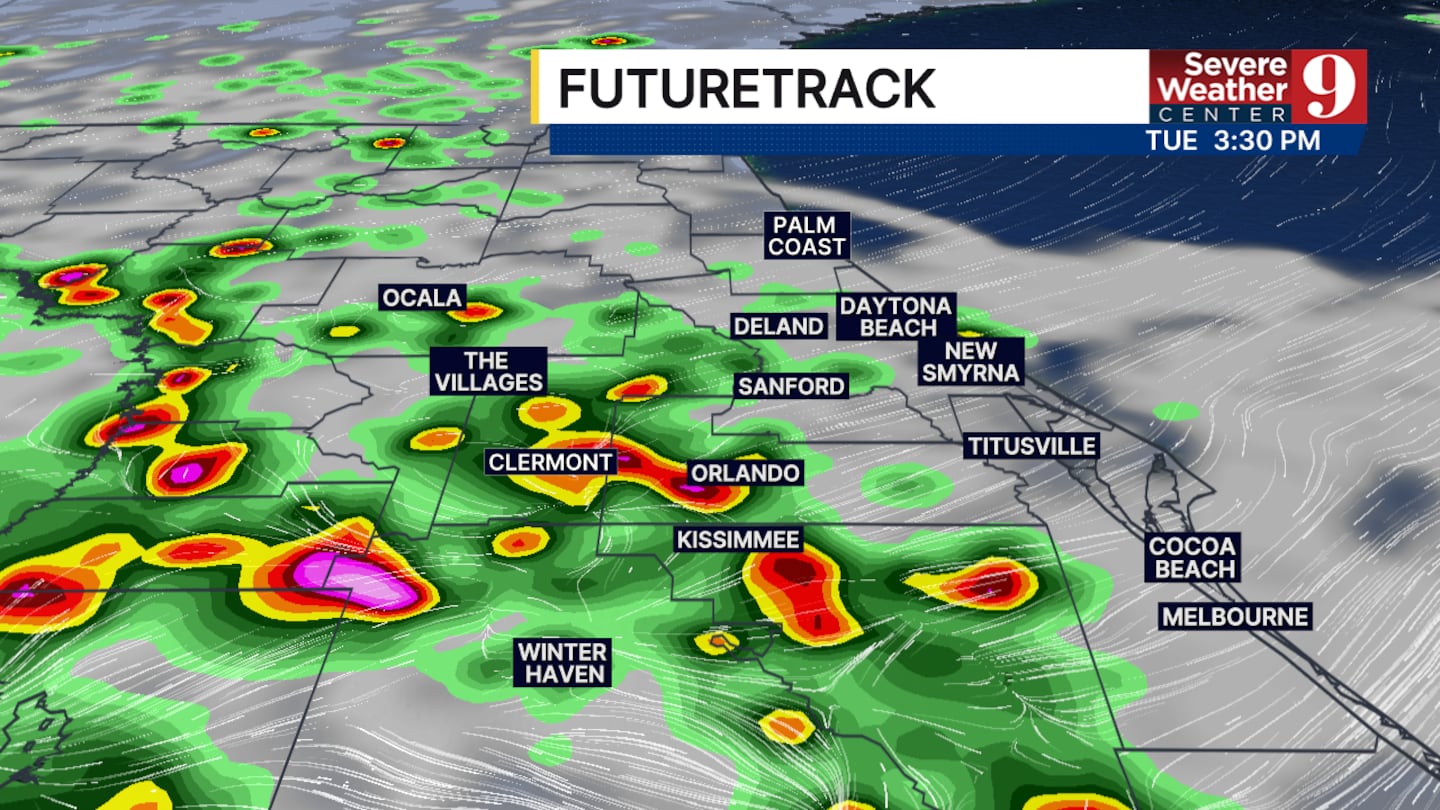
This will allow more moisture to accumulate on Tuesday, with more widespread storm coverage during the afternoon and evening.
Tomorrow will start off just as warm and humid as we’ve seen over the last few days.
Thankfully, the afternoon high will drop slightly, but that will not prevent the heat index from reaching the triple digits once again.
The heat and humidity will translate to better rain and thunderstorm chances by the middle of the afternoon. A few strong thunderstorms are possible, with the main threat being heavy rain.
Some storms may also produce wind gusts up to 50 mph, frequent lightning and small hail in the strongest storms.
Areas like Orlando, Sanford, Kissimmee and other portions of Orange, Osceola and Seminole counties have the best chance to see the stronger storms.
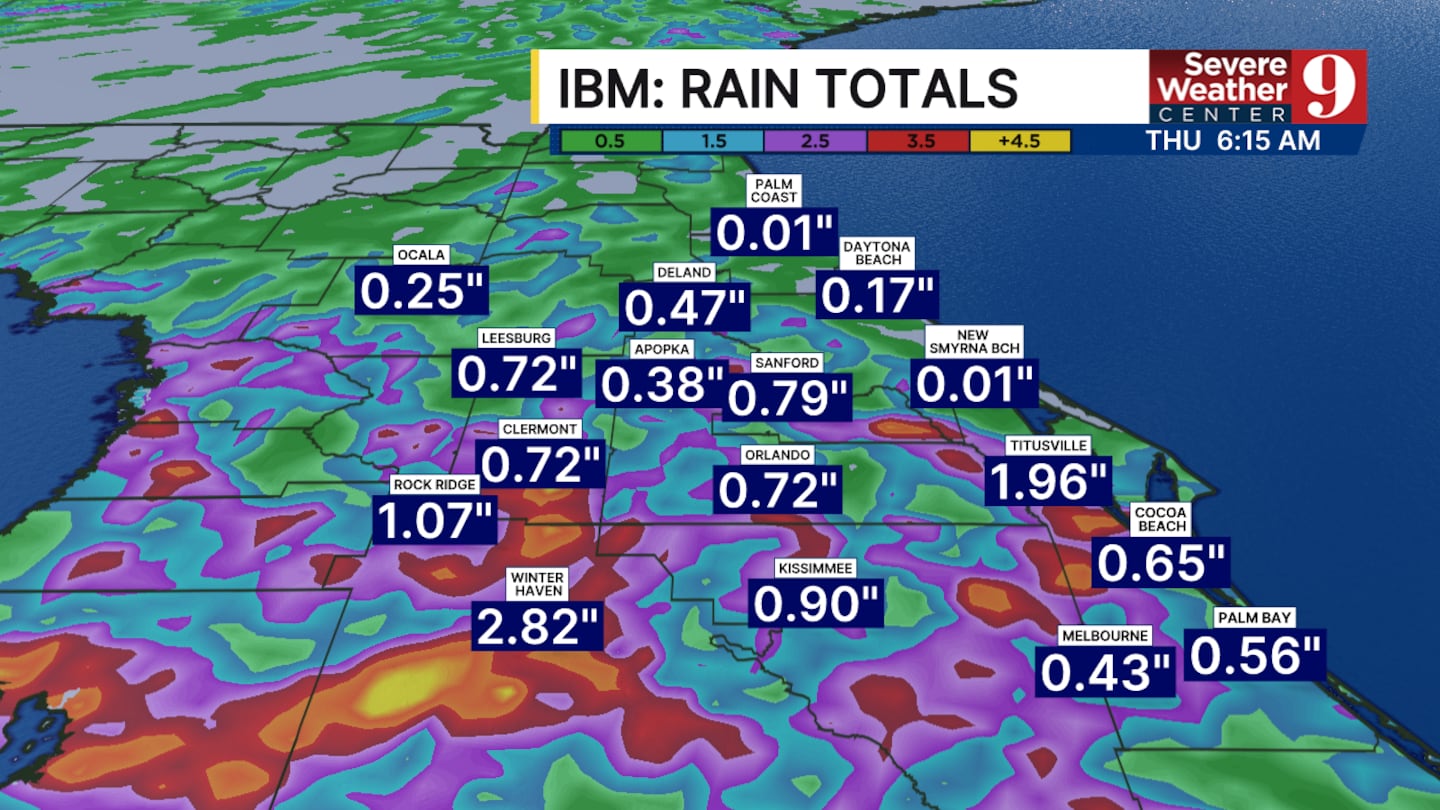
Wednesday could feature some earlier rain chances but a lesser chance of strong thunderstorm development.
One or two severe storms cannot be ruled out throughout this week.
If you’re looking forward to the 4th of July, we’re tracking rain chances for the afternoon and evening. Thankfully, the rain will last 30 minutes to an hour before clearing across many spots around central Florida.
The afternoon temperature will still reach the mid-90s.
Click here to download our free news, weather and smart TV apps. And click here to stream Channel 9 Eyewitness News live.

©2026 Cox Media Group


