
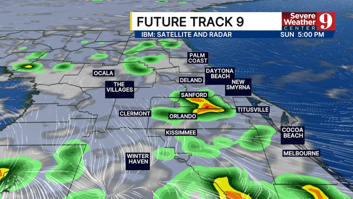
ORLANDO, Fla. — Another round of rain and storms is possible this afternoon.
The Saharan dust in the middle and upper layers of the atmosphere should limit the potential for widespread thunderstorms.
Chances of rain have dropped due to increased Saharan dust. However, a few pockets of heavy rain, lightning, and strong winds are still possible.
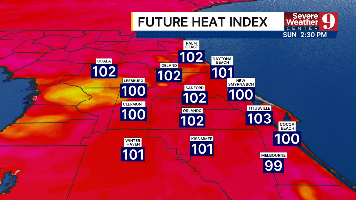
The dust will not stop central Florida from seeing the heat.
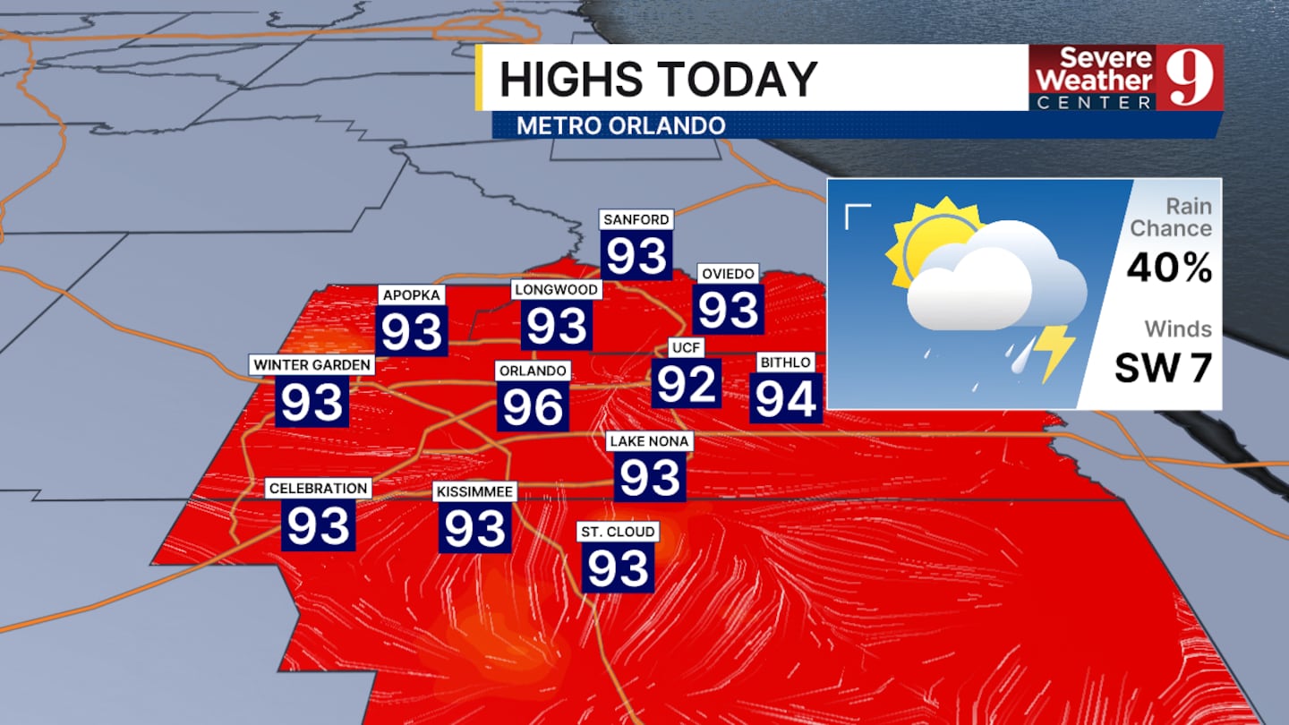
High temperatures will continue to reach the mid-90s during the afternoon, with a heat index over 100° for multiple hours.
These temperatures are not expected to change significantly over the next 7 to 10 days.
Better rain chances will begin tomorrow afternoon as more moisture builds up over our region.
The threat of severe weather over the next few days is low, but cannot be entirely ruled out.
Click here to download our free news, weather and smart TV apps. And click here to stream Channel 9 Eyewitness News live.

©2026 Cox Media Group


