CENTRAL FLORIDA — We are still tracking that cold front stalled to the north of central Florida that will continue to feed heavy rain at times over the next few days.
Central Florida is currently in the middle of a rainy stretch. The rain has been touch-and-go so far, and that will continue on Saturday.
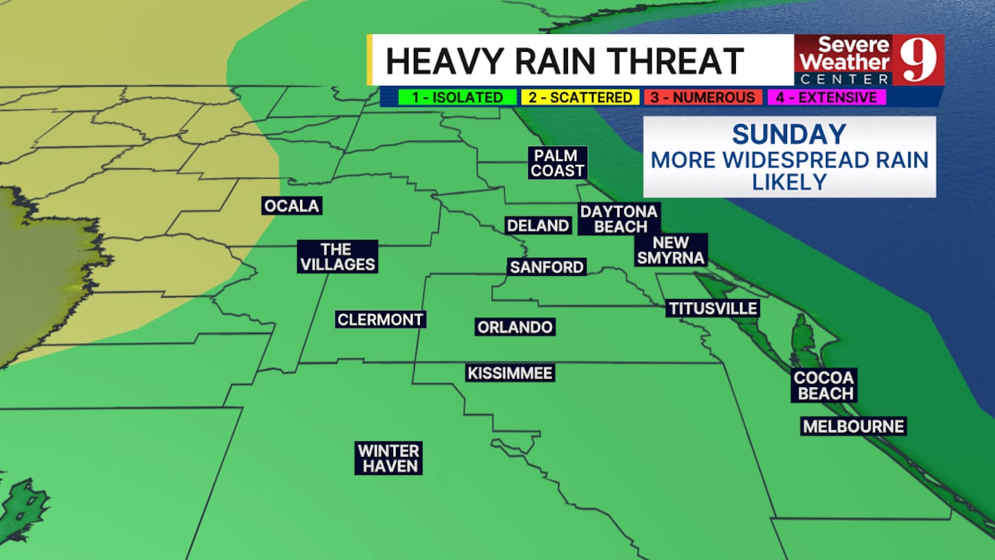
Scattered showers will start off in the late morning, mainly in Marion and Sumter counties.
More widespread rain will start to take over in the early afternoon for the rest of central Florida.
Severe weather is not expected in any storms that develop today. Heavy rain is the main threat we will be tracking between now and the start of this week.
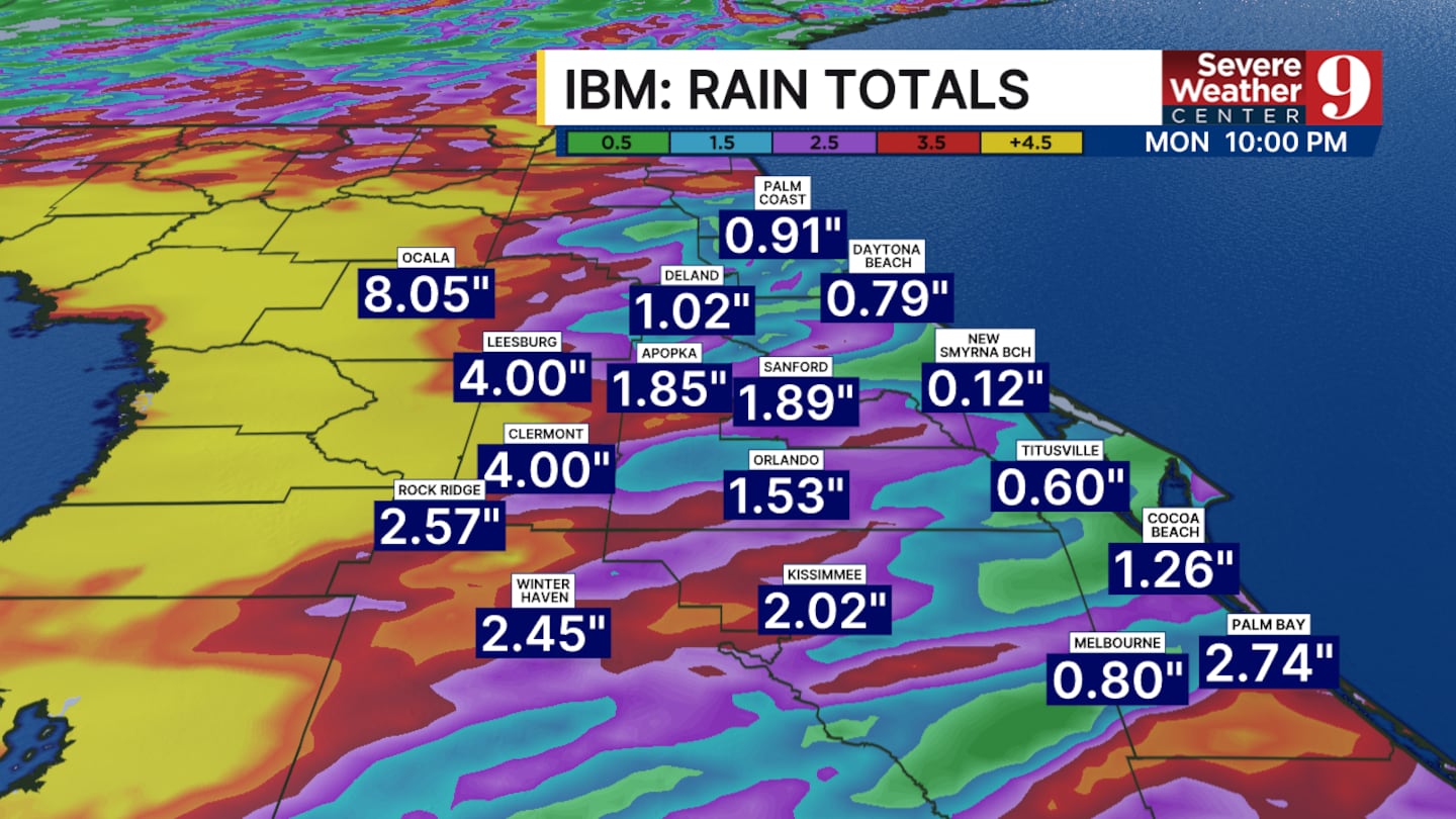
Rain totals in some locations could reach 6 to 8 inches between now and Wednesday.
Temperatures will hover around 90° for the next few days.
Click here to download our free news, weather and smart TV apps. And click here to stream Channel 9 Eyewitness News live.

©2026 Cox Media Group


