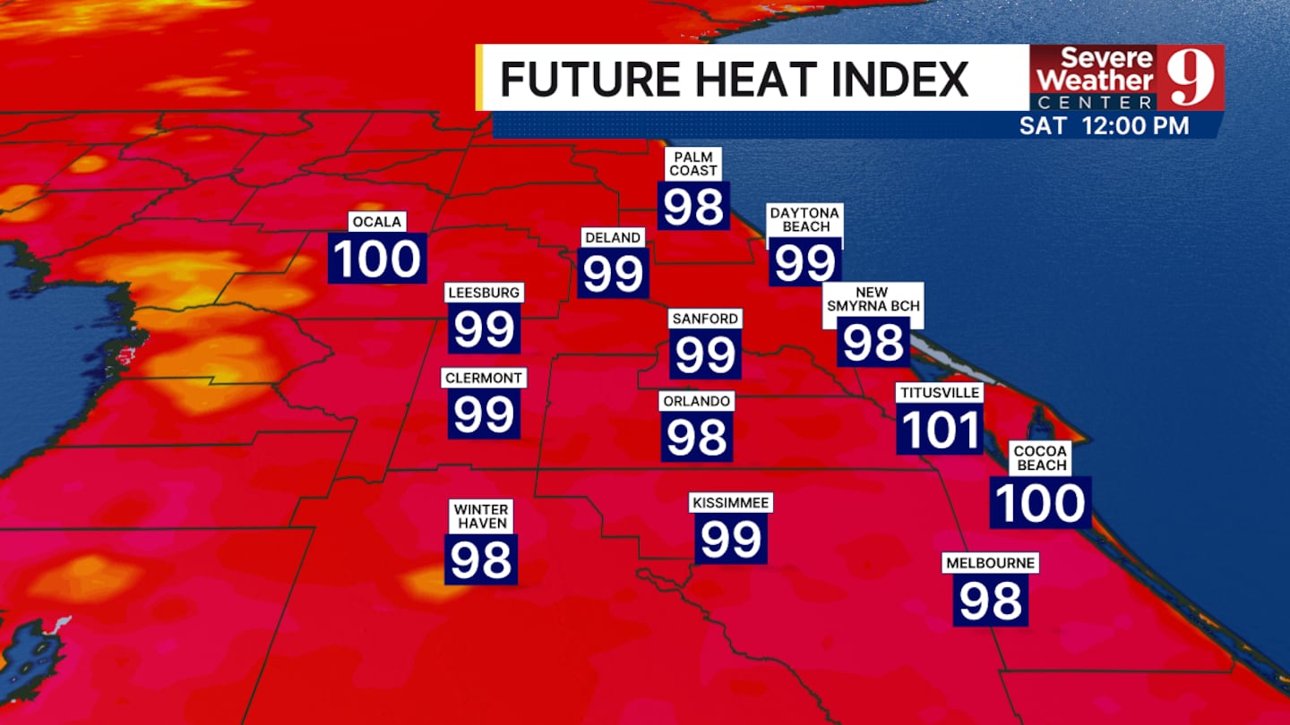
CENTRAL FLORIDA — We are tracking another heat wave, with afternoon highs ranging from the low to mid-90s. The heat index will be around 100° in the afternoon.
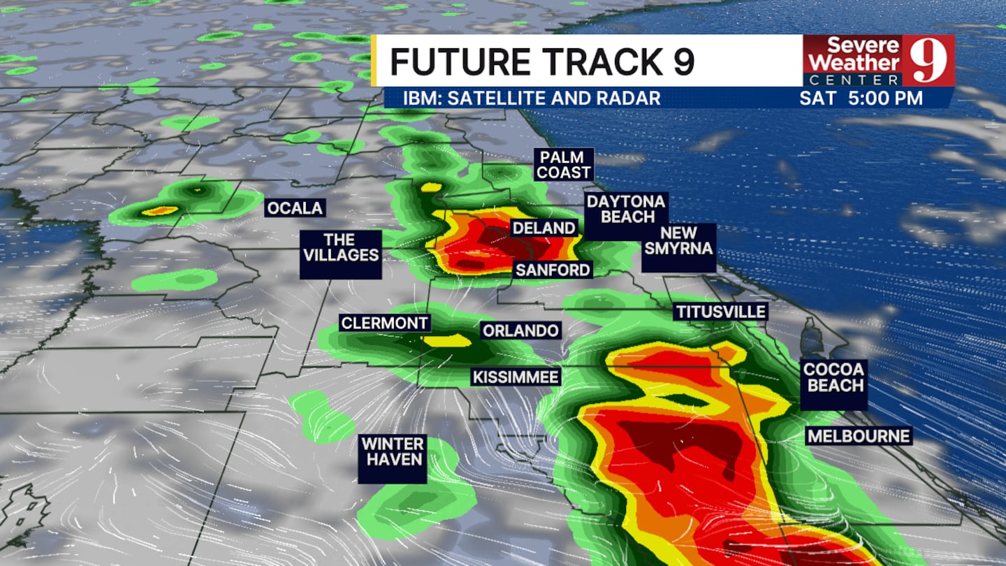
The heat and humidity will, of course, lead to scattered rain and thunderstorm chances during the afternoon and evening.
Most of the storms will occur before sunset, not interfering with fireworks times.
However, some areas could have this rain last until 9:00 or 10:00 p.m., delaying the fireworks for some.
The most likely locations for the later rain showers appear to be southern Brevard and Osceola counties. That said, remember that they could happen anywhere in central Florida.
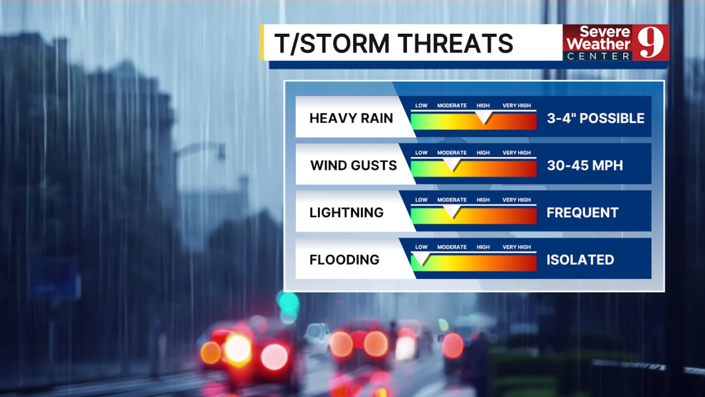
Heavy rain is the biggest threat. We could see up to 3 inches of rain for some between this afternoon and evening.
Thunderstorms could also produce wind gusts up to 50 mph and frequent lightning.
Frequent lightning will be the biggest issue for the early-evening storms.
If you see a storm in your area during the afternoon or early evening, the chances of rain later will decrease. This is because the storms developing today are being fed by the heat and humidity that will build up over the next few hours.
Once that energy is gone, it cannot be reused. That’s just something to keep in mind if you are making last-minute plans for fireworks.
These heat conditions and rain chances will hang on for the next few days.
Click here to download our free news, weather and smart TV apps. And click here to stream Channel 9 Eyewitness News live.

©2026 Cox Media Group


