
ORLANDO, Fla. — Invest 91L in the Northern Gulf is slowly becoming more defined and now has a greater chance of developing into a tropical depression over the next couple of days.
It remains disorganized on Sunday morning, but it’s continuing to strengthen thanks to warm Gulf waters.
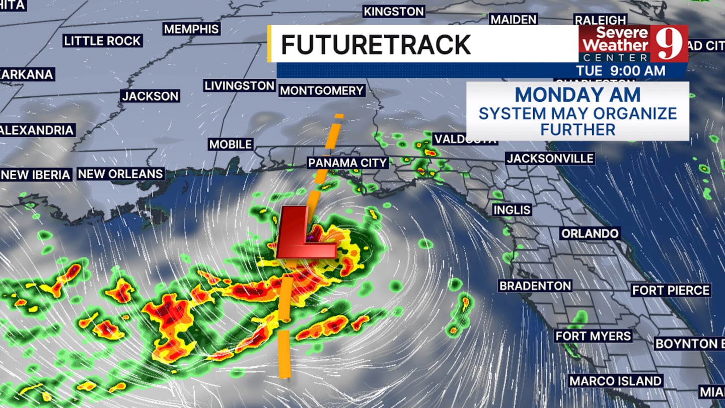
The National Hurricane Center gives it a 80% chance of development over the next 48 hours as it tracks northwest away from central Florida.
The models are largely showing two different outcomes with this system.
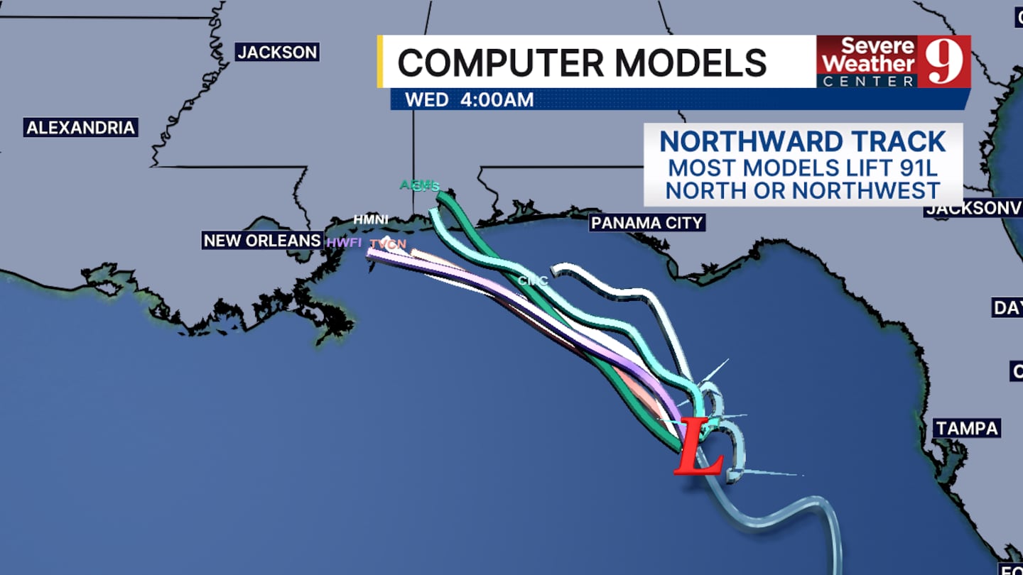
The first scenario is that it remains a tropical depression or a very weak tropical storm and hugs the Gulf Coast between Panama City and Pensacola. This would make it a big rainmaker for the panhandle.
The second scenario is that it takes a more westward turn, staying in the northern Gulf for longer and having more time to develop.
This would keep the heaviest rain away from the panhandle but could have the system develop into a more robust tropical storm as it approaches Louisiana or Texas.
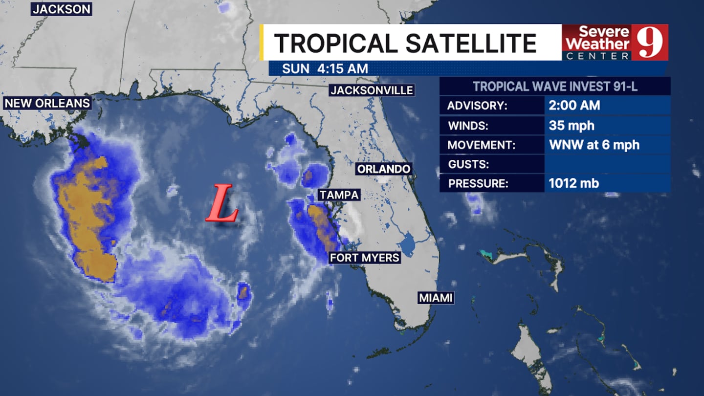
In either scenario, we are expecting dry air and central Florida. Invest 91L will pull moisture toward the storm’s center, away from our area.
This will leave us with isolated thunderstorms at best through most of this upcoming week.
If this system develops, it will be named Bertha.
Click here to download our free news, weather and smart TV apps. And click here to stream Channel 9 Eyewitness News live.

©2026 Cox Media Group


