
CENTRAL FLORIDA — The area of interest that we have been tracking in the northern Gulf currently has a 30% chance of development over the next week.
LOCAL FORECAST: Central Florida rain forecast as Gulf disturbance lingers
Showers and thunderstorms over the eastern Gulf are currently associated with an upper-level low. However, there are no signs of surface circulation. A closed area of surface circulation is required for tropical low designation.
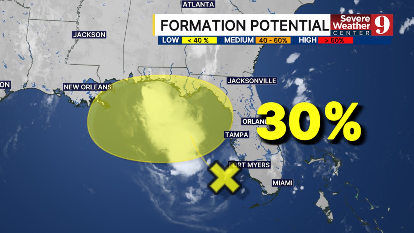
There has still not been much movement over the last few days with the certainty of what could happen with this system.
The vast majority of models that indicate a tropical low is forming are sending the system westward.
This means areas between Panama City and New Orleans could see a greater chance of impact from a tropical system than Central Florida.
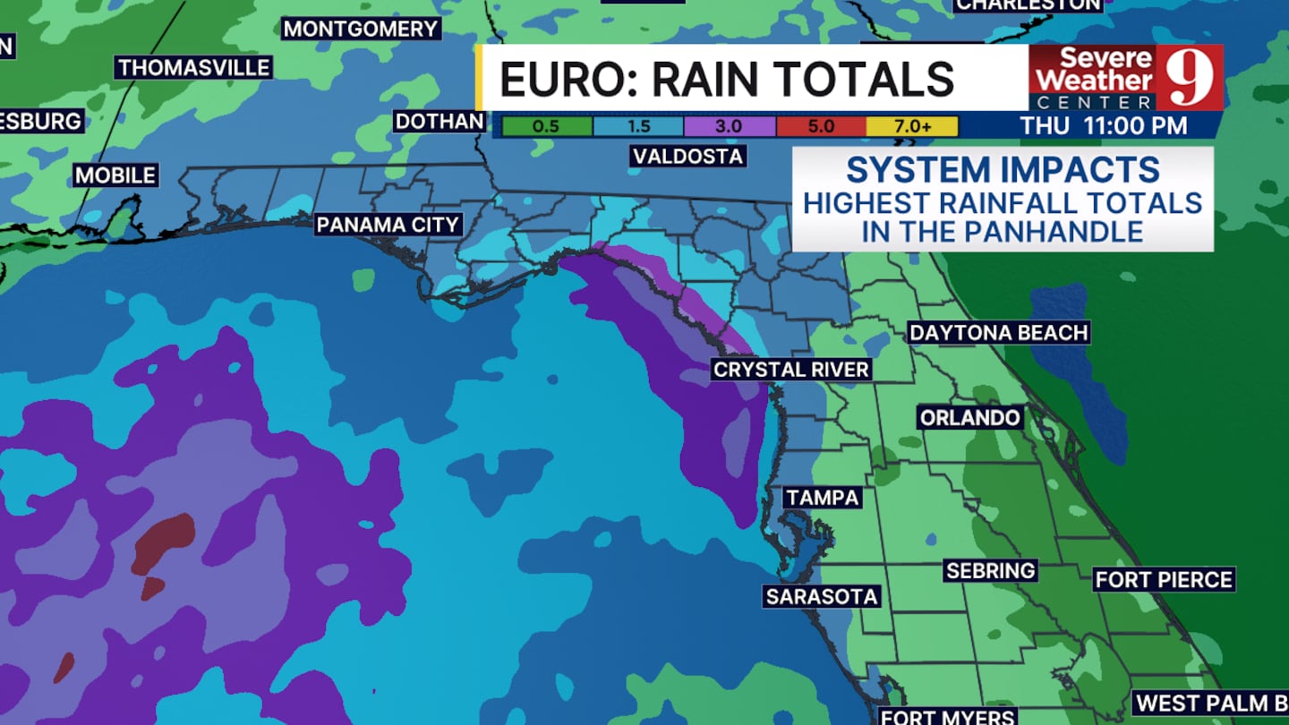
Regardless of what happens after development, some elevated rain chances are expected this afternoon from this area of interest.
Water temperatures along the panhandle are very warm. Ranging from the mid to upper 80s between the Big Bend and the Mississippi Delta. The warm water is a very important ingredient for tropical development.
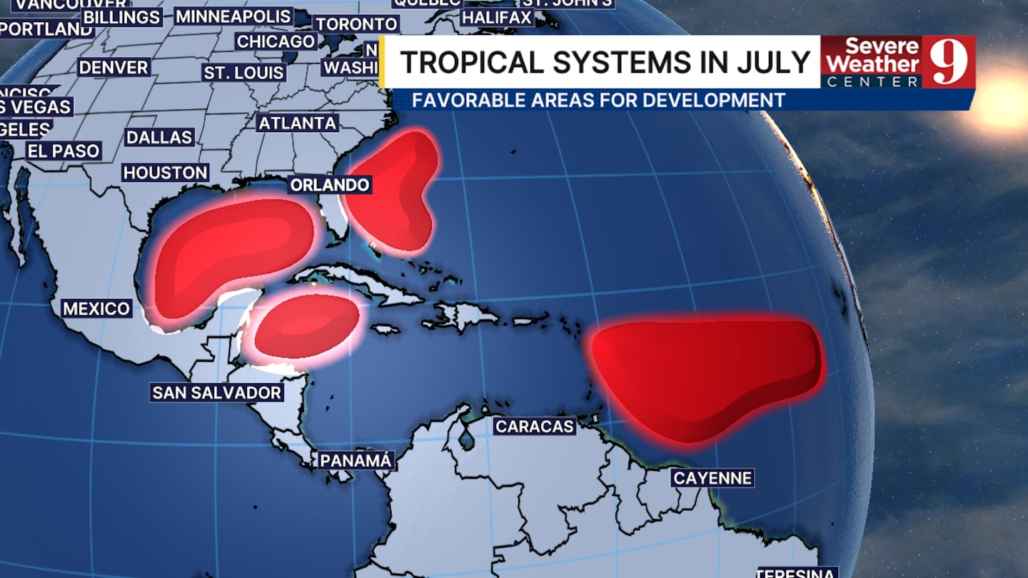
Confidence in this system will remain low until a true surface low forms.
Click here to download our free news, weather and smart TV apps. And click here to stream Channel 9 Eyewitness News live.

©2026 Cox Media Group


