ORLANDO, Fla. — We have Weather On the Way for an elevated fire danger and the threat of strong storms for late Sunday into Sunday night.
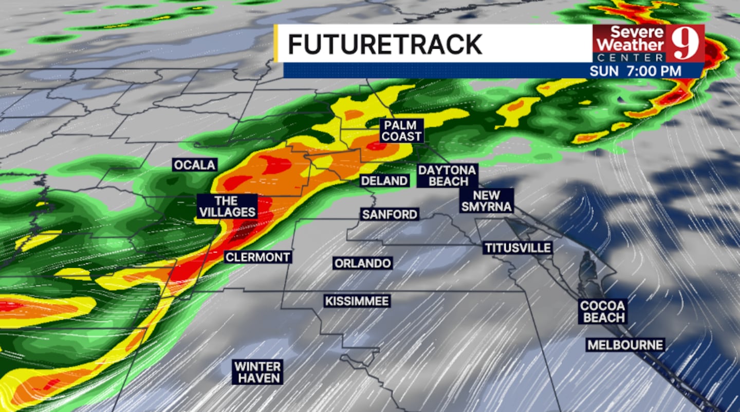
A powerful storm system will move into the area on Sunday, increasing winds and bringing showers and storms.
While Valentine’s Day will be pleasant on Sunday, things will change as the day progresses.
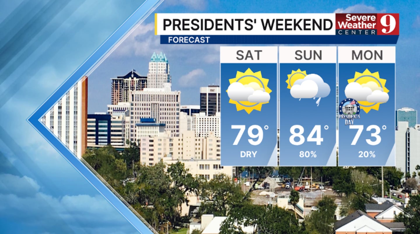
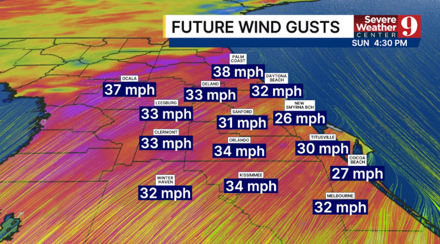
Clouds will increase and winds will ramp up, with wind gusts over 35 mph possible.
With the dry vegetation in place, fire danger will be elevated during the PM hours on Sunday.
The rain and storms will rapidly push into the region late Sunday into Sunday evening.
At this time, much of the Daytona 500 may stay dry as the rain stays just west of the speedway.
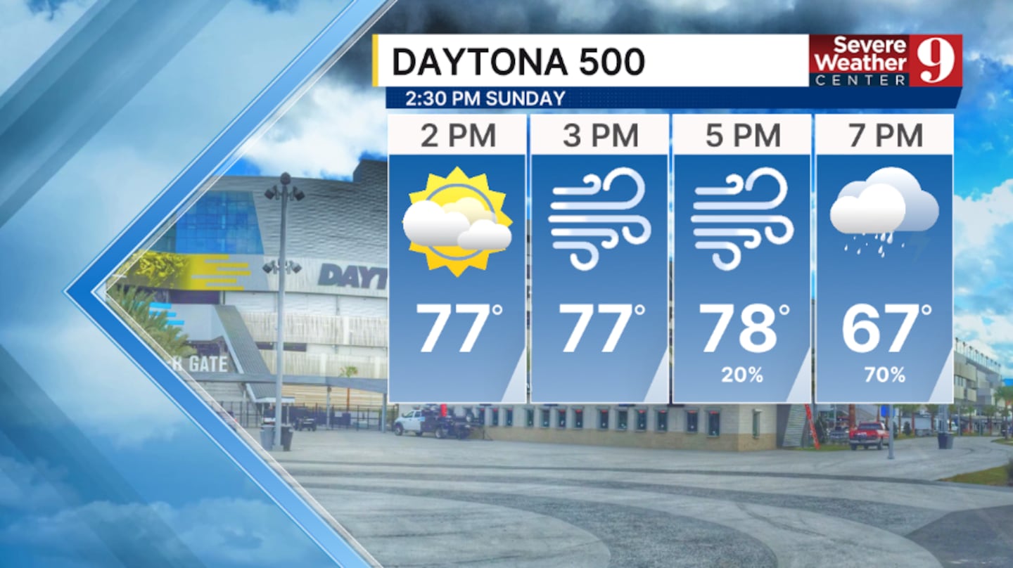
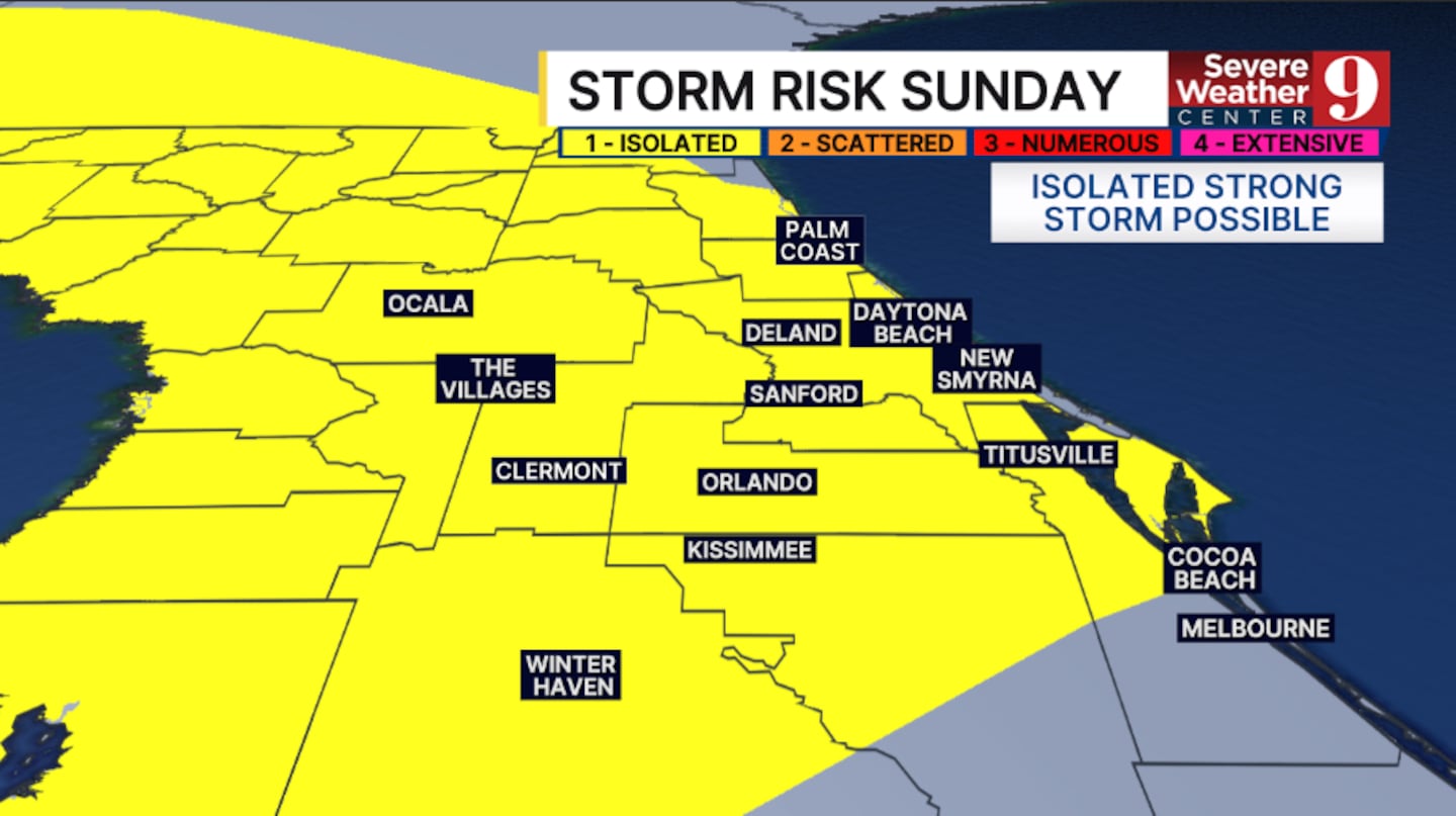
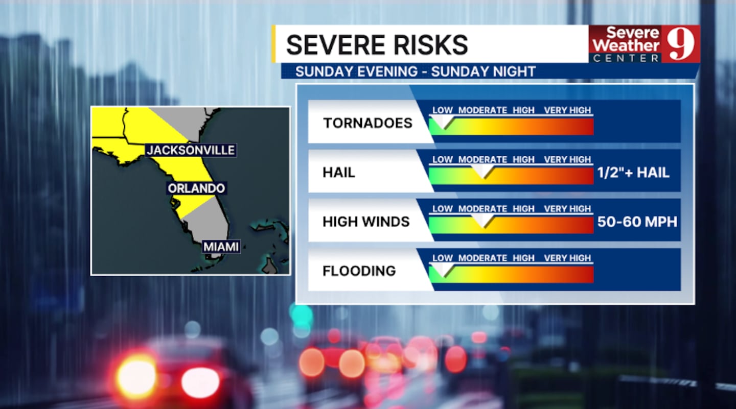
As the storms move in, strong to severe storms will be possible.
The greatest threats will be wind gusts over 50 mph, lightning and hail.
The rain and storms will linger Sunday night, with quieter weather returning for Presidents’ Day.
Stay with Severe Weather Center 9 for the latest on the fire concern and the severe weather threat on Sunday.
Click here to download our free news, weather and smart TV apps. And click here to stream Channel 9 Eyewitness News live.

©2026 Cox Media Group


