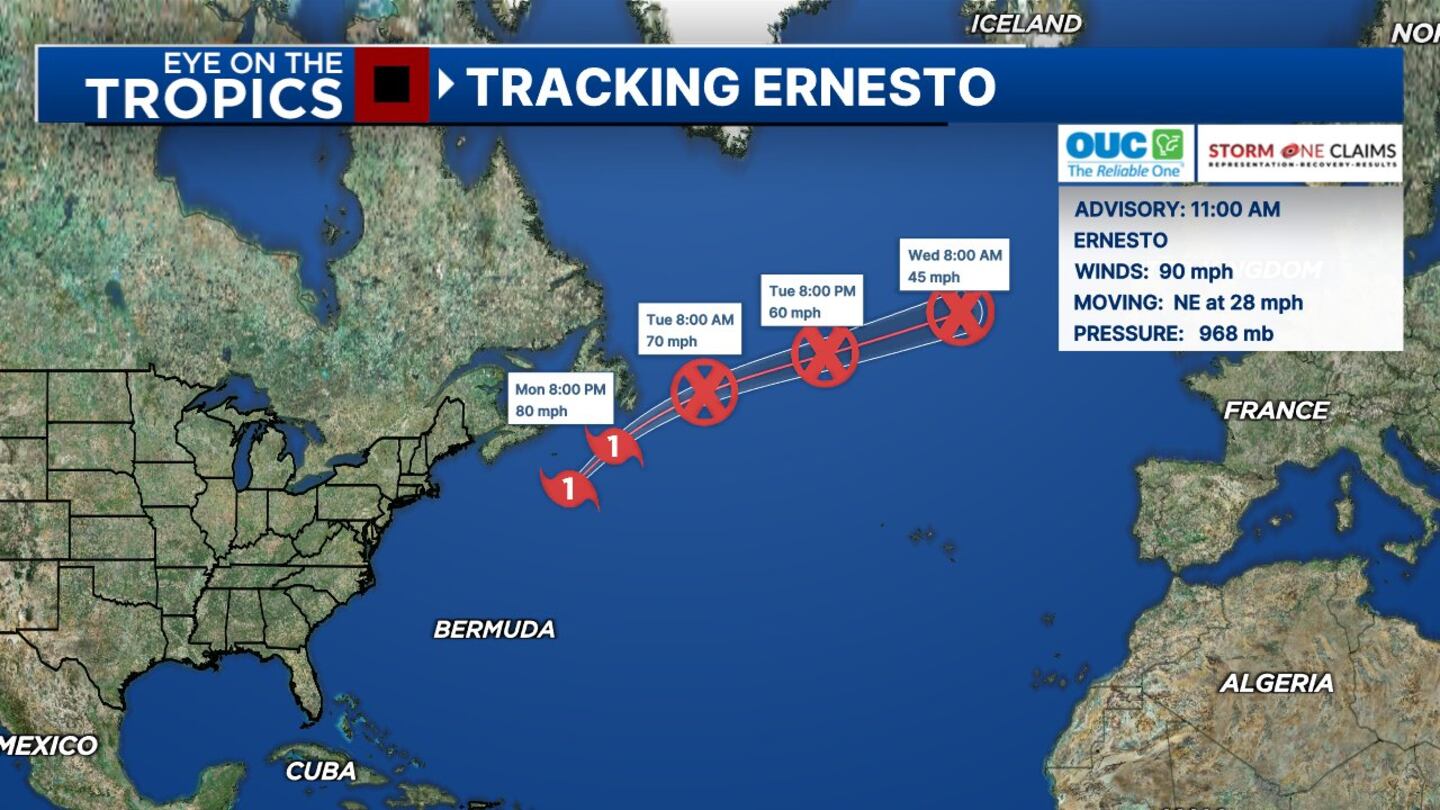
ORLANDO, Fla. — Ernesto remained a hurricane Monday morning.
▶ WATCH CHANNEL 9 EYEWITNESS NEWS
As of 11 a.m., the National Hurricane Center reported the storm’s maximum sustained winds at 90 mph.
The storm strengthened slightly since the 5 a.m. advisory, when winds clocked in at 85 mph.
READ: Talk show icon Phil Donahue dies
NHC said Ernesto was traveling through the Atlantic on a northeast path at 28 mph.
The storm should approach extreme eastern Canada Monday night.
Hurricane Ernesto actually strengthening as it moves farther away, no additional tropical cyclones are expected to form within the next 7 days. That will likely change toward the end of the month and early September so monitor with us. pic.twitter.com/jwh1fUzyYl
— George Waldenberger (@GWaldenWFTV) August 19, 2024
At that point, Ernesto is expected to lose its tropical characteristics and merge with a front.
READ: See the changes coming to downtown Orlando’s Church Street Station
However, what’s left of the system should be a big wind-maker for Ireland and the U.K. in the coming days, according to Channel 9 meteorologist Brian Shields.
Elsewhere, the tropics are quiet, he said.
Click here to download our free news, weather and smart TV apps. And click here to stream Channel 9 Eyewitness News live.
©2024 Cox Media Group


