
ORLANDO, Fla. — Friday featured more heat and more storms across the area, but some changes are ahead for the weekend.
The rain and storms will slowly fade away this evening, with quiet conditions overnight. Morning lows will be in the mid 70s.
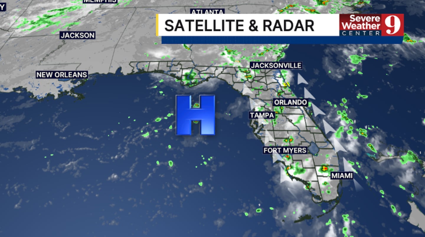
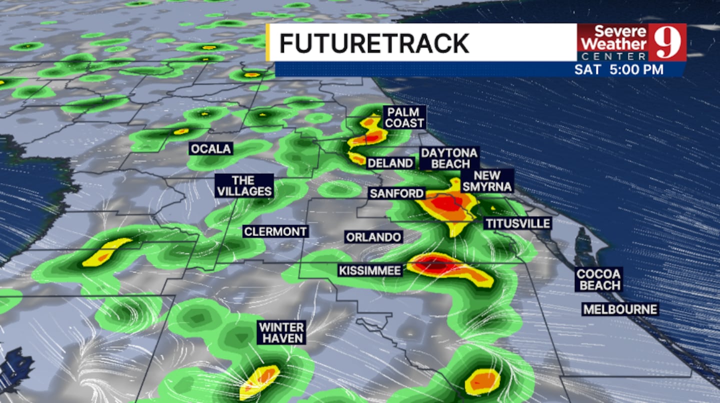
The threat of storms continues into Saturday. Coverage may be a bit higher than on Friday, with temps again in the mid 90s.
Some Saharan dust begins to move in for Sunday, reducing storm chances. Just widely scattered PM storms are expected, with warm highs in the mid-to-upper 90s.
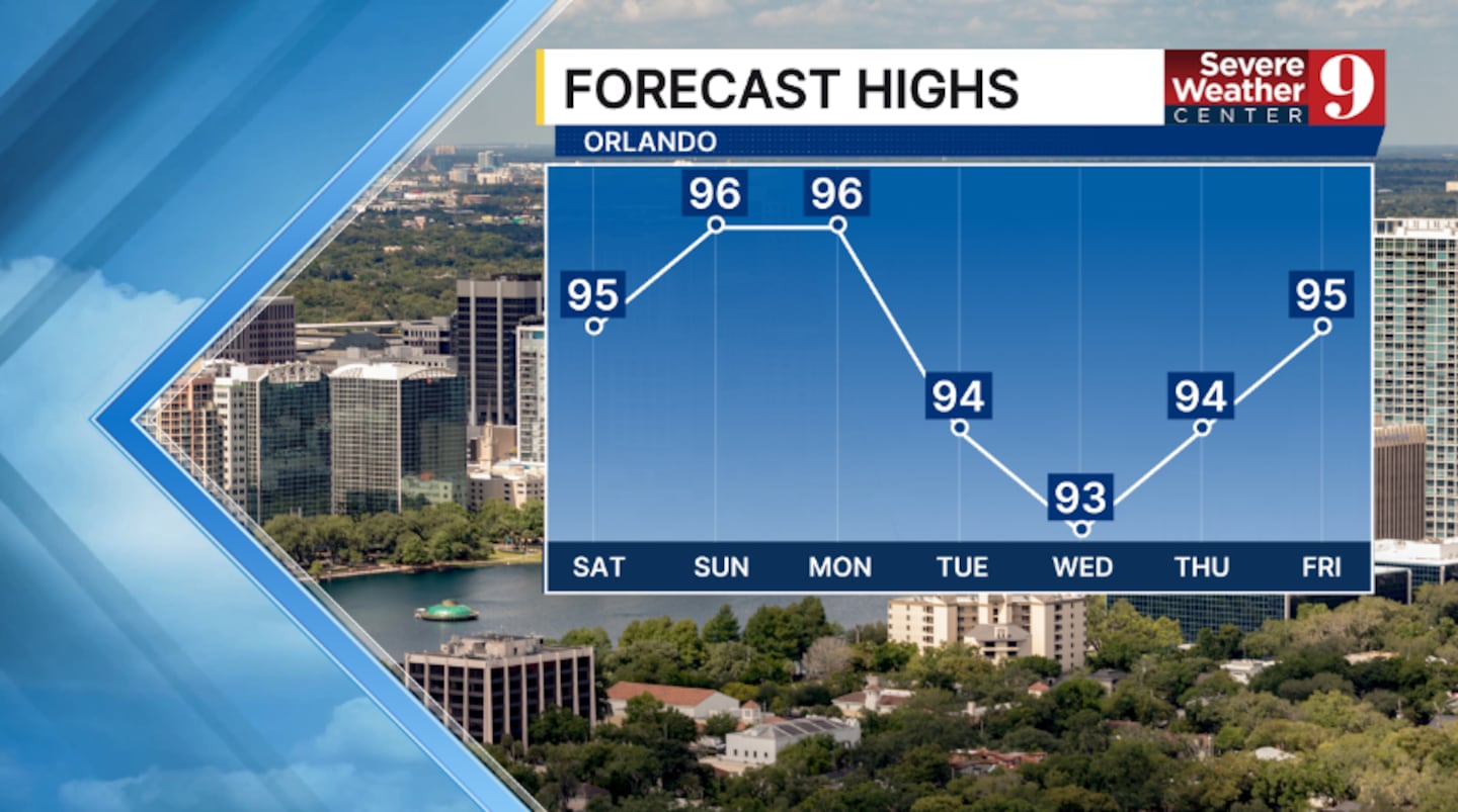
The moisture will quickly return to start next week. Elevated rain and storm chances are expected Monday and Tuesday, with highs in the mid-90s.
More active weather looks likely midweek, with more scattered PM storms. Highs on Wednesday and Thursday will remain in the mid-90s.
Right now, the July 4th weekend looks warm, with lower coverage of rain and storms.
Click here to download our free news, weather and smart TV apps. And click here to stream Channel 9 Eyewitness News live.

©2026 Cox Media Group


