ORLANDO, Fla. — Eyes remain on the tropics — namely Hurricane Lee — as we head into the weekend.
On Friday, Lee remained a Category 1 storm with maximum sustained winds of 80 mph.
The National Hurricane Center said Lee could unleash tropical storm-force winds across parts of New England and Atlantic Canada.
Downed trees and possible power outages are possible for those areas Friday night and Saturday.
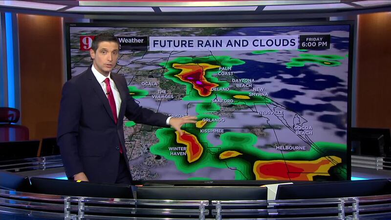
READ: Friday: Partly cloudy to start, stormy finish expected for Central Florida
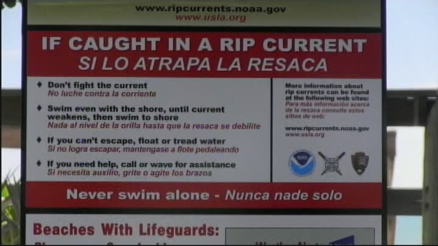
Along the U.S. East Coast, beach conditions will be dangerous throughout the weekend.
Meteorologist Brian Shields said seas off Central Florida’s beaches are high and the risk for rip currents is also high.
READ: Social Security Overpays Billions of Dollars to Americans — Then Asks for the Money Back
Exercise extreme caution if you’re heading to our beaches over the next several days.
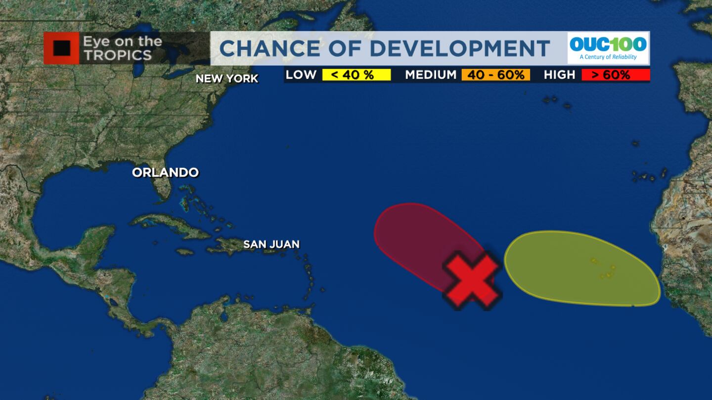
In other tropical activity, Shields said Nigel is expected to form in the Central Atlantic but should not pose a threat to land.
He added that there’s another area coming off the coast of Africa that is expected to develop next week.
WFTV Eye on the Tropics Monitoring tropical activity in the Atlantic (WFTV Staff)
READ: NASA releases UFO report
This is simply something to keep an eye on for now, Shields said.
Channel 9′s meteorologists will continue to monitor the tropics and provide updates on Eyewitness News.
Morning forecast: Friday, Sept. 15 (Brian Shields, WFTV.com/WFTV)
Hurricane season names These are the names for storms that develop during the 2023 Atlantic hurricane season. (WFTV.com News Staff) Arlene These are the names for storms that develop during the 2023 Atlantic hurricane season. (WFTV.com News Staff) Bret These are the names for storms that develop during the 2023 Atlantic hurricane season. (WFTV.com News Staff) Cindy These are the names for storms that develop during the 2023 Atlantic hurricane season. (WFTV.com News Staff) Don These are the names for storms that develop during the 2023 Atlantic hurricane season. (WFTV.com News Staff) Emily These are the names for storms that develop during the 2023 Atlantic hurricane season. (WFTV.com News Staff) Franklin These are the names for storms that develop during the 2023 Atlantic hurricane season. (WFTV.com News Staff) Gert These are the names for storms that develop during the 2023 Atlantic hurricane season. (WFTV.com News Staff) Harold These are the names for storms that develop during the 2023 Atlantic hurricane season. (WFTV.com News Staff) Idalia These are the names for storms that develop during the 2023 Atlantic hurricane season. (WFTV.com News Staff) Jose These are the names for storms that develop during the 2023 Atlantic hurricane season. (WFTV.com News Staff) Katia These are the names for storms that develop during the 2023 Atlantic hurricane season. (WFTV.com News Staff) Lee These are the names for storms that develop during the 2023 Atlantic hurricane season. (WFTV.com News Staff) Margot These are the names for storms that develop during the 2023 Atlantic hurricane season. (WFTV.com News Staff) Nigel These are the names for storms that develop during the 2023 Atlantic hurricane season. (WFTV.com News Staff) Ophelia These are the names for storms that develop during the 2023 Atlantic hurricane season. (WFTV.com News Staff) Philippe These are the names for storms that develop during the 2023 Atlantic hurricane season. (WFTV.com News Staff) Rina These are the names for storms that develop during the 2023 Atlantic hurricane season. (WFTV.com News Staff) Sean These are the names for storms that develop during the 2023 Atlantic hurricane season. (WFTV.com News Staff) Tammy These are the names for storms that develop during the 2023 Atlantic hurricane season. (WFTV.com News Staff) Vince These are the names for storms that develop during the 2023 Atlantic hurricane season. (WFTV.com News Staff) Whitney These are the names for storms that develop during the 2023 Atlantic hurricane season. (WFTV.com News Staff) Follow our Severe Weather team on X (Twitter) for live updates:
Click here to download our free news, weather and smart TV apps. And click here to stream Channel 9 Eyewitness News live.
©2023 Cox Media Group