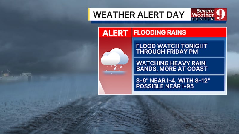
ORLANDO, Fla. — The Weather Alert Day continues for the remainder of the work week, as the threat of significant flooding continues to increase.
Rain will likely increase this evening and tonight, with heavy rainfall possible. Morning lows will be in the mid-60s.
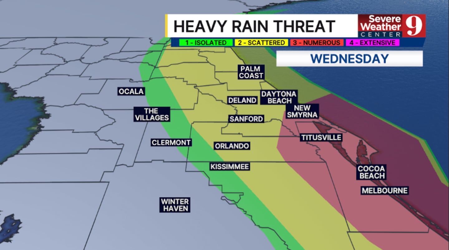
The threat for heavy rains increases further for Wednesday. Periods of rain are likely, with flooding possible in parts of the area. Highs for Wednesday will be in the low 70s.
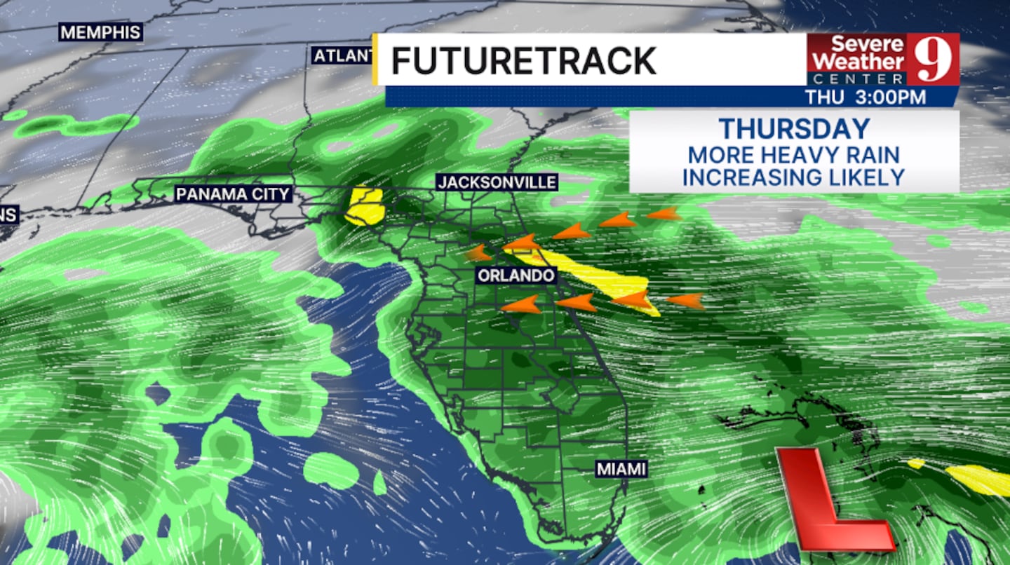
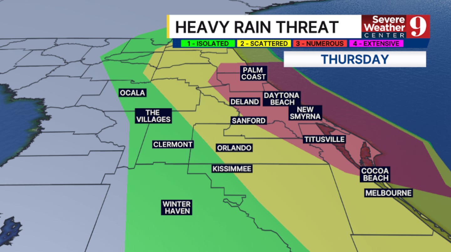
More heavy rain is likely for Thursday, with again areas of flooding possible. The greatest threat for flooding will be along the coast, with highs in the mid-70s.
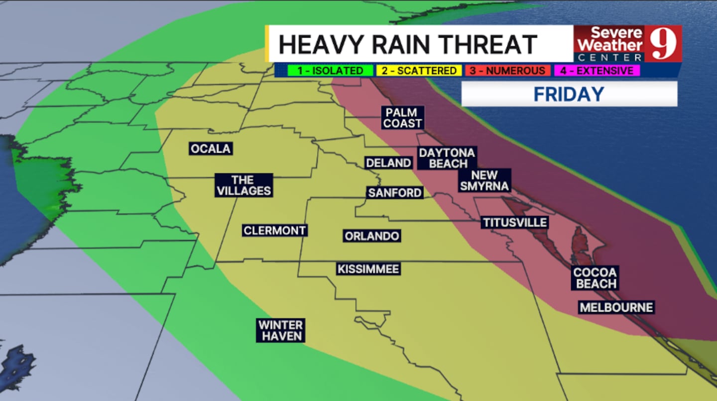
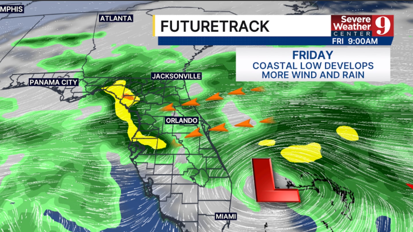
Our significant rain event continues into Friday, with heavy rainfall and flooding possible again. Temps to close out the work week will be in the upper 70s.
A coastal low will lift northward this weekend, finally ending the heavy rainfall threat. Highs for the weekend will be in the upper 70s and low 80s.
Drier weather looks to return to start next week.
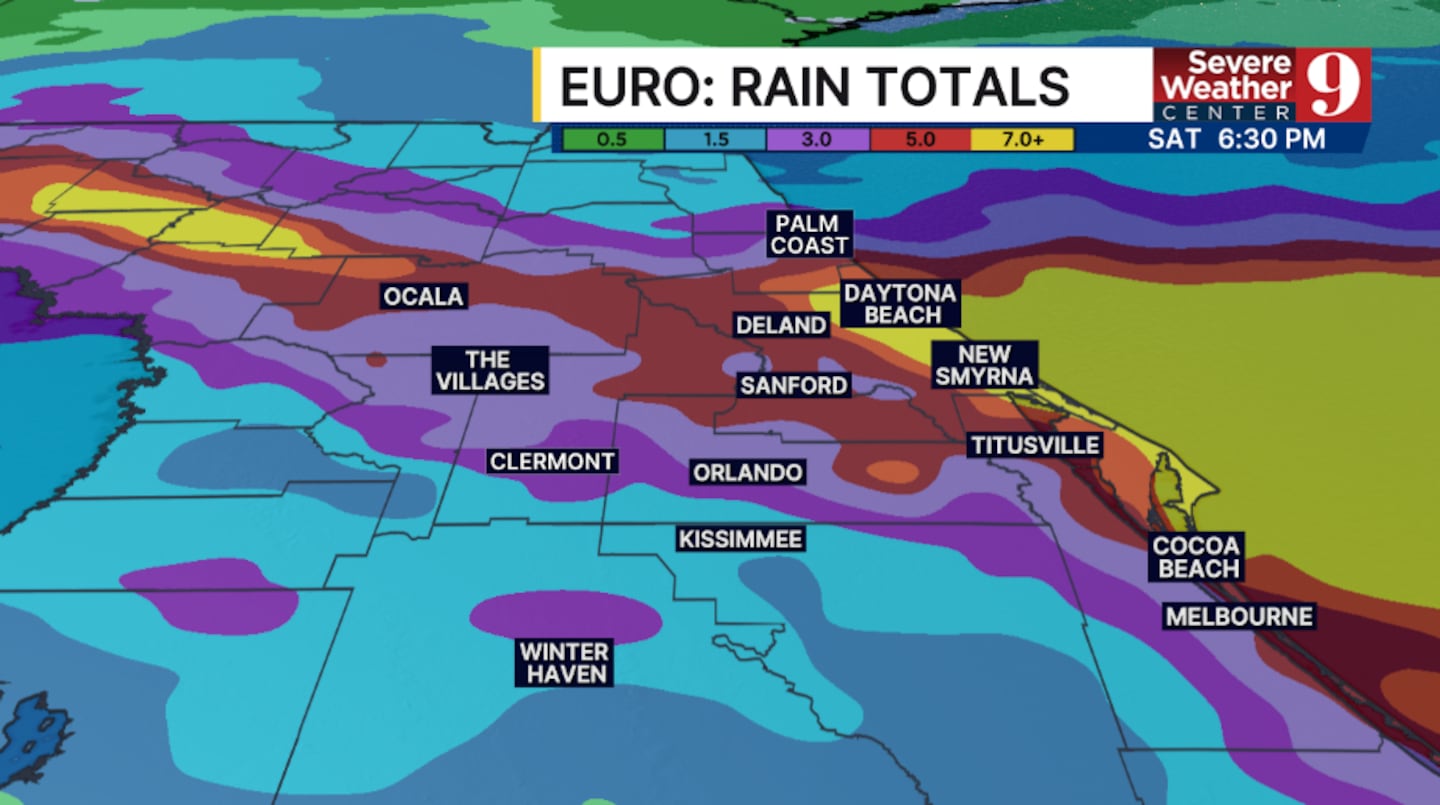
Area-wide storm totals will likely be between 4-6”, with 8-12” increasingly likely along the coast. Some areas may exceed 12”+ of rain over the next several days.
Stay with Severe Weather Center 9 for the latest on the flooding threat over the next several days.
Click here to download our free news, weather and smart TV apps. And click here to stream Channel 9 Eyewitness News live.

©2026 Cox Media Group