
ORLANDO, Fla. — Showers have been intermittently crossing Central Florida, mainly from west to east. This same trend will continue overnight and rainbands stream in from the Gulf of Mexico.
The rainbands are associated with a low-pressure system that is tracking over the Gulf of Mexico.
The system will continue to bring unstable weather conditions, which will produce downpours moving over the entire Florida peninsula, especially during the early morning hours on Monday. There is a high risk of flooding in Central Florida.
Once this system crosses over to the Atlantic we could have total storm rainfall around 3 to 4 inches across parts fo Central Florida.
Between 3 a.m. and 3 p.m. Sunday rainfall estimates are not impressive, but very even across Central Florida. The area accumulated about 0.25 to 0.50 inches of rain.
Models show heavier batches of showers and storms during the early morning hours on Monday. Make sure to avoid flooded areas if you are heading to work or finishing it up the preparations for the holidays.
Forecast for Christmas Eve & Christmas Day
Christmas Eve will start cloudy but the cloud will finally move away giving way to mostly clear skies during the evening hours. By Christmas morning, the temperatures will be into the upper 60s and in the mid-to upper 70s for Christmas Day.
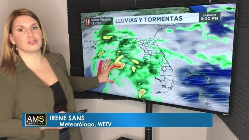
#stormalert9: So far, rainfall estimates are not impressive, but very even across Central Florida. The area has accumulated about 1/4 to 1/2 inch between 3 a.m. and 3p.m. Sunday. Expect heavier bands of showers to build during the late afternoon hours into the evening. pic.twitter.com/vTK5roDZZZ
— Irene Sans (@IreneSans) December 22, 2019
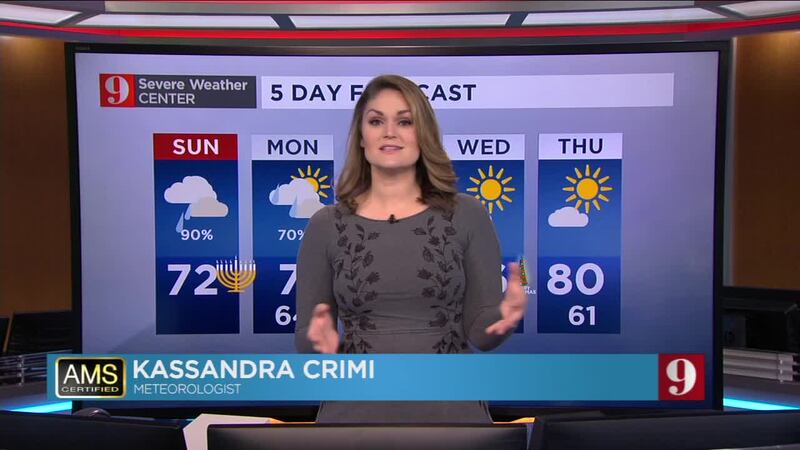
Catch up on your 5-day forecast:
Más información en español aquí: El tiempo para Florida Central
Pronóstico del tiempo en español por nuestra meteoróloga certificada Irene Sans
Follow our Severe Weather team on Twitter for live updates:
- Chief meteorologist Tom Terry
- Brian Shields
- Irene Sans
- Kassandra Crimi
- George Waldenberger
- Rusty McCranie
DOWNLOAD: Free WFTV News & Weather Apps
© 2019 Cox Media Group


