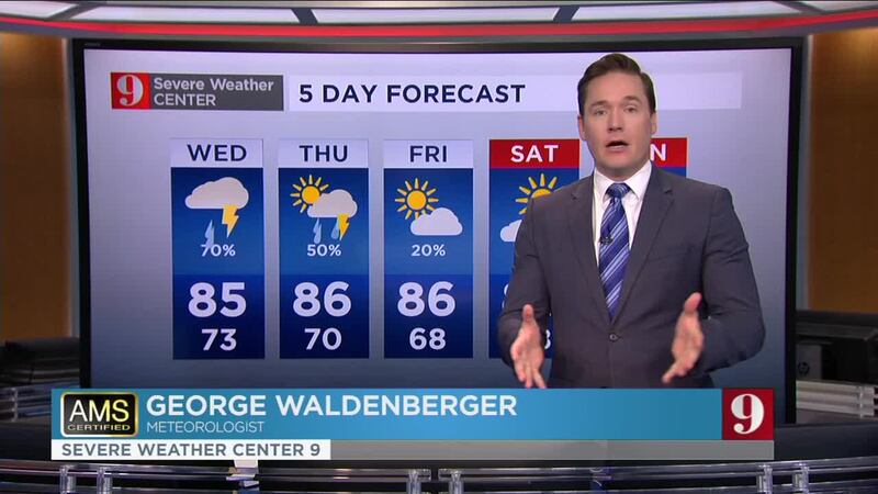
Numerous thunderstorms are expected on Wednesday. A cold front will be crossing Central Florida and the storm chance will continue to be above 50 percent. The work-week will end with drier and much more comfortable conditions. There will be mostly sunny skies and the humidity will also feel much lower.
There are 3 areas we are watching in the tropics. Fortunately, all three areas are moving away from Florida.
The rip current risk is moderate. "Long period of east swells will contribute to a moderate risk for rip currents at east Central Florida beaches. Always swim within sight of life guard. Rough surf will also impact the surf zone and be hazardous to swimmers entering the ocean today," according to the National Weather Service.
Three areas of low pressure, the first and third may both merge with a stronger non-tropical low (the second off the mid-Atlantic). Northeastern US watching for coastal flooding, strong winds, rough surf as a result. pic.twitter.com/O5jhEBImAB
— George Waldenberger (@GWaldenWFTV) October 8, 2019
Pronóstico en español por nuestra meteoróloga certificada Irene Sans

- Chief meteorologist Tom Terry
- Brian Shields
- Irene Sans
- Kassandra Crimi
- George Waldenberger
- Rusty McCranie

Cox Media Group


