ORLANDO, Fla. — Hurricane Ian made landfall in southwest Florida as a Category 4 storm after noon on Wednesday.
The storm is now expected to bring significant impacts to Central Florida. See live updates below:
>>> STREAM CHANNEL 9 EYEWITNESS NEWS LIVE <<<
>>> DOWNLOAD OUR FREE APPS TO STAY INFORMED <<<
11:50 p.m.
A flash flood warning has been issued for southeast Orange County.
11 p.m.
Winds with Hurricane Ian are reaching 90 mph and the storm is now a Category 1, Channel 9 Meteorologist George Waldenberger said.
The storm is moving at 8 mph to the north northeast.
READ: Why is the lightning we’re seeing during Hurricane Ian so unusual?
Ian continues to batter the Florida Peninsula with winds, storm surge and flooding. It is expected to move into the Atlantic tomorrow.
As of now, the storm is 70 miles south of Orlando. The center is currently near Sebring.
Track update shows a farther-south Ian, moving off the coast earlier. In the morning tomorrow. pic.twitter.com/MbvMqLU1xj
— George Waldenberger (@GWaldenWFTV) September 29, 2022
See the Spanish translation below:
El huracán Ian parece estar moviéndose más al sur según el nuevo modelo. Los vientos han disminuido y ahora están en 90 mph. El huracán es ahora de categoría 1 y se encuentra a unas 70 millas al sur de Orlando, golpeando la península con fuertes vientos e inundaciones. Se espera que mañana se adentre en el Atlántico.
10:30 p.m.
A tornado warning has been issued for Volusia County until 10:45 p.m.
9:30 p.m.
The hurricane shelter at Mascotte Charter has reached capacity.
See our complete guide to hurricane shelters by clicking here.
8:20 p.m.
As of 8 p.m., Hurricane Ian continues to weaken. Channel 9 meteorologists say the storm is still a Category 3 with winds of 115 mph and moving at a slow crawl to the north northeast at 8 mph.
Winds are forecast to increase overnight and tomorrow morning. Areas of Polk, Osceola, and southern Orange counties will experience hurricane force, sustained winds of 74 mph-plus. And most of us will experience tropical storm-force winds.
Many communities still have the potential of seeing 10- to 15-inches of additional rain.
8:10 p.m.
OUC crews have ceased restoration efforts for those who have lost power so far during Hurricane Ian. The company said once conditions are safe, workers will return to the field.
Read: Hurricane Ian: Here’s how to track power outages in Central Florida
Due to inclement conditions, OUC and helping crews have ceased restoration efforts for the evening. Once conditions are safe again, they will be released back into the field to continue. Please be patient and understand that the safety of our crews is of utmost importance. pic.twitter.com/YdAIy7hNyU
— Orlando Utilities Commission (@OUCreliableone) September 28, 2022
7:45 p.m.
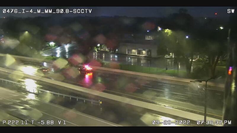
A tree has fallen on I-4 in Maitland as Hurricane Ian’s impacts are already being felt across Central Florida.
See video below:
7:15 p.m.
Residents in some Central Florida counties will be under a curfew on Wednesday and Thursday over safety concerns from Hurricane Ian.
See which counties are impacted by curfews here.
6:25 p.m.
Tropical storm winds have begun in Central Florida and will last all night and into Thursday. Hurricane gusts are coming tonight, especially Osceola, Polk, Orange counties.
Tropical storm winds have begun and will last all night and into Thursday. Hurricane gusts are coming tonight, especially Osceola, Polk, Orange. #HunkerDown pic.twitter.com/lBIuXXtnee
— Tom Terry (@TTerryWFTV) September 28, 2022
5:55 p.m.
Gov. Ron DeSantis is giving an update on Hurricane Ian NOW on Channel 9.
LIVE RIGHT NOW on @wftv - Gov. DeSantis - "This is way, way, way bigger than Charley." #HurricaneIan #wftv
— Daralene (@DaraleneJ) September 28, 2022
Gov. DeSantis "As this storm passes your community, understand it's still a hazardous situation, downed power lines, misuse of generators, floodwaters." #HurricaneIan #wftv
— Daralene (@DaraleneJ) September 28, 2022
>>> STREAM CHANNEL 9 EYEWITNESS NEWS LIVE <<<
5:35 p.m.
A wind gust of 74 mph was reported in New Smyrna Beach due to Hurricane Ian.
#Ian wind gust 74mph New Smyrna Beach.
— Tom Terry (@TTerryWFTV) September 28, 2022
5:05 p.m.
Hurricane Ian has slowed slightly, moving just 8 mph, after it made mainland landfall at 4:35 p.m.
The maximum wind is now at 140 mph, and although weaker is still a Category 4 hurricane. Meteorologists said the eye is becoming more cloud filled, and further weakening will happen as it approaches. Ian is still forecast to bring flooding and a tornado threat to Central Florida as it passes in the early morning hours of Thursday.
See this update in Spanish below:
Ian's mainland Florida landfall 4:35 pm, 145 mph max sustained winds, south of Punta Gorda near Pirate Harbor. pic.twitter.com/RFVAZKoUNO
— George Waldenberger (@GWaldenWFTV) September 28, 2022
El huracán Ian ha disminuido ligeramente después de haber tocado tierra firme a las cuatro y media
El viento máximo es ahora de 140 mph y sigue siendo un huracán de categoría 4. Los meteorólogos dijeron que el ojo se está llenando de nubes y que se debilitará aún más a medida que se acerque a nuestra area.
El huracán seguirá provocando inundaciones y amenaza de tornados en el centro de la Florida cuando pase en la mañana el jueves.
4:55 p.m.
The National Hurricane Center says Hurricane Ian made mainland Florida landfall just south of Punta Gorda near Pirate Harbor at 4:35 p.m. Maximum sustained winds at this landfall are estimated at 145 mph.
4:45 p.m.
Rain bands have already brought 50+ mph winds to Orange County.
Rain squalls bringing 50+ mph winds in Orange county. More tonight! pic.twitter.com/Rrymb32Eyq
— Tom Terry (@TTerryWFTV) September 28, 2022
4:30 p.m.
A tornado watch has been issued for Orange, Seminole, Brevard, Osceola, and Volusia counties through 1 a.m. Thursday.
Tornado Watch Conditions favorable for tornado development in shaded area.
— Kassandra Crimi (@KCrimiWFTV) September 28, 2022
Now is the time to know where you'd go in case of tornado
A safe place is the most central room, lowest level of your home, without windows. It's usually a closet or bathroom. pic.twitter.com/tz1MkvyI8E
4:20 p.m.
It was an eerie sight -- water being sucked away from Tampa Bay while storm surges from Hurricane Ian battered the southwest coast of Florida as the Category 4 storm made landfall on Wednesday. Read more about the phenomena here.
Read: Hurricane Ian: ‘Reverse storm surge’ sucks water out of Tampa Bay
⚠️WARNING⚠️: Now is NOT the time for sightseeing. Officers are continuously clearing cars from #Bayshore Blvd due to people coming out to see or walk on the the low tide. It is NOT safe to be out on the streets. Please, stay inside. #YourTampaPD pic.twitter.com/xyGuLnmYvx
— TampaPD (@TampaPD) September 28, 2022
4 p.m.
Residents in some Central Florida counties will be under a curfew on Wednesday and Thursday over safety concerns from Hurricane Ian. Click here to see the latest county curfew updates.
Read: Hurricane Ian: Curfews to take effect in some Central Florida counties
3:30 p.m.
With Hurricane Ian on its way to Central Florida, power outages are expected across our area. Click here to find out how to track outages across the area.
Read: Hurricane Ian: Here’s how to track power outages in Central Florida
3:15 p.m.
Hurricane Ian made landfall at 3:05 p.m. in Cayo Costa, Florida with winds of 150 mph.
landfall, Cayo Costa 3:05 pm pic.twitter.com/ebjCWErWqs
— George Waldenberger (@GWaldenWFTV) September 28, 2022
305 PM EDT 28 Sep -- Hurricane #Ian has made landfall as an extremely dangerous Category 4 hurricane near Cayo Costa, Florida with maximum sustained winds at 150 mph. The minimum pressure from Air Force Reconnaissance Hurricane Hunters was 940 mb.
— National Hurricane Center (@NHC_Atlantic) September 28, 2022
Latest: https://t.co/tnOTyfORCw pic.twitter.com/O3agPDOZHk
3:10 p.m.
Curfews have been issued in both Volusia and Flagler counties. The Volusia County curfew is in effect from 8 p.m. to 8 a.m. And in Flagler County the curfew is from 8 p.m. to 7 a.m.
3 p.m.
Tornado warning issued for Osceola County through 3:30 p.m.
Tornado warning for Osceola County includes Holopaw...it's showing persistent rotation, so, if it holds together, it could trigger a warning for Orange County. Monitoring. pic.twitter.com/cjBr568k1n
— George Waldenberger (@GWaldenWFTV) September 28, 2022
2:55 p.m.
Viewers can send us their safely captured photos/video of Hurricane Ian by going to wftv.com/share
2:35 p.m.
A tornado warning continues in Brevard County through 3 p.m.
Read: Hurricane Ian: County-by-county guide to shelter locations in Central Florida
2:20 p.m.
The shelter at Oak Ridge High School is Orange County has reached capacity. An additional shelter is now open at Memorial Middle School.
SHELTER UPDATE:
— Orange County FL (@OrangeCoFL) September 28, 2022
Oakridge High School has reached capacity. An additional shelter has now been opened at Memorial Middle School. https://t.co/lT2HtLT1EH pic.twitter.com/GdYivPI6Tv
2:10 p.m.
A tornado warning has been issued for portions of Brevard County through 2:30 p.m. Chief meteorologist Tom Terry is tracking it live NOW on Channel 9.
>>> STREAM CHANNEL 9 EYEWITNESS NEWS LIVE <<<
Tornado Warning Take action now if you are in shaded area.
— Kassandra Crimi (@KCrimiWFTV) September 28, 2022
A tornado has been detected. Go to the lowest, most central room in your home. Stay away from windows. Brevard, Indian River #StormAlert9 pic.twitter.com/lIHVhKCrBv
2 p.m.
Rough surf is moving into Daytona Beach as Hurricane Ian rain bands move through. A curfew for all of Volusia County will go into effect at 8 p.m. Wednesday.
Rough surf in Daytona Beach as rain bands move in from #HurricaneIan pic.twitter.com/kkkprHZBVW
— Mike Springer WFTV (@mspringerwftv) September 28, 2022
1:55 p.m.
The city of Naples has issued a curfew effective immediately.
The City of Naples has issued an emergency citywide curfew to protect and safeguard the health, safety, and welfare of City of Naples residents, visitors, and first responders. The curfew is effective immediately until further notice. pic.twitter.com/C1OIiFkCoN
— Naples Police Dept. (@NaplesPolice) September 28, 2022
1:20 p.m.
Volusia County is now under a hurricane warning. Officials said bridges won’t close until wind reaches sustained speeds of 39 mph. There are four shelters open in the county for those who need one.
Volusia County now under a hurricane warning, bridges won’t close until wind reaches sustained speeds of 39mph, 4 shelters are open for those who need one #hurricaneIan pic.twitter.com/MKtHb2Amtg
— Mike Springer WFTV (@mspringerwftv) September 28, 2022
1 p.m.
Gov. Ron DeSantis is discussing Ian’s landfall in southwest Florida. Click here to watch his update live NOW.
12:35 p.m.
Landfall is imminent in Captiva and Sanibel islands. When it does make land fall, meteorologist Rusty McCranie said it will be the fifth strongest land falling hurricane in U.S. history.
Landfall imminent of Hurricane Ian in Captiva and Sanibel Islands in SW Florida. It will be the 5th strongest land falling hurricane in U.S. history. pic.twitter.com/IlJ668Y3vT
— Rusty McCranie (@RMcCranieWFTV) September 28, 2022
12:10 p.m.
The National Hurricane Center says the eyewall of Ian is now moving onshore at Sanibel and Captiva islands.
12 PM EDT 9/28 Tropical Cyclone Update for Hurricane #Ian.
— National Hurricane Center (@NHC_Atlantic) September 28, 2022
The eyewall of Ian is now moving onshore at Sanibel & Captiva Islands.
Latest: https://t.co/tnOTyfOjMY pic.twitter.com/mQxbywROwy
11:45 a.m.
Publix officials said locations in Sumter, Orange, Lake (717 N. 14th St., Leesburg and 1120 Bichara Blvd., The Villages), Seminole, Marion, Osceola, and Volusia counties will now close at noon today.
Those locations were previously set to close at 6 p.m.
Read: Hurricane Ian: Publix stores in these Central Florida counties will close early for the storm
11:40 a.m.
Solid rain totals are already showing up in Brevard County as rain bands continue to spiral inland. Some areas have already seen near 4-inches of rain.
Solid rain totals already showing up in Brevard County as rainbands continue to spiral inland. We'll also keep a close eye for rotation. pic.twitter.com/B4NYFeEq5O
— Rusty McCranie (@RMcCranieWFTV) September 28, 2022
11 a.m.
English update:
Hurricane Ian remains a Category 4 storm with 155 mph winds. It is expected to make landfall near Sanibel Island within the hour.
Channel 9 meteorologist Rusty McCranie said the track of the storm adjusted slightly east in Central Florida, but Ian is so large the track change doesn’t make a difference to the impacts we can expect.
Read this update in Spanish below.
11am Wednesday Ian Update: Winds holding at 155mph as Ian should make landfall near Sanibel Island within the hour. Track has been ever so slightly adjusted east in Central Florida, but Ian is so large, the track move makes no difference for our impacts. pic.twitter.com/8vYDKzgKXn
— Rusty McCranie (@RMcCranieWFTV) September 28, 2022
Spanish update:
Desde el miércoles por la mañana, Ian es un huracán de categoría 4 con vientos que se mantienen en 155 mph.
Ian continúa moviéndose a lo largo de la costa suroeste de Florida y se espera que traiga impactos significativos al centro de la península.
WFTV le traerá noticias en directo sobre el huracán en inglés y español.
Se espera que Ian toque tierra cerca de la Isla de Sanibel dentro de la hora.
WFTV meteorólogo Rusty McCranie dijo que la trayectoria se ajustó ligeramente al este en el centro de la Florida, pero Ian es tan grande que el cambio de trayectoria no hace mucha diferencia en los impactos que podemos esperar.
El Servicio Meteorológico Nacional dijo que hay un alto riesgo de lluvias excesivas del huracán Ian desde el miércoles hasta el jueves por la noche en el centro y noreste de Florida.
10:50 a.m.
Channel 9 reporter Christopher Heath is on the ground in Lake County where resident are filling sandbags and filling up with gas.
In Lake County as residents fill sandbags, work crews are staging for the aftermath of #HurricaneIan pic.twitter.com/ROqbQLlXpx
— Christopher Heath (@CHeathWFTV) September 28, 2022
In Groveland at one of the few stations that still has gas and diesel #HurricaneIan pic.twitter.com/Ee8eQh3BBA
— Christopher Heath (@CHeathWFTV) September 28, 2022
Read: Hurricane Ian: How many Category 5 hurricanes have hit the US?
10:45 a.m.
Tampa Bay police posted photos of the water receded in Tampa Bay ahead of Hurricane Ian.
DOWN BY THE BAY 🌊: Check out this 𝒊𝒏𝒄𝒓𝒆𝒅𝒊𝒃𝒍𝒆 view of #BayshoreBlvd taken by one our TampaPD Lieutenants! The water has receded, a clear sign that #hurricaneian is drawing near. 𝗥𝗘𝗠𝗘𝗠𝗕𝗘𝗥: Evacuations are still in effect for Zones A and B #YourTampaPD pic.twitter.com/fLhTkNuHtz
— TampaPD (@TampaPD) September 28, 2022
10:35 a.m.
The National Weather Service said there is a high risk of excessive rainfall from Hurricane Ian from Wednesday through Thursday night in central and northeast Florida.
Officials said this will be the first high risk in five years for metro areas in Tampa, Orlando and Jacksonville.
Orlando officials said crews are out proactively cleaning storm drains checking rain gauges and other lake monitoring equipment.
Orlando crews will stay out as long as possible to ensure roads stay clear by removing fallen debris as the storm approaches.
10:05 a.m. update:
Gov. Ron DeSantis is giving un update on Hurricane Ian from Lake City, Florida.
<<< CLICK HERE TO WATCH GOV. DeSANTIS UPDATE >>>
9:30 a.m. update:
The latest models show double-digit rain totals for much of Central Florida.
DeLand is forecast to receive nearly 30 inches of rain.
The last 12 hours of Hurricane Ian. You can see the quick eyewall replacement cycle overnight, which let Ian strengthen this morning to near Cat 5 winds. pic.twitter.com/TVD1qc0N4R
— Rusty McCranie (@RMcCranieWFTV) September 28, 2022
Widespread flooding in rivers, low-lying and urban areas is expected.

Over the last 12 hours, Hurricane Ian had a quick eyewall replacement cycle, which allowed it to strengthen this morning to near Category 5.
Evacuation orders have been enacted for parts of Seminole and Flagler counties.
Seminole County:
Flagler County:
— Brian Shields, WFTV (@BrianWFTV) September 28, 2022
8:45 a.m. update:
The National Hurricane Center officials said tropical-storm-force winds are already beginning to affect the west coast of Florida.
Conditions are forecast to rapidly deteriorate, and catastrophic wind damage is expected.
As of 8 a.m., Hurricane Ian still has winds of 15 mph, making it a powerful Category 4.
As of 8am, still winds of 155mph, high end category 4. Less than 30 miles from Captiva Island. Landfall likely in less than 3 hours. Note, Ian's eye will track over or close to Fort Myers, with the full brunt of wind. pic.twitter.com/4ZNuMzKHVP
— Rusty McCranie (@RMcCranieWFTV) September 28, 2022
Ian is less than 30 miles from Captiva Island.
Landfall is likely in less than three hours.
Ian’s eye will track over or close to Fort Myers with the full brunt of the wind.
Time is quickly running out for residents to rush preparations to completion on the southwestern Florida peninsula as Hurricane #Ian nears.
— National Hurricane Center (@NHC_Atlantic) September 28, 2022
Tropical-Storm-Force winds already beginning to affect coast. Conditions will rapidly deteriorate & catastrophic wind damage is expected. pic.twitter.com/eHhEwPNLoY
8 a.m. update:
Gov. Ron DeSantis is giving an update on Hurricane Ian from the State Emergency Operations Center in Tallahassee.
WATCH LIVE: Gov. DeSantis gives update on Hurricane Ian
DeSantis said Florida has asked the federal government for more resources to help with storm recovery.
There are 500 Florida guardsmen now activated throughout the state.
Charlotte Harbor and surrounding areas could see 12 to 16 feet of storm surge or more.
This could submerge most or all of the Captiva and Sanibel islands and bring catastrophic water levels to a vast area.
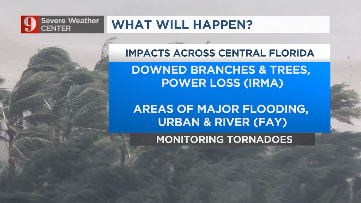
Channel 9 Meteorologist Brian Shields said Hurricane Ian could be worse than Hurricane Charley for Central Florida.
— Brian Shields, WFTV (@BrianWFTV) September 28, 2022
7:15 a.m. update:
Recent data from The National Oceanic and Atmospheric Administration’s Hurricane Hunter aircraft shows Hurricane Ian is rapidly intensifying and has max sustained winds around 155 mph.
The eye of Ian is now less than 40 miles from Captiva and Sanibel Islands.
Landfall is likely to happen before noon.
A look at Ian's satellite image as it nears Cat 5 strength.. Brother. pic.twitter.com/4YHVoRh9yo
— Rusty McCranie (@RMcCranieWFTV) September 28, 2022
Ian will bring catastrophic storm surge and wind damage to portions of southwest Florida.
Forecast models show the center of Hurricane Ian passing very close to downtown Orlando on Thursday.
This path could bring hurricane conditions to metro Orlando.
5:15 a.m. update:
Hurricane Ian’s maximum sustained winds are now around 140 mph.
Ian is moving north-northeast at 10 mph.
Read: Hurricane Ian: County-by-county guide to shelter locations in Central Florida
Though the storm is still far from Central Florida, it is triggering tornado watches.
Ian is a dangerous hurricane that will bring devastation to Southwest Florida.
5AM Wednesday Ian update: Winds have climbed to 140mph. Ian is now a powerful Category 4 hurricane. This is a dangerous hurricane that will bring devastation to SW Florida. Forecast still brings Ian to Central Florida, with hurricane and tropical storm conditions for our area. pic.twitter.com/Ex5GHvNt3j
— Rusty McCranie (@RMcCranieWFTV) September 28, 2022
The forecast still brings Ian to Central Florida, with hurricane and tropical storm conditions for our area.
Ian could still be a hurricane as it moves into Polk County, and hurricane conditions could be felt as far north as metro Orlando.
Read: Smell a scam? Florida activates price gouging hotline
Upclose look at the 5am Wed track. Ian could still be a hurricane as it moves into Polk County, and hurricane conditions could be felt as far north as metro Orlando. pic.twitter.com/LvLr1IqobG
— Rusty McCranie (@RMcCranieWFTV) September 28, 2022
3:45 a.m. update:
Rain from Hurricane Ian’s outer bands is already being felt in parts of Central Florida.
Chief Meteorologist Tom Terry said the highest risk for tornados will be from Interstate 4 to the east toward the coast starting Wednesday morning and lasting throughout the day.
Highest tornado risk (there will be many) will be from I-4 and east toward the coast, starting just before daybreak and lasting most of the day. pic.twitter.com/5bQcBAR8lV
— Tom Terry (@TTerryWFTV) September 28, 2022
Terry said starting Wednesday, residents should be in a safe place to ride out the storm, noting the possibility of tornadoes and flooding.
Read: Hurricane Ian: School closures in Central Florida
As we move into Thursday, Terry said Central Floridians can expect power outages and areas of flash flooding.
BIG IMPACTS from #Ian are coming today and Thursday! @WFTV pic.twitter.com/nvIzDc2pQM
— Tom Terry (@TTerryWFTV) September 28, 2022
11:15 p.m. Tuesday update:
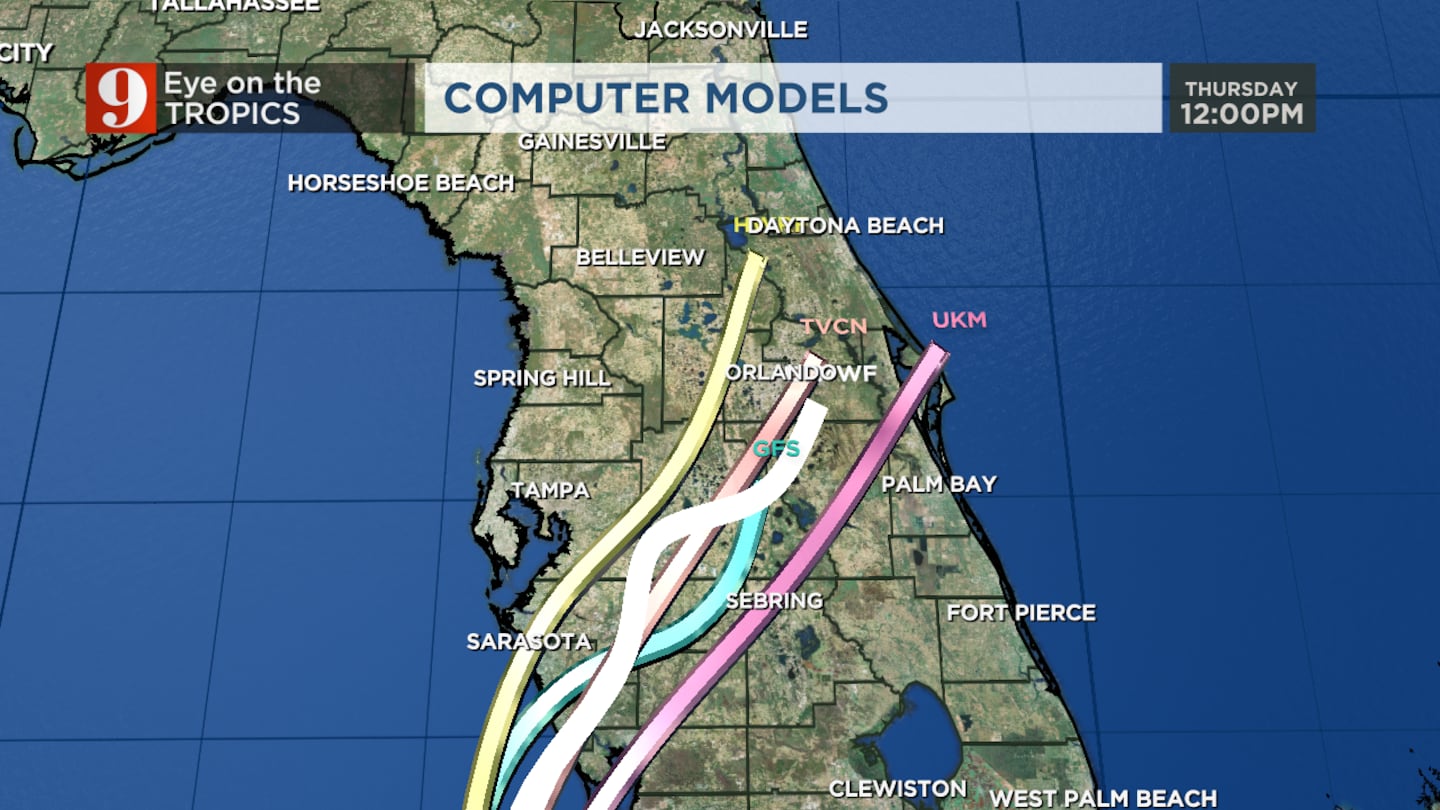
The forecast cone center for Hurricane Ian has shifted slightly southeast of Orlando, Channel 9 meteorologist George Waldenberger said.
Winds for the Category 3 storm remain at 120 mph.
Ian kicked up wind gusts up to 91 mph near Dry Tortugas as it passed west of Key West, Waldenberger said. The flood threat is heightened through Thursday.
11pm update...center of cone shifted a little south and east of Orlando. One of the things we're watching out for is a very heavy swath of rain on the north side of the core of Ian as it passes through. Flood threat is heightened through Thursday. pic.twitter.com/WGARaP2KMs
— George Waldenberger (@GWaldenWFTV) September 28, 2022
>>> WATCH LIVE RADAR HERE <<<
Follow our Severe Weather team on Twitter for live updates:
Visit our hurricane section: EYE ON THE TROPICS
Click here to download the free WFTV news and weather apps, click here to download the WFTV Now app for your smart TV and click here to stream Channel 9 Eyewitness News live.

©2022 Cox Media Group


