The landfall intensity was estimated at 155 mph, which makes Michael the strongest hurricane to make landfall in the continental U.S. since Andrew in 1992.
By Thursday morning, Michael will be over South Carolina as a tropical storm, producing heavy rainfall between 3 to 6 inches with 8 inches in some isolated spots. Tropical storm-force winds could knock down power in the Carolinas during the next 24 hours.
**8PM** #Michael down to a category 1 hurricane in southern Georgia - and still bringing high wind and flash flooding along it's path NE toward the Carolinas (again). pic.twitter.com/uYCnYZi3oq
— tom terry (@TTerryWFTV) October 11, 2018
And this was the weak side #HurricanMichael Panama City Beach pic.twitter.com/ebWHcWvVcI
— Jim Edds (@ExtremeStorms) October 10, 2018
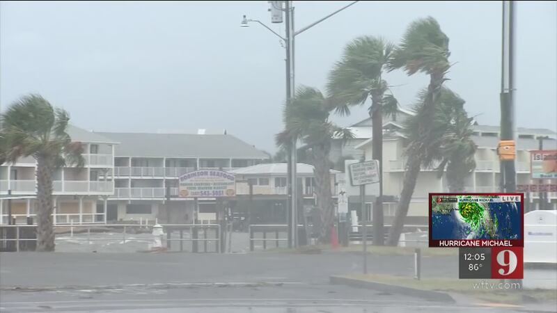
Michael is still a Major Category 3 Hurricane as its center enters Georgia. Still catastrophic damage can be expected in the Florida Panhandle and southern Georgia. Forward speed is at 16 mph to the north-northeast. North Florida residents are still urged to stay in place as there are still destructive winds affecting the region. Heavy rain will also continue, driving through these conditions is deadly.
Across the current path of Michael, life-threatening winds and flooding will become more imminent over southern central Georgia. The Carolinas can expect life-threatening flooding with tropical storm-force winds.
Michael will continue to move mainly to the northeast and will emerge over water again, the Atlantic, early Friday, where it is expected to intensify as an extra tropical system and move away from land fast.
This is an historic storm. Hurricane Michael has the potential to bring the highest storm surge ever recorded in the Panhandle. It will be one of the strongest storms to hit the U.S. and the strongest to hit the Florida Panhandle.
5pm advisory - #Michael now a Cat 3 storm, pressure increasing. Still a Major Storm strolls through south central Georgia. 125 mph sustained winds, damaging roof, trees. Storm surge still life-threatening along Big Bend/Nature Coast. pic.twitter.com/yUBPsMu4jc
— Irene Sans (@IreneSans) October 10, 2018
Wait for it... winds from #HurricaneMichael blow the roof right off a building in Panama City Beach, FL. Live updates >> https://t.co/18UhNwNxzB pic.twitter.com/2bSbpQYagA
— WFTV Channel 9 (@WFTV) October 10, 2018
3:45 p.m. UPDATE:
Many reports of roofs ripped away across #FloridaPanhandle as #Michael's center entered the area. Expect to see MAJOR catastrophic damage later this evening & in the coming days. pic.twitter.com/VS7fbtB1sX
— Irene Sans (@IreneSans) October 10, 2018
Behind the storm now and seeing the damage. Surreal. #Michael pic.twitter.com/ru4nKZzkY9
— Ginger Zee (@Ginger_Zee) October 10, 2018
Change a few storms' location, copy and paste.
— Irene Sans (@IreneSans) October 10, 2018
This will be the trend this afternoon across Central Florida. Fast moving rain bands will have embedded storms bringing gusty winds, lightning. Stay weather aware. #stormalert9 pic.twitter.com/IiKFpxr7mu
2:40 p.m. UPDATE
Michael continues move inland over the Florida Panhandle and it will be crossing over to the Alabama/Georgia border within the next hour or so. Still Florida Panhandle residents are not done with the hurricane's effects. Very strong, destructive winds, over 100 mph expected to arrive near Tallahassee soon, as well as very deep storms, all associated with the eye wall.
Residents along southern and central Georgia are advice to stay put in there secure location during the afternoon hours as the storm travels over the region, likely still as a hurricane.
Michael is expected to weaken to a tropical storm once its center (or what is left of it) approaches the Carolinas, moving out to the Atlantic Ocean by late Thursday evening. A large swath of heavy rainfall is expected bring flash flooding from the Florida Panhandle to the Carolinas and Virginia.
#HurricanMichael continues to batter Cedar Key. Water smashing against the seawalls and spilling into the streets. pic.twitter.com/oOvmOoqTIW
— Rusty McCranie (@RMcCranieWFTV) October 10, 2018
Almost inconceivable winds on the eastern Eyewall all just offshore and about 1500 feet above ground level. #Michael #FLwx @TVSteveBarrett pic.twitter.com/4HXv7VuiFJ
— tom terry (@TTerryWFTV) October 10, 2018
Yep.. after re-analysis in a few months.. it could be upgraded to a cat 5.. either way still catastrophic and deadly. Central and Southern Georgia residents need to stay in a secure location.. it will still be a powerful hurricane in a few hours as it enters the state. https://t.co/MFZtH9dDYd
— Irene Sans (@IreneSans) October 10, 2018
1:38 p.m. UPDATE
Michael strengthens to 155 mph, makes landfall near Mexico Beach, Florida.
#Michael makes landfall just to the NW of Mexico Beach, Fl. 155 mph & 919mb.
— Irene Sans (@IreneSans) October 10, 2018
3rd lowest pressure hurricane to make landfall in U.S. on record!
Michael toca tierra al NO de Mexico Beach, FL.
Viento: 155mph
Presión: 919mb
3er huracán con la presión más baja en llegar a EE.UU pic.twitter.com/Yj1oSKG8kk
The @Space_Station just passed over Hurricane #Michael... incredible images! This is more than a monster storm!
— Irene Sans (@IreneSans) October 10, 2018
Vista del Huracán Michael desde la estación internacional espacial. Esto es más que una tormenta monstruosa. pic.twitter.com/tSFH2kyejb
1:00 p.m. UPDATE
The @Space_Station just passed over Hurricane #Michael... incredible images! This is more than a monster storm!
— Irene Sans (@IreneSans) October 10, 2018
Vista del Huracán Michael desde la estación internacional espacial. Esto es más que una tormenta monstruosa. pic.twitter.com/tSFH2kyejb
Watch for updates here when the National Hurricane Center releases its latest updates. We will also send alerts using the free WFTV News app.
Don't have the WFTV News & Weather apps? Download them now for free.
Certified Meteorologist Rusty McCranie is in Cedar Key, Florida.
11:00 a.m. UPDATE
Extremely dangerous Hurricane Michael is closing in on the coast of the Florida Panhandle.
The Category 4 storm is close to becoming a Category 5 hurricane, making it one of the most powerful hurricanes on record to hit the U.S. It will be the strongest to have hit the Panhandle. It's sustained winds have increased to nearly 150 mph. To become a Category 5 storm, wind speeds must exceed 156 mph.
NEW INFO: The pressure is down again, a sign of strengthening. Winds may be increased some...close to Category 5 status. This is one of the most powerful hurricanes to hit the United States on record! pic.twitter.com/qb94WG4sqb
— Brian Shields (@BrianWFTV) October 10, 2018
The life-threatening storm surge from Hurricane Michael has already come ashore and is growing deeper.
According to a National Hurricane Center update, a National Ocean Service water level station at Apalachicola reported over 4 feet of inundation above ground level by mid-morning Wednesday.
14-foot storm surge is possible in Apalachicola, effects of the Michael plus the normal high tide.
Waves are already gnawing away at the base of sand dunes at Panama City Beach.
8:25 a.m. UPDATE
Hurricane Michael has become so powerful, that it is expected to remain a hurricane as it moves over central Georgia early Thursday.
The storm is strengthening as it races over the Gulf of Mexico approaching a landfall along Florida's Panhandle by Wednesday afternoon.
#Michael is so powerful that it will bring hurricane conditions to south & central Georgia. Power outages will be incredibly expansive. pic.twitter.com/lTl27W90E5
— Brian Shields (@BrianWFTV) October 10, 2018
The Category 4 storm has maximum sustained winds of 145 mph and is moving at 13 mph, according to Channel 9 certified meteorologist Brian Shields.
Michael will be the first Category 4 hurricane to make landfall on the Florida Panhandle and is poised to rank as one of the strongest to hit the U.S.
Michael will go down as one of the strongest storms to hit the US & strongest to hit the Florida Panhandle. It is an absolute beast. pic.twitter.com/hw47TY0Un8
— Brian Shields (@BrianWFTV) October 10, 2018
.@TVSteveBarrett and @RMcCranieWFTV are along the panhandle gearing up for #HurricaneMichael. Follow them for updates! https://t.co/18UhNwNxzB pic.twitter.com/QIRSvhr7JN
— WFTV Channel 9 (@WFTV) October 10, 2018
7:45 a.m. UPDATE
Florida Gov. Rick Scott is warning people in the path of massive Hurricane Michael that it's too late to evacuate.
In a tweet on Wednesday morning, Scott said "If you chose to state in an evacuation zone, you must SEEK REFUGE IMMEDIATELY."
#Michael is so powerful that it will bring hurricane conditions to south & central Georgia. Power outages will be incredibly expansive. pic.twitter.com/lTl27W90E5
— Brian Shields (@BrianWFTV) October 10, 2018
Hurricane Michael grew into a Category 4 storm overnight, scientists say a storm this strong has never hit the Florida Panhandle.
Winds intensified to 145 mph early Wednesday.
Meanwhile the Bay County Sheriff's Office warned residents that a "shelter-in-place" order has been issued, and urged everyone to stay off the roads. Sheriff's officials say deputies will continue to respond to calls for now, but that will change as the storm approaches the coastline.
The time for evacuating along the coast has come and gone. First responders will not be able to come out in the middle of the storm. If you chose to stay in an evacuation zone, you must SEEK REFUGE IMMEDIATELY.
— Rick Scott (@SenRickScott) October 10, 2018
5 a.m. UPDATE
The National Hurricane Center says Michael has become an extremely dangerous Category 4 storm.
Michael’s winds strengthened to 140 mph shortly before 5 a.m. Wednesday.
At 2:00 a.m. Wednesday, the eye of Michael was about 180 miles south-southwest of Panama City, Florida.
It also was about 170 miles southwest of Apalachicola, Florida. Hurricane-force winds extend outward up to 45 miles from the center and tropical-storm-force winds extend outward up to 175 miles. Michael was expected to become one of the Panhandle's worst hurricanes in memory.
The surge in the Big Bend/Panhandle could be like nothing on record. Incredible. #Michael https://t.co/7cQhO5iZ7B
— Brian Shields (@BrianWFTV) October 10, 2018
Video: Hurricane Michael approaches Florida Panhandle
The Associated Press contributed to this report
#Michael will remain over 300 miles W of Central Florida. This will keep impacts to a minimum, at least the ones directly associated with the system. We will likely see some scattered storms, but it won't be too different than a regular summer afternoon. Some gusty winds, too. pic.twitter.com/fuKM8Wnai8
— Irene Sans (@IreneSans) October 9, 2018
I’m live in Cedar Key tonight and I just saw an amazing sight, clusters of horseshoe crabs coming onshore ahead of Hurricane #Michael @wftv pic.twitter.com/CaNEyGOgjo
— Rusty McCranie (@RMcCranieWFTV) October 9, 2018
Pronóstico en español por Irene Sans, meteoróloga certificada
Huracán MichaelHuracán Michael se intensifica, vientos destructivos, marejada ciclónica e inundaciones para el Norte de Florida --Tocaría tierra el miércoles por la tarde
Posted by Irene Sans on Tuesday, October 9, 2018
Cox Media Group


