
ORLANDO, Fla. — Sally is a dangerous, slow-moving Category 1 hurricane Tuesday morning. The storm is moving very slow at 2 mph.
Hurricane Sally
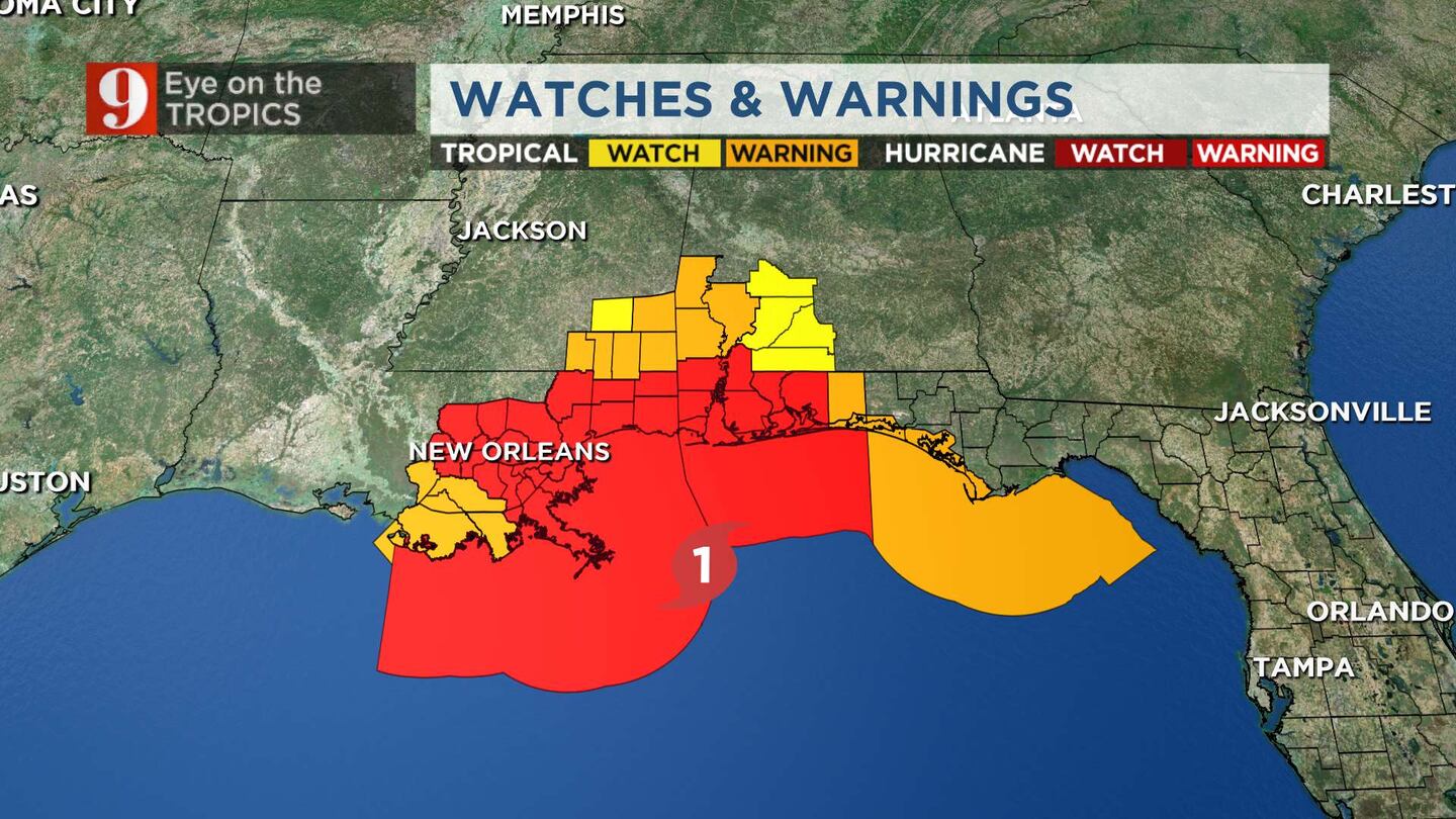
Hurricane Sally is expected to be a dangerous hurricane when it makes landfall Wednesday morning.
The storm is moving north-northeast toward the Florida-Alabama state line for an early- or mid-morning landfall on Wednesday. Surge and rainwater flooding continue to be huge concerns, especially the rain.
11pm #Sally: Winds at 85mph, could strengthen a bit more before Wednesday AM landfall along FL/AL state line. Widespread flooding rain and storm surge! #EyeonTropics pic.twitter.com/JoS5zkDMnG
— Tom Terry (@TTerryWFTV) September 16, 2020
The storm weakened overnight but it continues to move slowly toward the northern Gulf Coast.
Forecasters said the storm could bring “historic flooding with extreme life-threatening flash flooding" to portions of the Gulf Coast."
Sally has lost much of it (already slow) speed because there is a stationary frontal boundary just to its north. This front is acting as a lid, not allowing Sally to move to the north. We can expect Sally to possibly come to a halt for a few hours Tuesday, this is what will actually start the turn of Sally to the north
Impacts to the Gulf Coast
Storm Storm
The deepest water will occur along the immediate coast in areas of onshore winds, where the surge will be accompanied by large and damaging waves. Surge-related flooding depends on the relative timing of the surge and the tidal cycle and can vary greatly over short distances.
Rainfall
Due to Sally’s slow movement rainfall will be high. Rain has been fallen across parts of southern Alabama, and northern Florida.
Sally is forecast to produce 10 to 20 inches of rainfall with isolated amounts of 30 inches along and just inland of the central Gulf Coast from the western Florida Panhandle to far southeastern Mississippi. Historic flooding is likely with extreme life-threatening flash flooding likely through Wednesday.
Once Sally moves inland the flash flooding threat will continue starting Wednesday across the Southeast. Rainfall of 4 to 8 inches, with isolated maximum amounts of 12 inches, across portions of southeastern Mississippi, southern and central Alabama, northern Georgia, and the western Carolinas. Tornadoes will also be possible over this region.
Little variation in strength is forecast before it makes landfall, this hurricane will be extremely dangerous due to its slow movement.
Hurricane-force winds extend outward up to 45 miles from the center and tropical-storm-force winds extend outward up to 125 miles
Read: La Niña is officially declared; tropical effects already being seen

There are a few other systems in the Atlantic, here’s what you need to know about them:
Tropical Storm Vicky
Tropical Storm Vicky is expected to be a short-lived storm. It is moving northwest at 9 mph and is expected to turn west-northwest in a few days. It will eventually turn toward the west. It will stay out to sea.
The storm is forecast to weaken due to strong upper-level winds.
It is likely to weaken into a remnant low by Wednesday.


