
ORLANDO, Fla. — We have Weather On the Way for an elevated fire threat and cold air on the way for Sunday through Tuesday.
A strong cold front is on track to push into Central Florida Sunday, ushering in much drier and colder conditions.
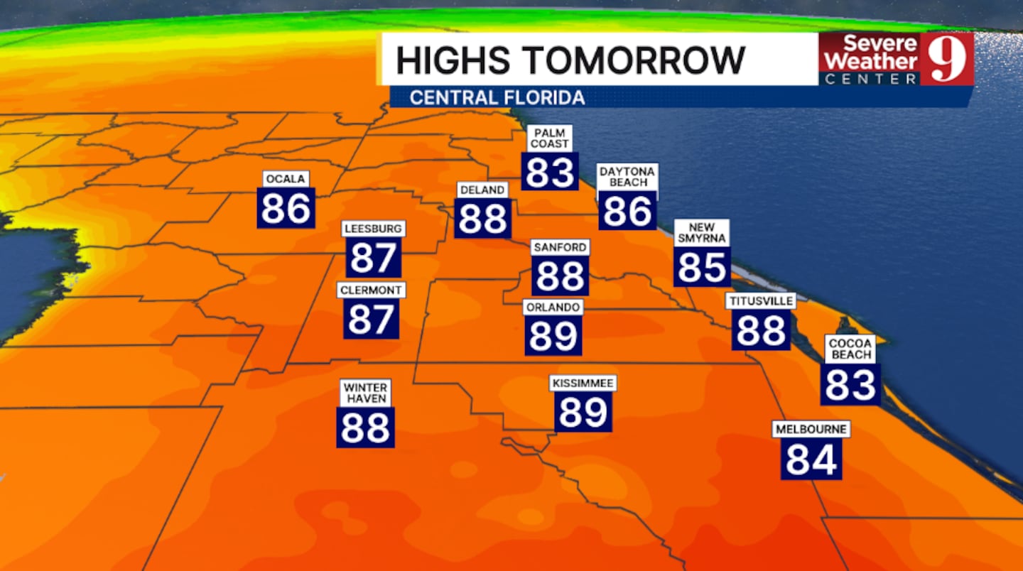
Ahead of it, records or near-record highs are again expected Saturday. Temps to start the weekend will soar into the upper 80s.
Changes arrive early Sunday as the storm system pushes into the area. Scattered showers are likely on Sunday, with highs in the 70s.
Very dry, cool air quickly pushes in late Sunday and into Monday.
Gusty northwesterly winds and dry vegetation will lead to high fire danger in the PM hours Sunday and likely lingering into Tuesday.
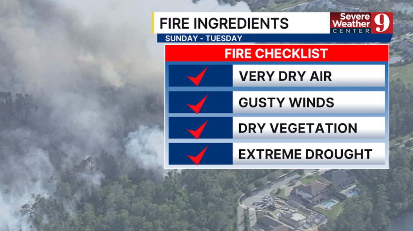
Red Flag Warnings are becoming increasingly likely.
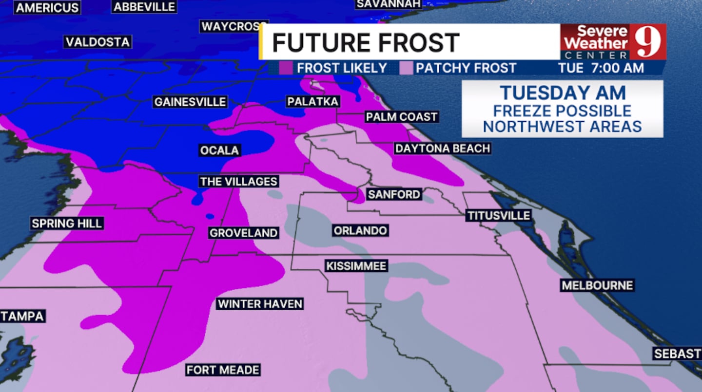
The cold air will also keep temperatures well below average with highs on Monday and Tuesday will only be in the upper 50s.
The threat of a freeze is increasing in northwest areas Tuesday morning, and a frost is becoming probable in parts of the area Wednesday morning.
Warmer weather does return for the back end of next week.
Stay with Severe Weather Center 9 for the latest on the fire threat and the cold temps in the coming days.
Click here to download our free news, weather and smart TV apps. And click here to stream Channel 9 Eyewitness News live.

©2026 Cox Media Group


