
ORLANDO, Fla. — After a quiet and warm weekend, we have Weather On the Way to kick off the work week.
A cold front will push through the area tonight, keeping clouds in place. Most will stay dry tonight with morning lows in the upper 60s.
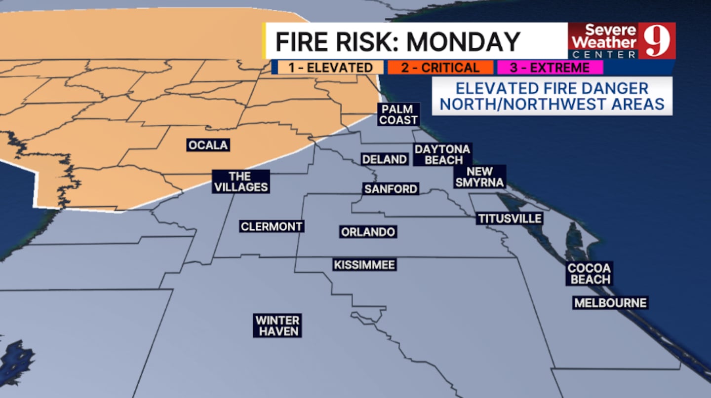
Changes begin to arrive on Monday. We’ll see gusty winds and an elevated fire danger in the northwest. A stray shower will be possible, with cooler temps in the upper 70s.
With low humidity, the higher fire danger will continue on Tuesday, with breezy conditions again. Temps for Tuesday will be in the low 80s.
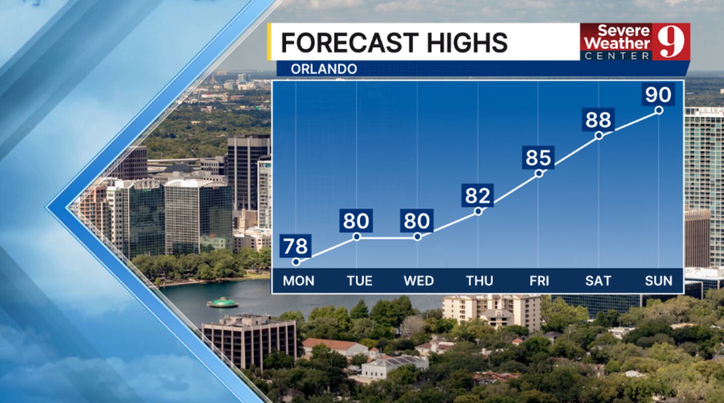
The below-average temps persist into midweek, along with dry conditions. Highs for Wednesday and Thursday will be in the low 80s.
Warmer weather arrives on Friday, with a mix of sun and clouds. Temps to close out the work week will be in the mid-80s.

Right now, the Orlando Puerto Rican Parade on Saturday looks to feature highs in the upper 80s and a low chance of rain showers.
Click here to download our free news, weather and smart TV apps. And click here to stream Channel 9 Eyewitness News live.

©2026 Cox Media Group


