
ORLANDO, Fla. — It was a hot and stormy end to the weekend, and more heat and storms are on the way.
The scattered showers and storms will continue to wind down this evening, with partly cloudy skies overnight.
It will remain warm, with overnight lows only down into the mid 70s.
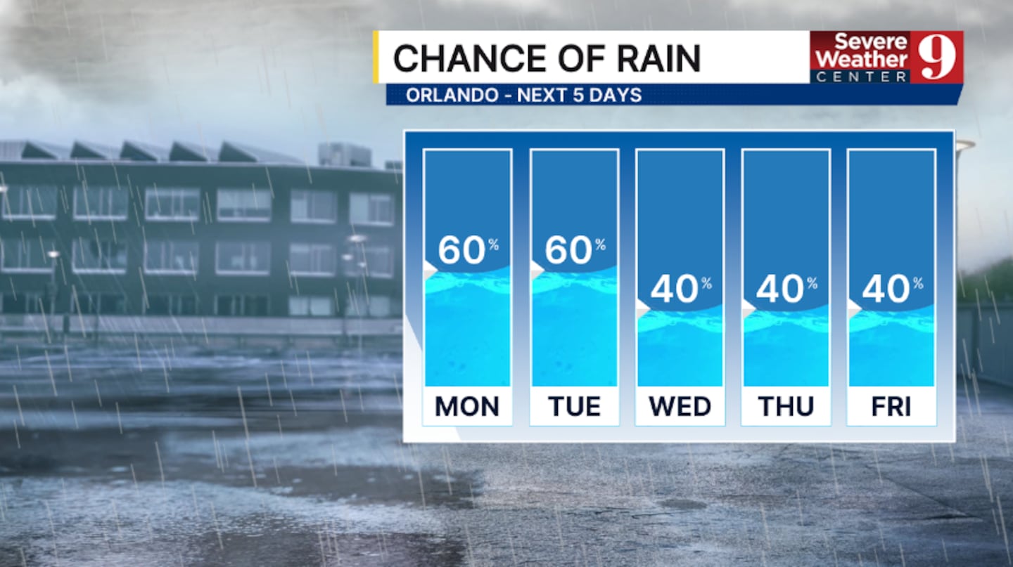
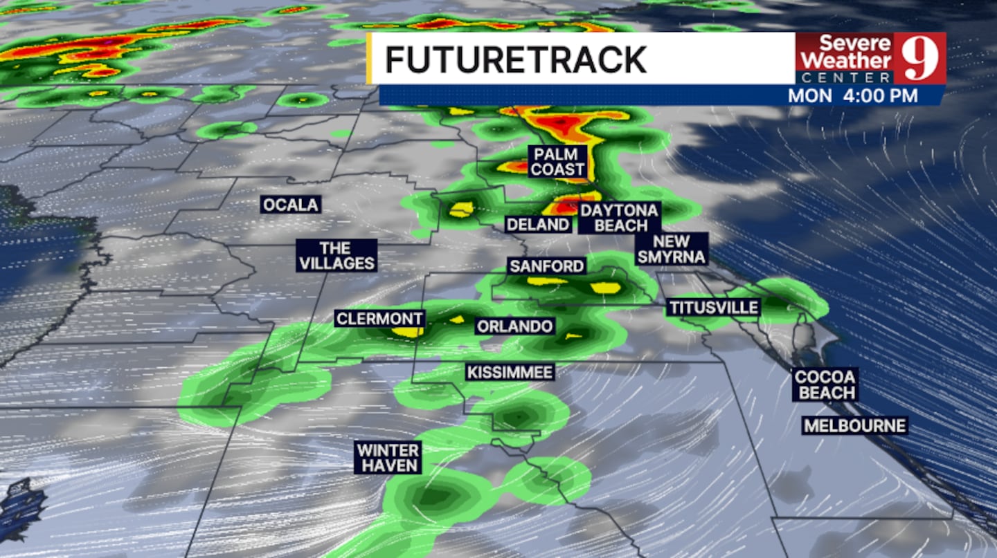
The rain and storm chances continue for Monday. Scattered PM showers and storms will develop, with the best chance for activity along and east of I-4.
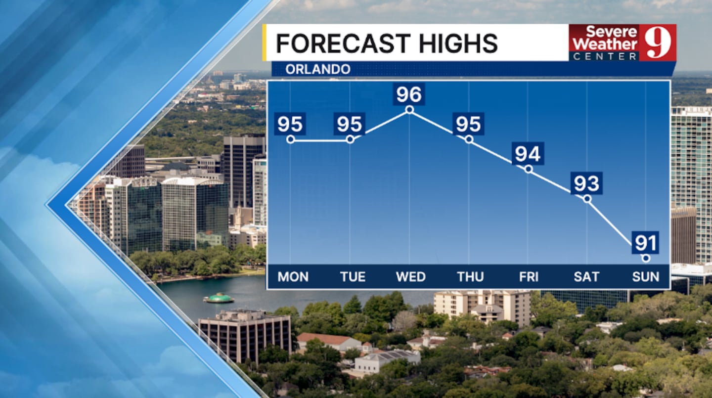
Highs to start the work week will be in the mid 90s.

The storm chances continue into Tuesday, with again activity developing in the afternoon and evening.
Temps for Tuesday will again be in the mid 90s.
Some slightly drier air does arrive for midweek.
This will reduce coverage of the rain and storms some across the area, with highs holding in the mid 90s.
Juneteenth Friday will also feature scattered storms and warm temps. Highs for the holiday will be in the mid 90s.
Higher chances of rain and storms are likely to return next weekend, along with increased moisture in the region.
Click here to download our free news, weather and smart TV apps. And click here to stream Channel 9 Eyewitness News live.

©2026 Cox Media Group


