
CENTRAL FLORIDA — We are tracking potential record-breaking high temperatures on Saturday afternoon. This will be followed by a rain chance early Sunday and elevated fire threats to start off the work week.
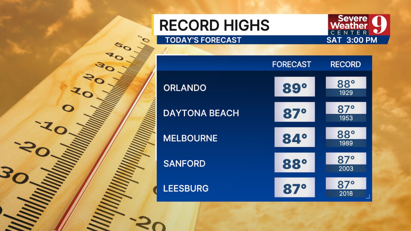
High pressure and dry air will allow our high temperatures to reach the upper 80s across Central Florida.
Orlando could reach 89°, and Daytona Beach could threaten 87°, matching a record set in 1953.
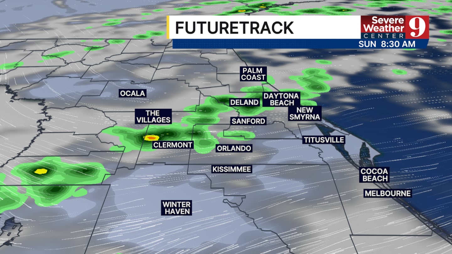
A cold front will bring down our temperatures starting on Sunday and offer a small chance of rain. However, the bigger threat to watch with this system will be the strong winds after the front passes.
We are tracking less than 1/10th of an inch of rain for the majority of Central Florida on Sunday morning.
The front will begin to move further south early Sunday afternoon and leave us with increasingly dry air along with consistent winds of 20 to 25 mph and gusts up to 40 mph.
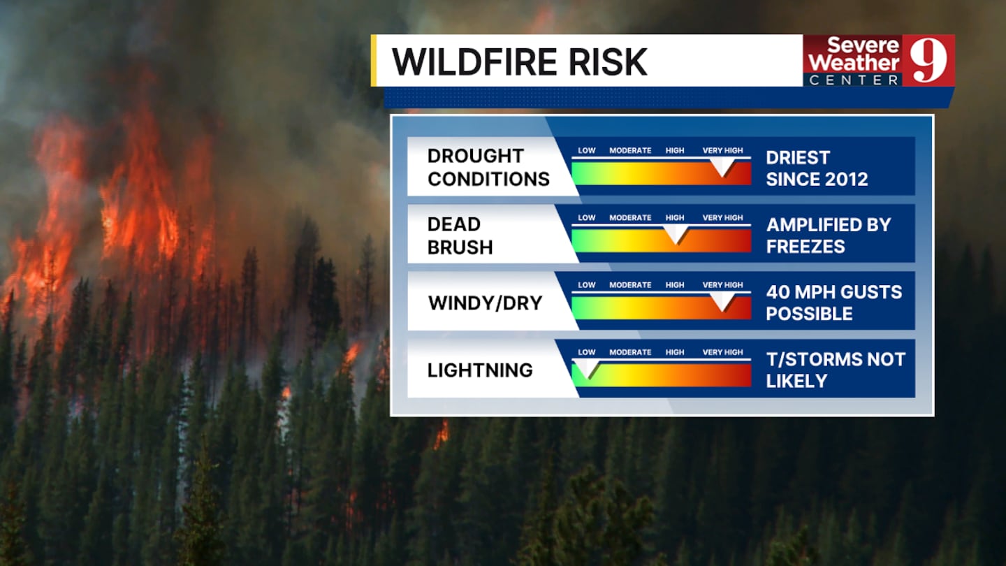
The wind, paired with the very dry air, will elevate our fire danger starting late Sunday and lasting through Tuesday. Red flag warnings are likely to be issued by the National Weather Service ahead of this change.
The cooldown associated with this front will not see Orlando fall to the freezing point. Orlando will see a morning low between 36 and 38°, while Marion and Sumter counties could fall to the freezing point both early Tuesday and Wednesday morning. Patchy frost will be possible each of these days.
We will start to see a warmup at the end of this upcoming work week.
Click here to download our free news, weather and smart TV apps. And click here to stream Channel 9 Eyewitness News live.

©2026 Cox Media Group


