
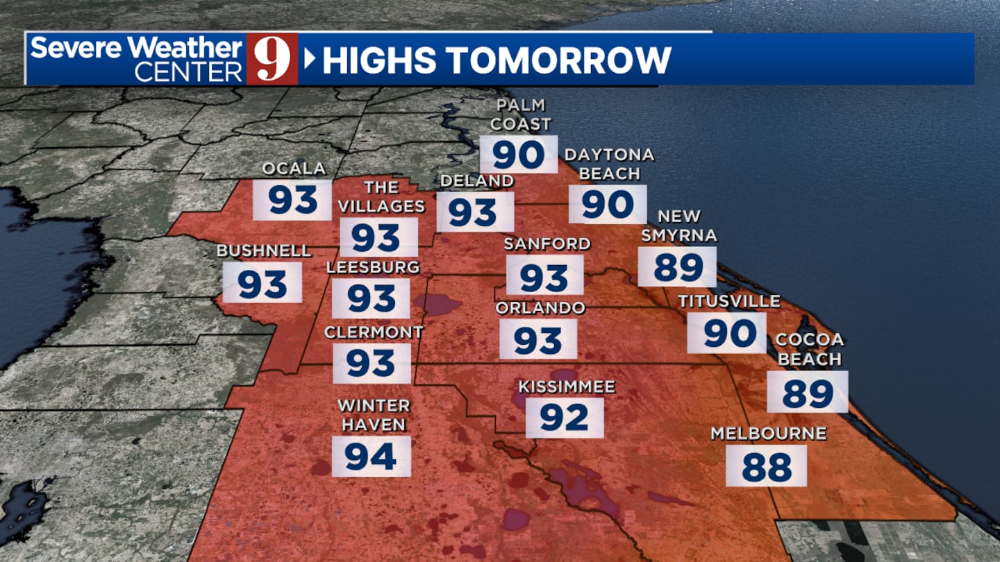
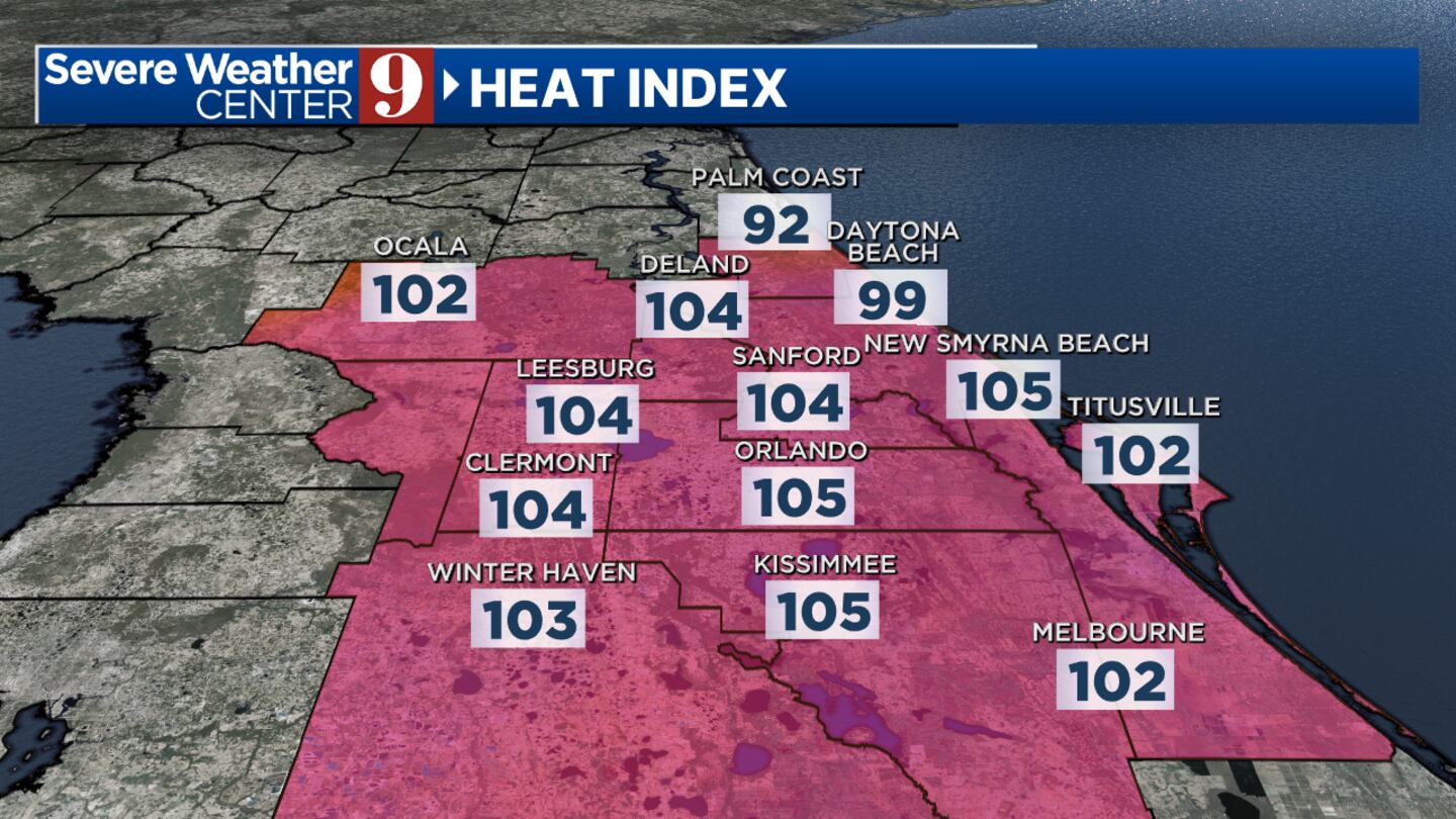
ORLANDO, Fla. — Central Florida is much hotter than normal again today.
▶ WATCH CHANNEL 9 EYEWITNESS NEWS
Meteorologist George Waldenberger said a few areas through 10 p.m. will get scattered downpours to cool things off, mainly along and northwest of I-4.
There is a chance for lightning risks of storms developing near you.
Read: ‘I feel for the families’: Lake County residents evacuated after ground depression
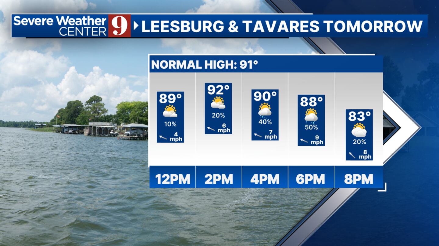
Monday will have some late-day storms.
Monday’s highest chance of rain will be on the drive home during dinner time, just after sunset, and again in areas northwest of I-4.
Temperatures in the upcoming week will be in the mid-upper 90s.
Follow our Severe Weather team on X for live updates:
Click here to download our free news, weather and smart TV apps. And click here to stream Channel 9 Eyewitness News live.
©2024 Cox Media Group


