
, Fla. — A Weather Alert Day continues through the late evening hours, as strong storms will push through parts of Central Florida.
A Tornado Watch remains in effect for Marion and Flagler counties until 8 pm, and the watch may be expanded southward later this evening.
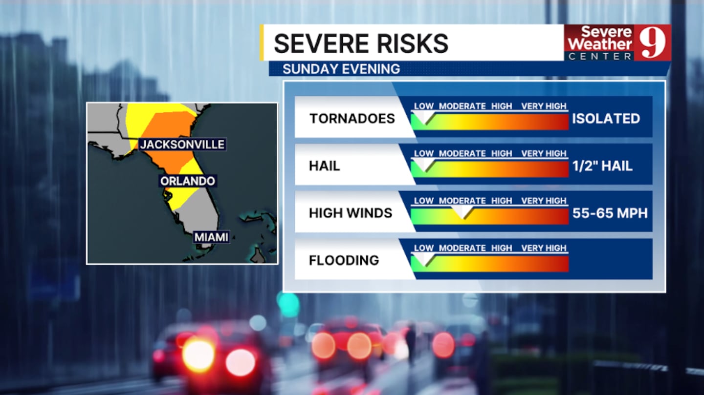
A watch means conditions are favorable for isolated tornadoes.
The rain and storms will move quickly through the area, with activity likely arriving along the I-4 corridor around 9-11 pm and exiting south Brevard after midnight.
The greatest threat with these storms remains gusty winds over 55 mph and small hail. An isolated tornado cannot be ruled out either.
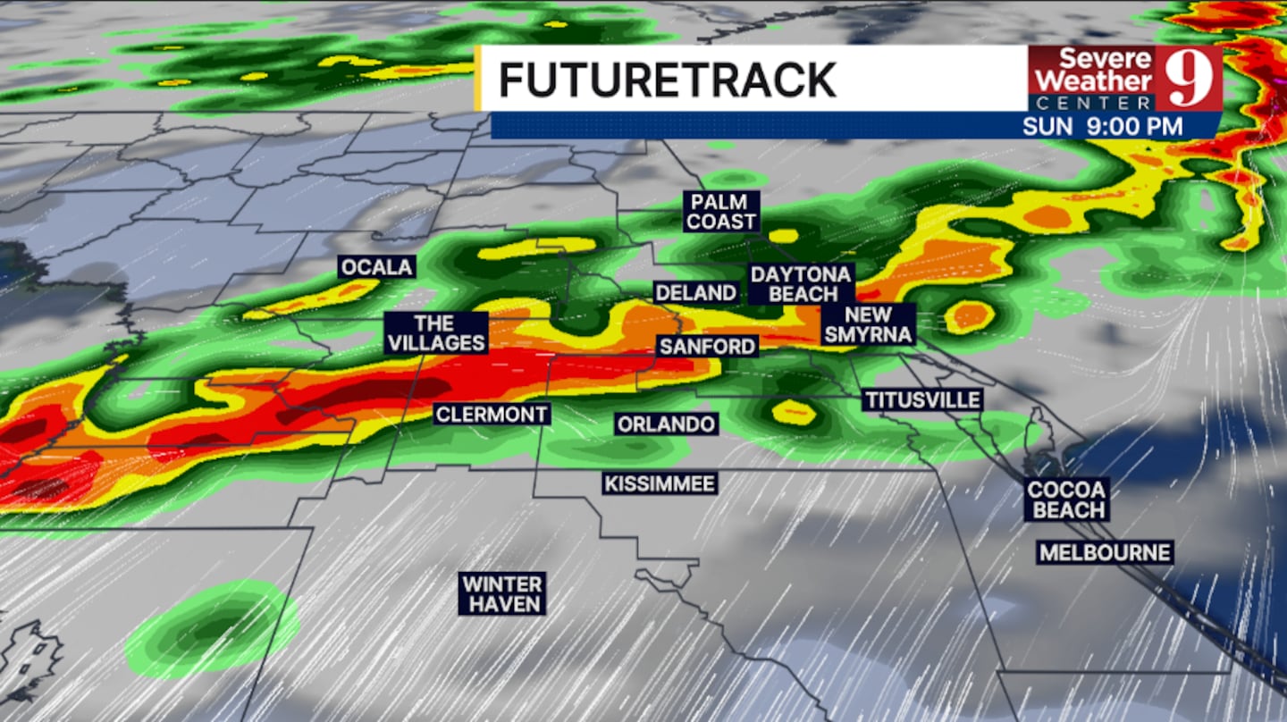
The rain and storms will exit Sunday night, with quieter and cooler weather returning for Presidents’ Day.
After this storm system exits, no major rain is likely over the next 5-7 days.

Stay with Severe Weather Center 9 for the latest on the storm threat this evening.
Click here to download our free news, weather and smart TV apps. And click here to stream Channel 9 Eyewitness News live.

©2026 Cox Media Group


