ORLANDO, Fla. — Central Florida, get ready for another hot one — and another chance for stormy weather.
Afternoon highs Thursday will climb into the upper 80s and low 90s.
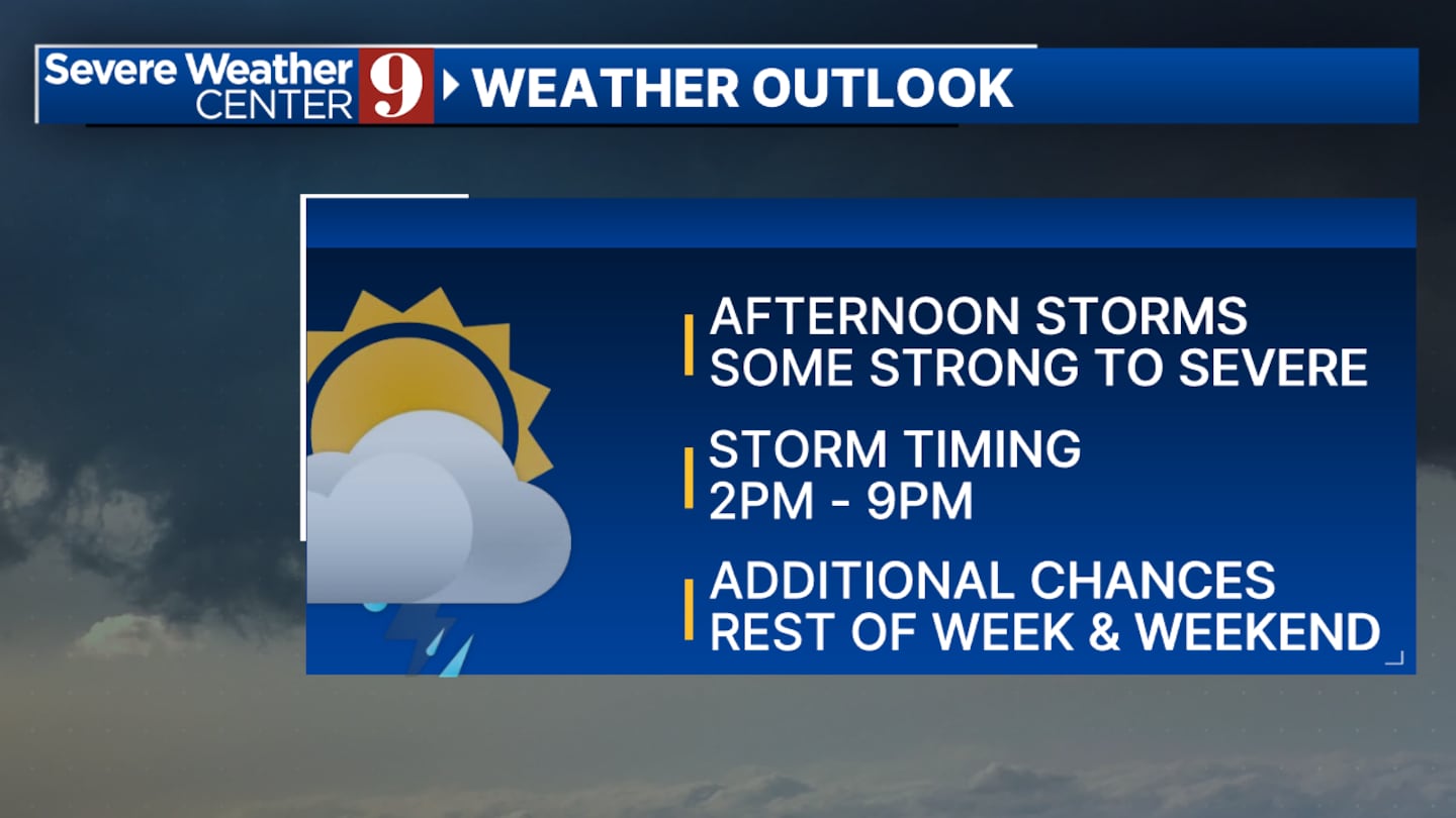
Meteorologist Kassandra Crimi said scattered showers and isolated thunderstorms will return in the afternoon as well.
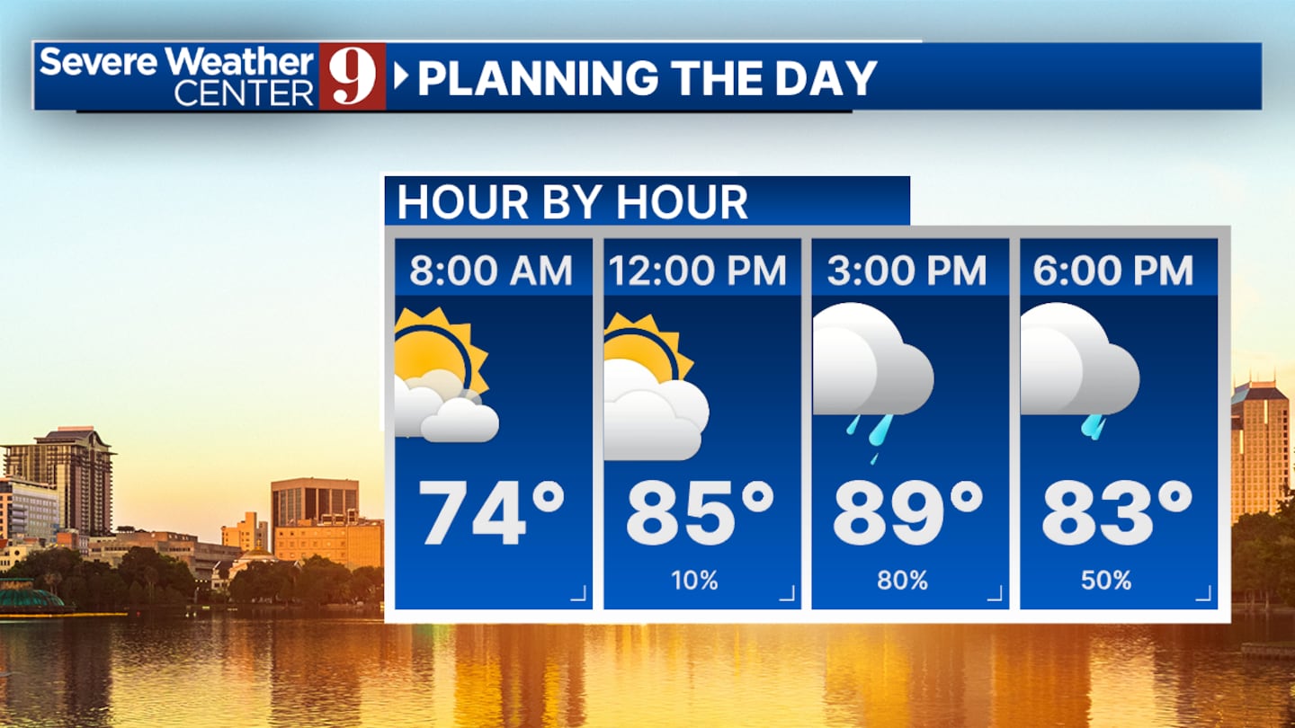
Look for those storms to start after 2 p.m. in parts of the Channel 9 viewing area.
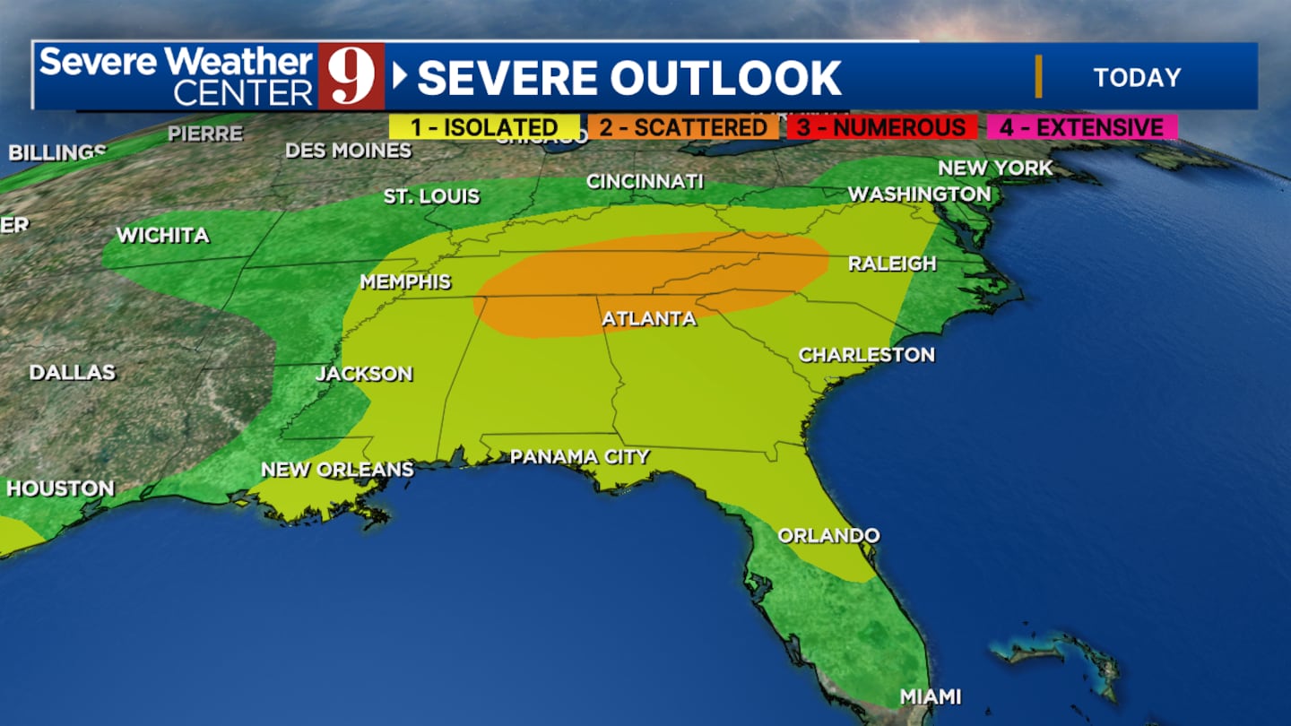
Crimi said some of these storms could turn strong or even severe as areas of Central Florida sit at a Level 1 for the possibility of severe weather.
Thursday’s biggest storm threats will be heavy rain, lightning, wind gusts between 45-55 mph, and coin-sized hail.
Approaching the weekend, the next few afternoons will continue to bring the possibility of widely-scattered showers and storms.
When all said and done, Crimi said we could pick up as much as 3 to 8 inches of rain by early next week.
Follow our Severe Weather team on X for updates:
Click here to download our free news, weather and smart TV apps. And click here to stream Channel 9 Eyewitness News live.

©2025 Cox Media Group


