ORLANDO, Fla. — There is a very typical weather pattern for Sunday.
>>> STREAM CHANNEL 9 EYEWITNESS NEWS LIVE <<<
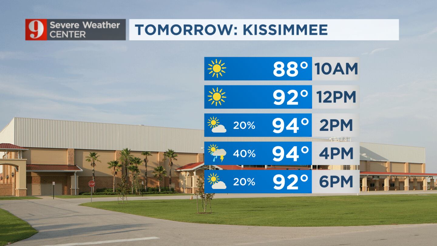
Meteorologist George Waldenberger said there was a quick shot of passing storms, with rainfall amounts pushing near an inch in some heavier storms.
By mid-afternoon, storms had already moved across most of the area along the east coast beaches.
After that, most of the rain will push offshore and end well before sunset.
We’ll still keep a chance for a lingering shower in the forecast for a few straggler rain clouds that trail the overall system as it dissipates through the day’s end.
Read: Bus catches fire on SR-528 in Brevard County
Central Florida is still under a heat advisory for the heat, but the rain arrived to cool things off enough.
We may see more heat advisories in the next day or two.
Stay cool, and please don’t overdo hard work out in this heat.
Monday and Tuesday have similar rain patterns, with brief, passing storms, especially early to mid-afternoon.
Read: Wawa offers free coffee to teachers, school staff all month in August
Tuesday’s batch may have a few that additionally linger into the evening.
No systems are expected to form in the tropics over the next seven days.
Still, we’ll monitor a more active pattern of tropical waves developing over the Atlantic in the coming weeks.
Follow our Severe Weather team on Twitter for live updates:
Click here to download the free WFTV news and weather apps, click here to download the WFTV Now app for your smart TV and click here to stream Channel 9 Eyewitness News live.
©2023 Cox Media Group


