
CENTRAL FLORIDA — It was a hot and unsettled Fourth of July, and more storms are likely for Sunday.
The rain and storms will fade away this evening, with quiet conditions returning overnight. Morning lows will be in the mid 70s.
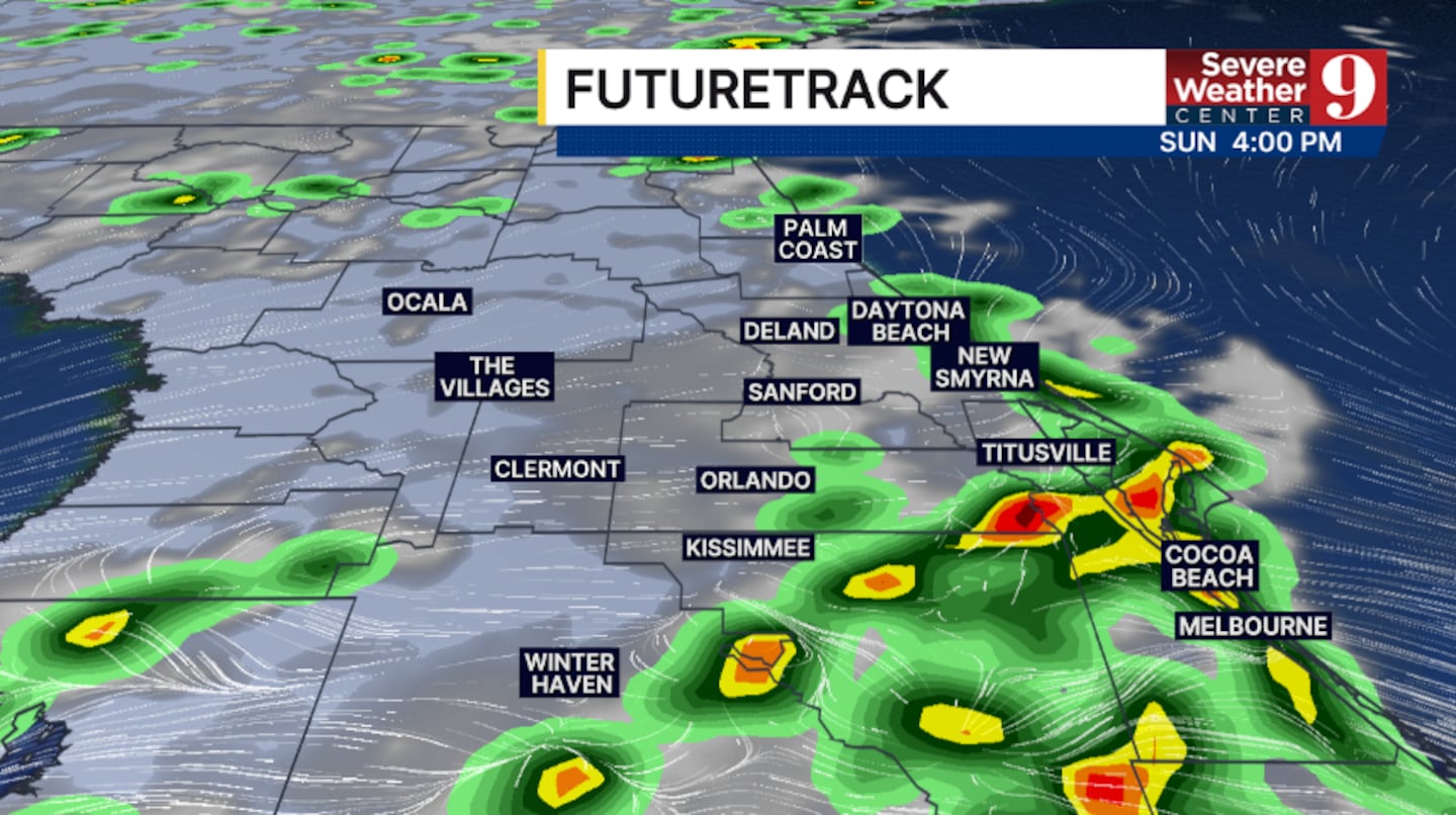
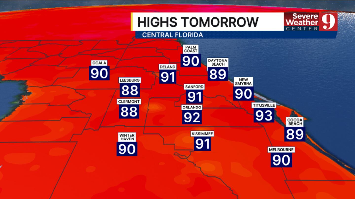
The threat for rain and storms continues Sunday. The morning hours will be dry, with rain and storms developing in the afternoon and early evening. Highs to close out the holiday weekend will be in the low 90s.
The elevated rain and storm chances continue into the start of next week. Expect fairly high coverage of PM storms Monday, with temps in the low 90s.
Drier air does begin to move in for the middle of next week. Scattered storms will still develop, with warmer highs in the mid 90s both Tuesday and Wednesday.
The heat builds further late next week, as drier air filters back into the area. Temps are expected to climb into the upper 90s with just a few widely scattered PM storms.
Click here to download our free news, weather and smart TV apps. And click here to stream Channel 9 Eyewitness News live.

©2026 Cox Media Group


