ORLANDO, Fla. — A Weather Alert Day has been issued for Wednesday.
▶ WATCH CHANNEL 9 EYEWITNESS NEWS
▶ DOWNLOAD OUR WEATHER APP
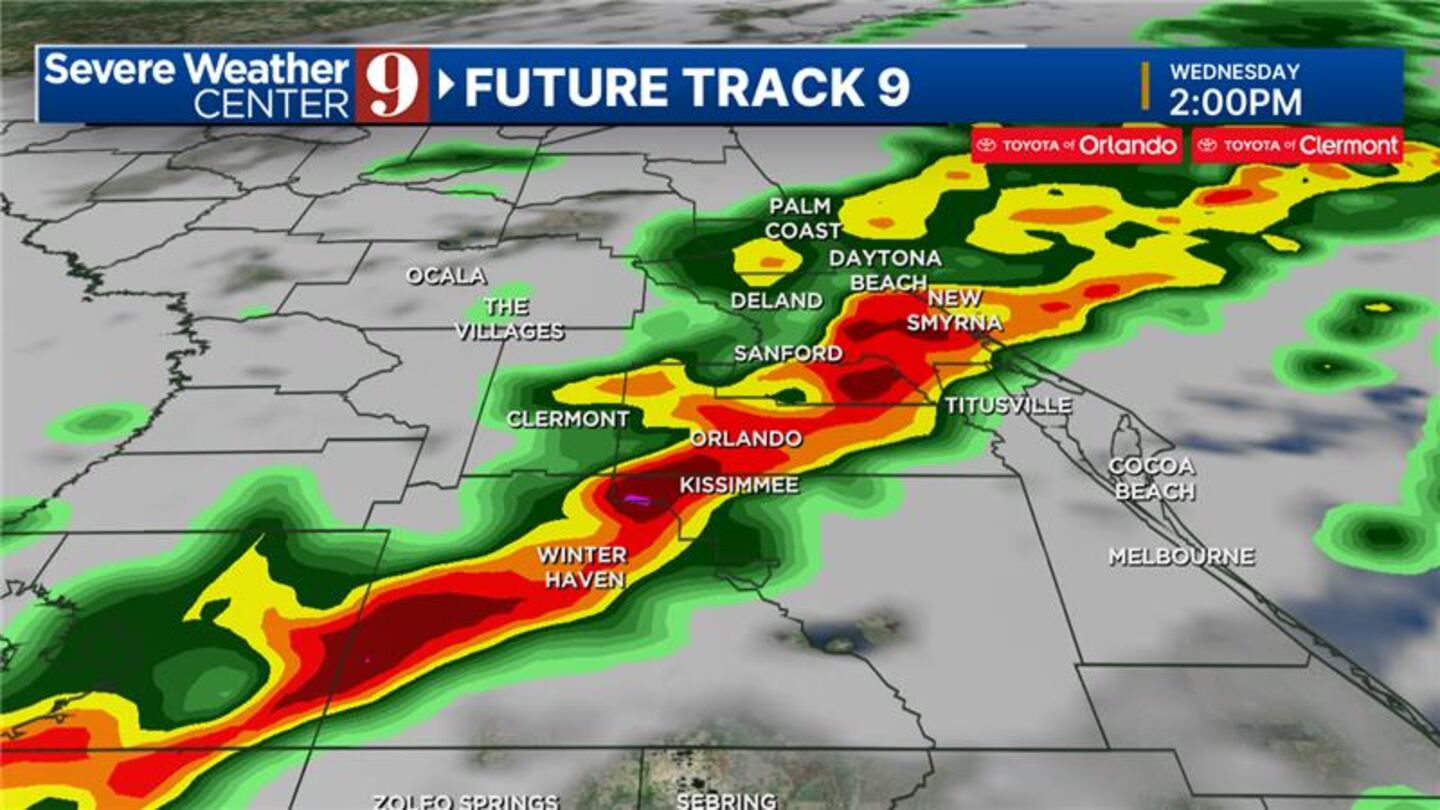
Chief meteorologist Tom Terry said the next spring storm system will move through Central Florida during the day Wednesday, bringing with it the slight risk for severe weather.
He said the system is forecast to move into Marion County at about 10 a.m., approaching The Villages before noon.
The storms are expected to reach the I-4 corridor between 1 p.m. and 4 p.m., Terry said.
Read: Tornado Watch vs. Tornado Warning? What you need to know
They will reach Brevard County between 3 p.m. and 8 p.m., he said.
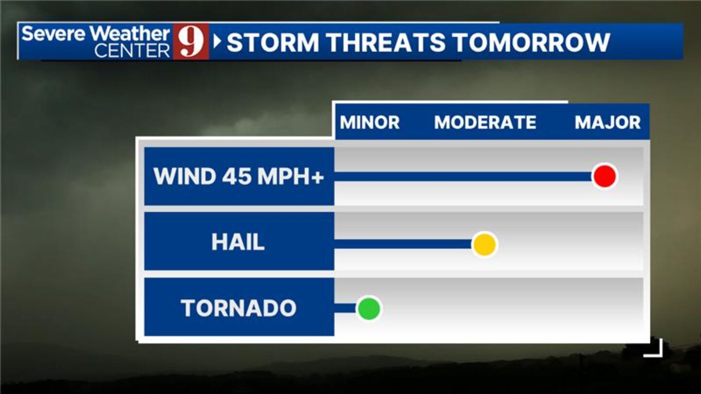
Some of the storms could bring damaging winds in excess of more than 50 mph, small hail and an isolated risk of a tornado.
After the front moves through the area, expect cooler temperatures and sunny skies.
Read: Man, 76, dies when new plane crashes at Polk County airstrip
Watch Channel 9 Eyewitness News as we continue to update the timing and impact of Wednesday’s storms.
Follow our Severe Weather team on X for live updates:


©2024 Cox Media Group


